
Wandelkaart 262 Anglesey West- Wales AONB - OSI
Het westen van het eiland van Anglesey AONB (Ynys Mon)
Korte omschrijving
Wandelkaart Anglesey West - Wales AONB Productbeschrijving: Holyhead 262 - Anglesey West, Wales AONB - Kaart nummer 262 in de OS Explorer reeks heeft betrekking op het westen van het ei...

Specificaties
- Uitgever: Ordnance Survey
- ISBN-13: 9780319244593
- HOOFDCATEGORIEËN: Wandelkaart
- Activiteiten: Wandelen, Hiking & Trekking
- Regio: Wales
- Land: Wales
- AONB - Area of Outstanding Beauty: Isle of Anglesey AONB
- Schaal: 1:25000
- Afmeting: 13x23
- Taal: Engels
- Reeks: Explorer Series OSI
Volledige omschrijving
Wandelkaart Anglesey West - Wales AONB
Productbeschrijving: Holyhead
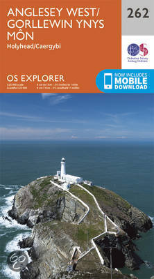
262 - Anglesey West, Wales AONB - Kaart nummer 262 in de OS Explorer reeks heeft betrekking op het westen van het eiland van Anglesey AONB (Ynys Mon) met inbegrip van Holyhead (Caergbyi). Hoogtepunten van het gebied zijn onder andere: Holy Island (Ynys Gybi), Holyhead bay, Llyn Alaw, Wylfa Head en Carmel hoofd. De OS Explorer kaart voor Anglesey West is beschikbaar in zowel de standaard papieren versie als de weerbestendige 'Actief' versie.
262 - Anglesey West, Wales AONB - Map sheet number 262 in the OS Explorer series covers the west of the Isle of Anglesey (Ynys Mon) including Holyhead (Caergbyi). Highlights of the area include: Holy Island (Ynys Gybi), Holyhead bay, Llyn Alaw, Wylfa Head, and Carmel Head. The OS Explorer map for Anglesey West is available in both the standard paper version and weatherproof 'Active' version.
Locatie op kaart
Gekoppelde artikelen

Wandelkaart 262 Anglesey West- Wales AONB - OSI • 9780319244593
standaard versieWandelkaart Anglesey West - Wales AONB Productbeschrijving: Holyhead 262 - Anglesey West, Wales AONB - Kaart nummer 262 in de OS Explorer reeks heeft betrekking op het westen van het eiland van Anglesey AONB (Ynys Mon) met inbegrip van Holyhead (Caergbyi). Hoogtepunten van het gebied zijn onder andere: Holy Island (Ynys Gybi), Holyhead bay, Llyn Alaw, Wylfa Head en Carmel hoofd. De OS…

Wandelkaart 262 Anglesey West North Wales - OSI • 9780319471340
weatherproof versieWandelkaart Anglesey West - North Wales Omvat ook: Holyhead. Productbeschrijving: Kaart nummer 262 in de OS Explorer kaarten reeks heeft betrekking op het westen van het eiland van Anglesey (Ynys Mon) met inbegrip van Holyhead (Caergbyi). Hoogtepunten van het gebied zijn onder meer: Holy Island (Ynys Gybi), Holyhead bay, Llyn Alaw, Wylfa Head en Carmel Head. De OS Explorer kaart voor A…
Overzichtskaarten

Area's of Outstanding Natural Beauty - AONB's UK
Area's of Outstanding Natural Beauty - AONB's UK

Producten op de overzichtskaart
Klik op een product om naar de detailpagina te gaan.
- Wandelgids - Guide to the Cotswolds AONB - AA
- Wandelkaart 24 - Chilterns AONB - AA
- Fietskaart- en Mtb kaart - The Cotswolds - Goldeneye
- Wandelgids - Cotswold classic walks guidebook - Goldeneye
- Wandelgids - Exploring the Cotswolds - Goldeneye
- Wandelgids - Cotswold Classic Walks - Goldeneye
- Wandelkaart - Cotswolds- Malverns & Forest of Dean - Goldeneye
- Wandelgids - The Cotswold Way 30 classic routes - Cicerone
- Wandelgids - Kent walking guide - Cicerone
- Wandelgids - North Downs Way Nat. trail - Cicerone
- Wandelgids - Chilterns walking guide - Cicerone
- Wandelgids - Suffolk coast & Heaths walks - Cicerone
- Wandelgids - North Downs Way - Map Booklet - Cicerone
- Wandelgids - North Pennines AONB walking guide - Cicerone
- Wandelgids - Ridgeway National Trail - Cicerone
- Wandelgids - Forest of Bowland & Pendle - Cicerone
- Wandelgids - Hampshire's Test Way walking guide - Cicerone
- Wandelgids & Fietsgids - The Cotswold AONB - Cicerone
- Wandelgids - Walking on the Gower - Cicerone
- Wandelgids - North Wessex Downs - Cicerone Press
- Wandelgids - Walking on the North Wessex Downs - Cicerone
- Wandelgids - Silverdale & Arnside AONB - Cicerone
- Wandelgids - North Downs Way- 246 km - Trailblazer
- Wandelkaart OL2 - Yorkshire Dales- Southern & Western Areas - OSI
- Wandelkaart OL19 - Howgill Fells and Upper Eden Valley - OSI
- Wandelkaart OL21 - South Pennines - Yorkshire - OSI
- Wandelkaart OL31 - North Pennines- Teesdale & Weardale - OSI
- Wandelkaart OL40 - The Broads - OSI
- Wandelkaart OL41 - Forest of Bowland & Ribblesdale - OSI
- Wandelkaart OL45 - The Cotswolds AONB- Gloucestershire - OSI
- Wandelkaart 108 - Lower Tamer Valley & Plymouth- Cornwall- OSI
- Wandelkaart 115 - Exmouth & Sidmouth- Devon - OSI
- Wandelkaart 137 - Ashford- Kent downs AONB- England - OSI
- Wandelkaart 140 - Quantock Hills AONB- Somerset - OSI
- Wandelkaart 140 - Quantock Hills AONB & Bridgwater- Devon - OSI
- Wandelkaart 147 - Sevenoaks & Tonbridge- Kent - OSI
- Wandelkaart 164 - Gower AONB & Gwyr- South Wales - OSI
- Wandelkaart 164 - Gower AONB & Gwyr- Wales - OSI
- Wandelkaart 171 - Chiltern Hills West & Henley-on-Thames OSI
- Wandelkaart 171 - Chiltern Hills West AONB- Wycombe - OSI
- Wandelkaart 172 - Chiltern Hills East AONB- Wycombe - OSI
- Wandelkaart 181 - Chiltern Hills AONB North- England - OSI
- Wandelkaart 181 - Chiltern Hills North AONB- Wycombe - OSI
- Wandelkaart 190 - Malvern Hills & Bredon Hill - OSI
- Wandelkaart 190 - Malvern Hills AONB & Bredon Hill - OSI
- Wandelkaart 203 - Ludlow- Shropshire Hills AONB - OSI
- Wandelkaart 217 - Long Mynd & Wenlock Edge- Schropshire- OSI
- Wandelkaart 254 - Lleyn Peninsular East- North Wales - OSI
- Wandelkaart 261 - Boston- Lincolnshire AONB - OSI
- Wandelkaart 262 - Anglesey West- Wales AONB - OSI
- Wandelkaart 263 - Anglesey East AONB- Wales - OSI
- Wandelkaart 273 - Lincolnshire Wolds South AONB - OSI
- Wandelkaart 282 - Lincolnshire Wolds North AONB - OSI
- Wandelkaart 298 - Nidderdale AONB- Yorkshire - OSI
- Wandelkaart 298 - Nidderdale AONB North Yorkshire - OSI
- Wandelkaart 300 - Howardian Hills AONB - OSI
- Wandelkaart 300 - Howardian Hills AONB & Malton - OSI
- Wandelkaart - Mourne Mountains N. Ireland - Harvey maps
- Wandelkaart - Fietskaart Forest of Bowland - Harvey maps
- Wandelkaart XT40 - Anglesey Coastal Path N. Wales - Harvey Maps
- Wandelkaart XT40 - Pennine Way Noord - Harvey Maps
- Wandelkaart XT40 - Pennine Way Zuid - Harvey Maps
- Wandelgids Cotswold - Way Two-way trekking guide - Knife Edge
- Reisgids Oxford & the Cotswolds AONB - Edicola
- Reisgids Cotswolds England - Rough Guides
- Travelguide Oxford & The Cotswolds pocket guide - Lonely Planet
- Wandelgids - The Ridgeway National trail - Trailblazer

OSI Explorer & Explorer Active - Wales
OSI Explorer & Explorer Active - Wales

Producten op de overzichtskaart
Klik op een product om naar de detailpagina te gaan.
- Wandelkaart 151 Cardiff & Bridgend- Wales - OSI
- Wandelkaart 152 Newport & Pontypool- South Wales - OSI
- Wandelkaart 164 Gower AONB & Gwyr- South Wales - OSI
- Wandelkaart 165 Swansea & Abertawe- South Wales - OSI
- Wandelkaart 166 Rhondda & Merthyr Tydfil - OSI
- Wandelkaart 177 Carmarthen & Kidwelly- Wales - OSI
- Wandelkaart 178 Llanelli- Ammanford & Rhydaman - OSI
- Wandelkaart 185 Newcastle & Emly- Northumberland - OSI
- Wandelkaart 186 Llandeilo- Brechfa Forest- Wales - OSI
- Wandelkaart 187 Llandovery- South Wales - OSI
- Wandelkaart 188 Builth Wells & Llanfair-ym-Muallt - OSI
- Wandelkaart 189 Hereford & Ross-on-Wye- England - OSI
- Wandelkaart 198 Cardigan & New Quay- Wales - OSI
- Wandelkaart 199 Lampeter- Wales - OSI
- Wandelkaart 200 Llandrindod Wells & Elan Valley - OSI
- Wandelkaart 201 Knighton & Presteigne- Wales - OSI
- Wandelkaart 202 Leominster & Bromyard Hererfordshire - OSI
- Wandelkaart 203 Ludlow & Shropshire Hills AONB - OSI
- Wandelkaart 213 Aberystwyth & Cwm Rheidol - Wales - OSI
- Wandelkaart 214 Llanidloes- Newtown & Y Drenewydd - OSI
- Wandelkaart 215 Newtown & Machynlleth- Powys Wales - OSI
- Wandelkaart 216 Welshpool & Montgomery- Powys - OSI
- Wandelkaart 217 Long Mynd & Wenlock Edge - OSI
- Wandelkaart 239 Lake Vyrnwy & Efyrnwy- North Wales - OSI
- Wandelkaart 240 Oswestry & Croesoswallt- Shropshir - OSI
- Wandelkaart 241 Shrewsbury- shropshire England - OSI
- Wandelkaart 253 Lleyn Peninsula West Wales - OSI
- Wandelkaart 254 Lleyn Peninsula East- Wales - OSI
- Wandelkaart 255 Llangollen & Berwyn- West Wales - OSI
- Wandelkaart 256 Wrexham- Wrecsam & Llangollen - OSI
- Wandelkaart 257 Crewe & Nantwich & Cheshire East - OSI
- Wandelkaart 262 Anglesey West- Wales AONB - OSI
- Wandelkaart 263 Anglesey East AONB- Wales - OSI
- Wandelkaart 264 Vale of Clwyd & Dyffryn Clwyd - OSI
- Wandelkaart 265 Clwydian Range & Bryniau Clwyd - OSI
- Wandelkaart 266 Wirral- Chester & Caer- Merseyside - OSI
- Wandelkaart 267 Northwich & Delamere Forest - OSI
- Wandelkaart 275 Liverpool- South West England - OSI
- Wandelkaart OL12 Brecon Beacons NP- West & Central - OSI
- Wandelkaart OL13 Brecon Beacons NP - Eastern area - OSI
- Wandelkaart OL17 Snowdon & Conwy Valley area - OSI
- Wandelkaart OL35 North Pembrokeshire Wales - OSI
- Wandelkaart OL36 South Pembrokeshire- Wales - OSI
Artikelen uit dezelfde regio

Wandelgids 19 routes England- Schotland & Wales - Cicerone • 9781852847883
Wandelgids - 19 routes England- Schotland & Wales - Cicerone Productomschrijving: Deze inspirerende gids kijkt naar elk van de 19 National Trails in het Verenigd Koninkrijk, met informatie die het gemakkelijk maakt om vergelijking en contrast te vinden, inspiratie bij het vinden van, en tot het nemen van een lange afstandsuitdaging. Sommige Trails zijn kort en gemakkelijk, anderen veel lan…

Wandelkaart 114 Anglesey- North West Wales - OSI • 9780319474372
Wandelkaart Anglesey - North West Wales - OSI Productbeschrijving: Kaart nummer 114 in de reeks van de OS Landranger kaarten bestrijkt het platteland Welsh eiland Anglesey. Het is omringd door zandstranden en rotsachtige grotten, met het binnenland dat deel is van het eiland wordt meestal landbouw geteelt. Anglesey is briljant geschikt voor toeristen met een ruime keuze aan accommodatie en…

Reisgids L'essentiel de l'Angleterre et du Pays de Galle - LP • 9782816179422
L'essentiel de l'Angleterre et du Pays de Galle - LP Productomschrijving: De Lonely Planet-gids voor de basis, om het beste van Engeland en Wales te ontdekken - Een volledig opnieuw ontworpen versie, zodat je tijdens uw reis naar Engeland en Wales geen enkele must-haves hoeft te missen. Een kleurrijke gids, geïllustreerd met tientallen foto's. Onmisbare locaties (Londen, Stonehenge, Salisb…

Reisgids PassePartout Wales - Edicola Reisgidsen • 9789493300620
Reisgids Wales van Edicola Productomschrijving: Wie Wales zegt, zegt schitterende natuur, vriendelijke mensen en een rijke Keltische geschiedenis. Het land in het Verenigd Koninkrijk telt maar liefst drie nationale parken: het berggebied Snowdonia, de Brecon Beacons en de kustlijn van Pembrokeshire. Hoofdstad Cardiff is een verrassend gezellige stad die bruist van de cultuur, sport…

Reisgids Great Britain - Lonely Planet • 9781838693541
Reisgids Great Britain - Lonely Planet Productomschrijving: Buckingham Palace, Stonehenge, Manchester United, The Beatles - Groot-Brittannië heeft iconen zoals nergens anders en reizen hierheen is een fascinerende mix van beroemde namen en verborgen juweeltjes.. Omvat: London, Canterbury, Southeast England, Oxford, Cotswolds, Southwest England, Cambridge, East Anglia, Birmingham, the M…