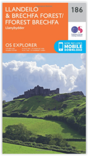
Wandelkaart 186 Llandeilo- Brechfa Forest- Wales - OSI
Ten noordwesten van de Brecon Beacons ligt Brechfa Forest
Korte omschrijving
Wandelkaart Llandeilo- Brechfa Forest - West Wales Omvat ook: Llanybydder. Productbeschrijving: Ten noordwesten van de Brecon Beacons ligt Brechfa Forest, gedekt door OS Explorer kaart 1...

Specificaties
- Uitgever: Ordnance Survey
- ISBN-13: 9780319243794
- HOOFDCATEGORIEËN: Wandelkaart
- Activiteiten: Wandelen, Hiking & Trekking
- Regio: West Wales
- Land: Wales
- Regionale parken: Brechfa Forest, West Wales
- Schaal: 1:25000
- Afmeting: 13x23
- Taal: Engels
- Reeks: Explorer Series OSI
Volledige omschrijving
Wandelkaart Llandeilo- Brechfa Forest - West Wales
Omvat ook: Llanybydder.
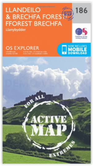
Productbeschrijving: Ten noordwesten van de Brecon Beacons ligt Brechfa Forest, gedekt door OS Explorer kaart 186. Dit gebied omvat een aantal kleine dorpen, alsmede Rivery brân en de stad van Llandeilo. De OS Explorer kaart voor Llandeilo & Brechfa Forest is beschikbaar in zowel de standaard papieren versie als de weerbestendige 'Actief' versie.
Productdiscription: Northwest of the Brecon Beacons is Brechfa Forest, covered by OS Explorer map 186. This area includes a number of small villages, as well as Rivery Towy and the town of Llandeilo. The OS Explorer map for Llandeilo & Brechfa Forest is available in both the standard paper version and weatherproof 'Active' version.

Locatie op kaart
Gekoppelde artikelen

Wandelkaart 186 Llandeilo- Brechfa Forest- Wales - OSI • 9780319243794
standaard versieWandelkaart Llandeilo- Brechfa Forest - West Wales Omvat ook: Llanybydder. Productbeschrijving: Ten noordwesten van de Brecon Beacons ligt Brechfa Forest, gedekt door OS Explorer kaart 186. Dit gebied omvat een aantal kleine dorpen, alsmede Rivery brân en de stad van Llandeilo. De OS Explorer kaart voor Llandeilo & Brechfa Forest is beschikbaar in zowel de standaard papieren versie als…

Wandelkaart 186 Llandeilo & Brechfa Forest- Wales - OSI • 9780319470589
weatherproof versieWandelkaart Llandeilo & Brechfa Forest - Wales Omvat ook: Llanybydder. Productbeschrijving: Ten noordwesten van de Brecon Beacons ligt het régionaal park Brechfa Forest, en worden gedekt door OS Explorer kaart 186. Dit gebied omvat een aantal kleine dorpen, alsmede de Rivery brân en de stad van Llandeilo. De OS Explorer kaart voor Llandeilo & Brechfa Forest is beschikbaar in zowel de s…
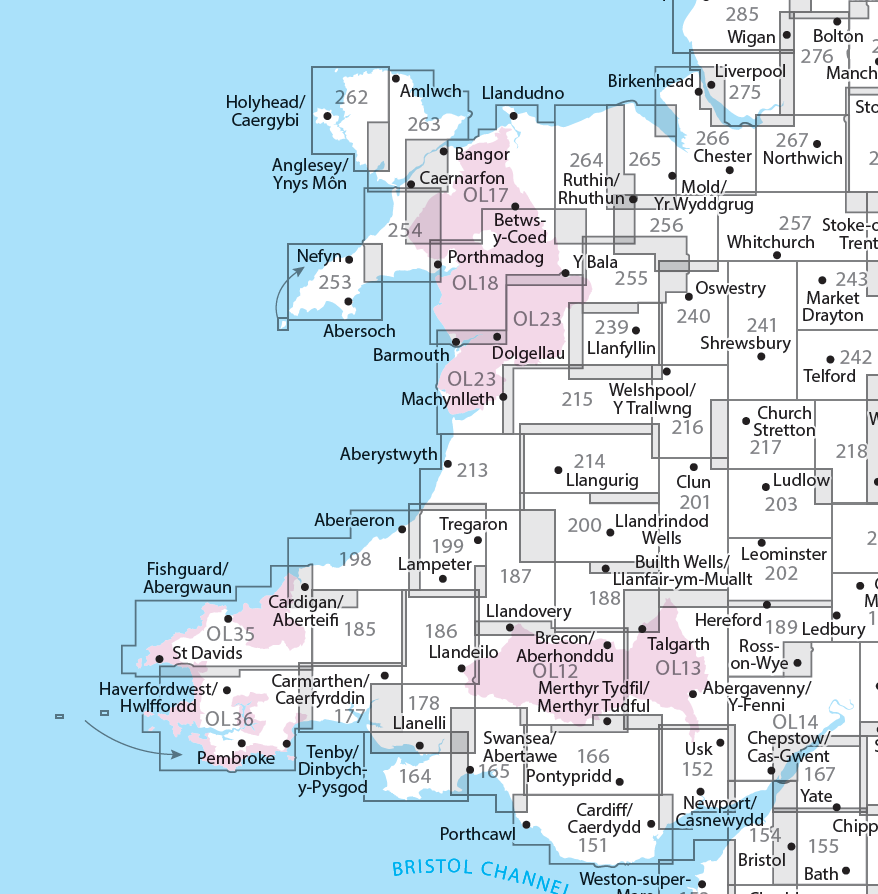
Overzichtskaarten

OSI Explorer & Explorer Active - Wales
OSI Explorer & Explorer Active - Wales

Producten op de overzichtskaart
Klik op een product om naar de detailpagina te gaan.
- Wandelkaart 151 Cardiff & Bridgend- Wales - OSI
- Wandelkaart 152 Newport & Pontypool- South Wales - OSI
- Wandelkaart 164 Gower AONB & Gwyr- South Wales - OSI
- Wandelkaart 165 Swansea & Abertawe- South Wales - OSI
- Wandelkaart 166 Rhondda & Merthyr Tydfil - OSI
- Wandelkaart 177 Carmarthen & Kidwelly- Wales - OSI
- Wandelkaart 178 Llanelli- Ammanford & Rhydaman - OSI
- Wandelkaart 185 Newcastle & Emly- Northumberland - OSI
- Wandelkaart 186 Llandeilo- Brechfa Forest- Wales - OSI
- Wandelkaart 187 Llandovery- South Wales - OSI
- Wandelkaart 188 Builth Wells & Llanfair-ym-Muallt - OSI
- Wandelkaart 189 Hereford & Ross-on-Wye- England - OSI
- Wandelkaart 198 Cardigan & New Quay- Wales - OSI
- Wandelkaart 199 Lampeter- Wales - OSI
- Wandelkaart 200 Llandrindod Wells & Elan Valley - OSI
- Wandelkaart 201 Knighton & Presteigne- Wales - OSI
- Wandelkaart 202 Leominster & Bromyard Hererfordshire - OSI
- Wandelkaart 203 Ludlow & Shropshire Hills AONB - OSI
- Wandelkaart 213 Aberystwyth & Cwm Rheidol - Wales - OSI
- Wandelkaart 214 Llanidloes- Newtown & Y Drenewydd - OSI
- Wandelkaart 215 Newtown & Machynlleth- Powys Wales - OSI
- Wandelkaart 216 Welshpool & Montgomery- Powys - OSI
- Wandelkaart 217 Long Mynd & Wenlock Edge - OSI
- Wandelkaart 239 Lake Vyrnwy & Efyrnwy- North Wales - OSI
- Wandelkaart 240 Oswestry & Croesoswallt- Shropshir - OSI
- Wandelkaart 241 Shrewsbury- shropshire England - OSI
- Wandelkaart 253 Lleyn Peninsula West Wales - OSI
- Wandelkaart 254 Lleyn Peninsula East- Wales - OSI
- Wandelkaart 255 Llangollen & Berwyn- West Wales - OSI
- Wandelkaart 256 Wrexham- Wrecsam & Llangollen - OSI
- Wandelkaart 257 Crewe & Nantwich & Cheshire East - OSI
- Wandelkaart 262 Anglesey West- Wales AONB - OSI
- Wandelkaart 263 Anglesey East AONB- Wales - OSI
- Wandelkaart 264 Vale of Clwyd & Dyffryn Clwyd - OSI
- Wandelkaart 265 Clwydian Range & Bryniau Clwyd - OSI
- Wandelkaart 266 Wirral- Chester & Caer- Merseyside - OSI
- Wandelkaart 267 Northwich & Delamere Forest - OSI
- Wandelkaart 275 Liverpool- South West England - OSI
- Wandelkaart OL12 Brecon Beacons NP- West & Central - OSI
- Wandelkaart OL13 Brecon Beacons NP - Eastern area - OSI
- Wandelkaart OL17 Snowdon & Conwy Valley area - OSI
- Wandelkaart OL35 North Pembrokeshire Wales - OSI
- Wandelkaart OL36 South Pembrokeshire- Wales - OSI
Artikelen uit dezelfde regio

Fietskaart Pembrokeshire National Park - Goldeneye • 9781859651223
Fietskaart Pembrokeshire NP - West Wales - Goldeneye Productomschrijving: Pembrokeshire (Wels: Sir Benfro) is een bestuurlijk graafschap in het zuidwesten van Wales, gelegen in het ceremoniële behouden graafschap Dyfed. Een supergeschikte regio voor de fietser in het algemeen, rustig gelegen in de hoek van Wales. Het grenst in het oosten aan Carmarthenshire en in het noordoosten aan Ceredi…


