
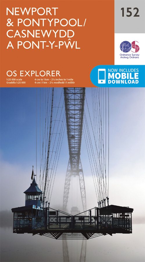
Wandelkaart 152 Newport & Pontypool South Wales - OSI
Dit gebied is zeer belangrijk natuurgebied voor Wales

Korte omschrijving
Wandelkaart Newport & Pontypool - South Wales Productbeschrijving: OS Explorer kaart 152 toont Pontypool to Newport en de monding van de Severn. Dit gebied is zeer belangrijk voor de natuur ...

Specificaties
- Uitgever: Ordnance Survey
- ISBN-13: 9780319243459
- HOOFDCATEGORIEËN: Wandelkaart
- Activiteiten: Wandelen, Hiking & Trekking
- Regio: South Wales
- Land: Wales
- Schaal: 1:25000
- Afmeting: 13x23
- Taal: Engels
- Reeks: Explorer Series OSI
Volledige omschrijving
Wandelkaart Newport & Pontypool - South Wales
Productbeschrijving: OS Explorer kaart 152 toont Pontypool to Newport en de monding van de Severn. Dit gebied is zeer belangrijk voor de natuur en het wild die er rond loopt, met veel van het estuarium, is deze aangewezen als een site van bijzonder wetenschappelijk belang. De OS Explorer kaart voor Newport & Pontypool is beschikbaar in zowel de standaard papieren versie als de weerbestendige 'Actief' versie
Kaart nummer 152 is een all purpose kaart vol gepakt met informatie om u het gebied te helpen leren kennen. De kaarten bestrijken het land. Elke kaart heeft een oppervlakte van 40 km door 40 km (25 mijl door 25 mijl) en zoals andere kaarten van Ordnance Survey, National Grid-vierkanten worden verstrekt zodat elke functie een unieke referentienummer kan worden gegeven.
Productdiscription: OS Explorer Map 152 shows Pontypool (Pont-y-p?l) to Newport and the Mouth of the Severn. This area is very important for wildlife, with much of the estuary designated a site of special scientific interest. The OS Explorer map for Newport & Pontypool is available in both the standard paper version and weatherproof 'Active' version
Locatie op kaart
Gekoppelde artikelen

Wandelkaart 152 Newport & Pontypool South Wales - OSI • 9780319243459
standaard versieWandelkaart Newport & Pontypool - South Wales Productbeschrijving: OS Explorer kaart 152 toont Pontypool to Newport en de monding van de Severn. Dit gebied is zeer belangrijk voor de natuur en het wild die er rond loopt, met veel van het estuarium, is deze aangewezen als een site van bijzonder wetenschappelijk belang. De OS Explorer kaart voor Newport & Pontypool is beschikbaar in zowel de…

Wandelkaart 152 Newport & pontypool South Wales - OSI • 9780319470244
weatherproof versieWandelkaart Newport & pontypool - South Wales Productbeschrijving: OS Explorer kaart 152 toont Pontypool aan Newport en de monding van de Severn. Dit gebied is zeer belangrijk voor wilde dieren, met veel van het estuarium die als een site van bijzonder wetenschappelijk belang word aangewezen. De OS Explorer kaart voor Newport & Pontypool is beschikbaar in zowel de standaard papieren versie…
Overzichtskaarten

OSI Explorer & Explorer Active - Wales
OSI Explorer & Explorer Active - Wales

Producten op de overzichtskaart
Klik op een product om naar de detailpagina te gaan.
- Wandelkaart 151 Cardiff & Bridgend- Wales - OSI
- Wandelkaart 152 Newport & Pontypool- South Wales - OSI
- Wandelkaart 164 Gower AONB & Gwyr- South Wales - OSI
- Wandelkaart 165 Swansea & Abertawe- South Wales - OSI
- Wandelkaart 166 Rhondda & Merthyr Tydfil - OSI
- Wandelkaart 177 Carmarthen & Kidwelly- Wales - OSI
- Wandelkaart 178 Llanelli- Ammanford & Rhydaman - OSI
- Wandelkaart 185 Newcastle & Emly- Northumberland - OSI
- Wandelkaart 186 Llandeilo- Brechfa Forest- Wales - OSI
- Wandelkaart 187 Llandovery- South Wales - OSI
- Wandelkaart 188 Builth Wells & Llanfair-ym-Muallt - OSI
- Wandelkaart 189 Hereford & Ross-on-Wye- England - OSI
- Wandelkaart 198 Cardigan & New Quay- Wales - OSI
- Wandelkaart 199 Lampeter- Wales - OSI
- Wandelkaart 200 Llandrindod Wells & Elan Valley - OSI
- Wandelkaart 201 Knighton & Presteigne- Wales - OSI
- Wandelkaart 202 Leominster & Bromyard Hererfordshire - OSI
- Wandelkaart 203 Ludlow & Shropshire Hills AONB - OSI
- Wandelkaart 213 Aberystwyth & Cwm Rheidol - Wales - OSI
- Wandelkaart 214 Llanidloes- Newtown & Y Drenewydd - OSI
- Wandelkaart 215 Newtown & Machynlleth- Powys Wales - OSI
- Wandelkaart 216 Welshpool & Montgomery- Powys - OSI
- Wandelkaart 217 Long Mynd & Wenlock Edge - OSI
- Wandelkaart 239 Lake Vyrnwy & Efyrnwy- North Wales - OSI
- Wandelkaart 240 Oswestry & Croesoswallt- Shropshir - OSI
- Wandelkaart 241 Shrewsbury- shropshire England - OSI
- Wandelkaart 253 Lleyn Peninsula West Wales - OSI
- Wandelkaart 254 Lleyn Peninsula East- Wales - OSI
- Wandelkaart 255 Llangollen & Berwyn- West Wales - OSI
- Wandelkaart 256 Wrexham- Wrecsam & Llangollen - OSI
- Wandelkaart 257 Crewe & Nantwich & Cheshire East - OSI
- Wandelkaart 262 Anglesey West- Wales AONB - OSI
- Wandelkaart 263 Anglesey East AONB- Wales - OSI
- Wandelkaart 264 Vale of Clwyd & Dyffryn Clwyd - OSI
- Wandelkaart 265 Clwydian Range & Bryniau Clwyd - OSI
- Wandelkaart 266 Wirral- Chester & Caer- Merseyside - OSI
- Wandelkaart 267 Northwich & Delamere Forest - OSI
- Wandelkaart 275 Liverpool- South West England - OSI
- Wandelkaart OL12 Brecon Beacons NP- West & Central - OSI
- Wandelkaart OL13 Brecon Beacons NP - Eastern area - OSI
- Wandelkaart OL17 Snowdon & Conwy Valley area - OSI
- Wandelkaart OL35 North Pembrokeshire Wales - OSI
- Wandelkaart OL36 South Pembrokeshire- Wales - OSI
Artikelen uit dezelfde regio

Wandelgids Walking in Carmarthenshire South Wales - Cicerone • 9781852847371
Wandelgids - Walking in Carmarthenshire South Wales - Cicerone Productomschrijving: Deze gids beschrijft 30 wandelroutes van (2 to 10 mijl) in Carmarthenshire, Zuid-Wales, met inbegrip van delen van het "Carmarthenshire Coast Path". Wandelingen voor alle niveaus, met inbegrip van de kust, rivier, bos- en heuvelwandelingen in de Cambrian Mountains, Tywi Valley, Y Mynydd Du (Zwarte Bergen) e…
Wandelkaart 213 Aberystwyth & Cwm Rheidol Wales - OSI • 9780319244067
Wandelkaart Aberystwyth & Cwm Rheidol - Wales 213 - Aberystwyth / Cwm Rheidol - Wales - Kaart blad nummer 213 in de OS Explorer reeks beslaat een gebied aan de westkust van Wales rond Aberystwyth op Cardigan Bay. Hoogtepunten van het gebied zijn onder andere: Plynlimon, het hoogste punt van het Cambrian Mountains and Devil's Bridge. De OS Explorer kaart voor Aberystwyth & Cwm Rheidol is be…
Wandelgids 50 walks in the Brecon Beacons & South Wales - AA • 9780749583705
Wandelgids Brecon Beacons & South Wales - AA Productomschrijving: De Brecon Beacons in Wales vormen een waar paradijs voor wandelaars. Met zijn uitgestrekte landschappen, ruige bergen en diepe valleien biedt dit nationale park meer dan genoeg om de avontuurlijke wandelaar bezig te houden. Stel je voor dat er 50 wandelroutes zijn, elk met hun eigen charme en uitdaging, variërend van eenvoud…

Wandelkaart 166 Rhondda & Merthyr - Wales - OSI • 9780319470381
Wandelkaart Rhondda & Merthyr & Merthyr Tudful - Wales Productbeschrijving: Kaart nummer 166 in de OS Explorer kaarten reeks is ideaal voor het ontdekken van het gebied van Rhondda en Merthyr Tydfil in Zuid-Wales. Dit gebied ligt net ten zuiden van de Brecon Beacons, met bijzonder hoge natuurlijke schoonheid en vele wandelingen. Hoogtepunten van het gebied zijn onder andere: Aberdare, Bar…
Wandelkaart XT40 Brecon Beacons West Wales - Harvey Ultra Maps • 9781851375998
Wandelkaart XT40 - Brecon Beacons West Wales - Harvey Ultra Maps Productomschrijving: Omvat een grote oppervlakte, en heel handig & compact. Gedetailleerde kaart voor hardlopers en wandelaars van het westelijke deel van het Brecon Beacons National Park op de magische schaal van 1:40, 000. Omvat: Pen y Fan, Fan Fawr en Foel Fraith. - Welsh-Engelse tekst. * Heeft de voordelen van zij…