
Wandelkaart Cotswolds- Malverns & Forest of Dean - Goldeneye
Een samenstelling van wandelkaart en bijhorende wandelgids
Korte omschrijving
Cotswolds- Malverns & Forest of Dean - Goldeneye Productomschrijving: Een samenstelling van wandelkaart en bijhorende wandelgids, over enkele van de meest bezochte wandellocaties van Engelan...

Specificaties
- Uitgever: Goldeneye
- ISBN-13: 9781859652893
- HOOFDCATEGORIEËN: Wandelkaart
- Activiteiten: Toerisme
- Auteur: William Fricker
- Regio: Oxfordshire west England, Somerset South West England, Warwickshire, West Midlands, Wiltshire, West England, Worcestershire, West England
- Land: England
- AONB - Area of Outstanding Beauty: Cotswolds AONB, Malvern Hills AONB
- Schaal: 1:126720
- Afmeting: 13x29
- Editie: 8
- Taal: Engels
Volledige omschrijving
Cotswolds- Malverns & Forest of Dean - Goldeneye
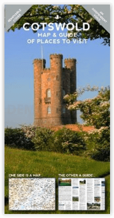
Productomschrijving: Een samenstelling van wandelkaart en bijhorende wandelgids, over enkele van de meest bezochte wandellocaties van Engeland, zowel de Cotwolds als Marvern Hills zijn beiden geklasseerd als AONB regio's of meerbepaald, Gebieden van uitmuntend natuurschoon. deze gebieden, met de Forest of Dean inbegrepen zijn allemaal bij elkander gelegen te vinden rond de monding van het kanaal van Bristol (Bristol Channel)
Engelse omschrijving: It is the simple combination of the Map and the Guide that makes exploring the Cotswolds such a pleasure.
• Where to Go, What to See, What to Do... and Where to Eat & Drink...
• The ideal publication for a short break, a long weekend, or your first-ever visit to the Cotswolds...
• Choose this practical combination of a Leisure Map
The Leisure Map:
• The ideal scale for touring @ 1:126,720 (2 miles to 1 inch)
• Tourist Attractions/Inns With Rooms/Hotels are illustrated
• Altitude Layering indicates the topography
• 5 Scenic Drives (Car tours) overprinted
• Clear and easy-to-follow...easy to fold and unfold
The Travel Guide:
• Opening Times to Attractions: gardens, country houses, art galleries
• Foodie pubs and tearooms selected on merit
• Lavishly illustrated with colour photographs
• 3 Scenic Drives (car tours) described
• So easy to plan your day, your week...your holiday
The Ideal Companion for exploring the Cotswolds scenic villages, ‘Wool’ towns, river valleys and, atypical English landscape.
Locatie op kaart
Overzichtskaarten

Area's of Outstanding Natural Beauty - AONB's UK
Area's of Outstanding Natural Beauty - AONB's UK

Producten op de overzichtskaart
Klik op een product om naar de detailpagina te gaan.
- Wandelgids - Guide to the Cotswolds AONB - AA
- Wandelkaart 24 - Chilterns AONB - AA
- Fietskaart- en Mtb kaart - The Cotswolds - Goldeneye
- Wandelgids - Cotswold classic walks guidebook - Goldeneye
- Wandelgids - Exploring the Cotswolds - Goldeneye
- Wandelgids - Cotswold Classic Walks - Goldeneye
- Wandelkaart - Cotswolds- Malverns & Forest of Dean - Goldeneye
- Wandelgids - The Cotswold Way 30 classic routes - Cicerone
- Wandelgids - Kent walking guide - Cicerone
- Wandelgids - North Downs Way Nat. trail - Cicerone
- Wandelgids - Chilterns walking guide - Cicerone
- Wandelgids - Suffolk coast & Heaths walks - Cicerone
- Wandelgids - North Downs Way - Map Booklet - Cicerone
- Wandelgids - North Pennines AONB walking guide - Cicerone
- Wandelgids - Ridgeway National Trail - Cicerone
- Wandelgids - Forest of Bowland & Pendle - Cicerone
- Wandelgids - Hampshire's Test Way walking guide - Cicerone
- Wandelgids & Fietsgids - The Cotswold AONB - Cicerone
- Wandelgids - Walking on the Gower - Cicerone
- Wandelgids - North Wessex Downs - Cicerone Press
- Wandelgids - Walking on the North Wessex Downs - Cicerone
- Wandelgids - Silverdale & Arnside AONB - Cicerone
- Wandelgids - North Downs Way- 246 km - Trailblazer
- Wandelkaart OL2 - Yorkshire Dales- Southern & Western Areas - OSI
- Wandelkaart OL19 - Howgill Fells and Upper Eden Valley - OSI
- Wandelkaart OL21 - South Pennines - Yorkshire - OSI
- Wandelkaart OL31 - North Pennines- Teesdale & Weardale - OSI
- Wandelkaart OL40 - The Broads - OSI
- Wandelkaart OL41 - Forest of Bowland & Ribblesdale - OSI
- Wandelkaart OL45 - The Cotswolds AONB- Gloucestershire - OSI
- Wandelkaart 108 - Lower Tamer Valley & Plymouth- Cornwall- OSI
- Wandelkaart 115 - Exmouth & Sidmouth- Devon - OSI
- Wandelkaart 137 - Ashford- Kent downs AONB- England - OSI
- Wandelkaart 140 - Quantock Hills AONB- Somerset - OSI
- Wandelkaart 140 - Quantock Hills AONB & Bridgwater- Devon - OSI
- Wandelkaart 147 - Sevenoaks & Tonbridge- Kent - OSI
- Wandelkaart 164 - Gower AONB & Gwyr- South Wales - OSI
- Wandelkaart 164 - Gower AONB & Gwyr- Wales - OSI
- Wandelkaart 171 - Chiltern Hills West & Henley-on-Thames OSI
- Wandelkaart 171 - Chiltern Hills West AONB- Wycombe - OSI
- Wandelkaart 172 - Chiltern Hills East AONB- Wycombe - OSI
- Wandelkaart 181 - Chiltern Hills AONB North- England - OSI
- Wandelkaart 181 - Chiltern Hills North AONB- Wycombe - OSI
- Wandelkaart 190 - Malvern Hills & Bredon Hill - OSI
- Wandelkaart 190 - Malvern Hills AONB & Bredon Hill - OSI
- Wandelkaart 203 - Ludlow- Shropshire Hills AONB - OSI
- Wandelkaart 217 - Long Mynd & Wenlock Edge- Schropshire- OSI
- Wandelkaart 254 - Lleyn Peninsular East- North Wales - OSI
- Wandelkaart 261 - Boston- Lincolnshire AONB - OSI
- Wandelkaart 262 - Anglesey West- Wales AONB - OSI
- Wandelkaart 263 - Anglesey East AONB- Wales - OSI
- Wandelkaart 273 - Lincolnshire Wolds South AONB - OSI
- Wandelkaart 282 - Lincolnshire Wolds North AONB - OSI
- Wandelkaart 298 - Nidderdale AONB- Yorkshire - OSI
- Wandelkaart 298 - Nidderdale AONB North Yorkshire - OSI
- Wandelkaart 300 - Howardian Hills AONB - OSI
- Wandelkaart 300 - Howardian Hills AONB & Malton - OSI
- Wandelkaart - Mourne Mountains N. Ireland - Harvey maps
- Wandelkaart - Fietskaart Forest of Bowland - Harvey maps
- Wandelkaart XT40 - Anglesey Coastal Path N. Wales - Harvey Maps
- Wandelkaart XT40 - Pennine Way Noord - Harvey Maps
- Wandelkaart XT40 - Pennine Way Zuid - Harvey Maps
- Wandelgids Cotswold - Way Two-way trekking guide - Knife Edge
- Reisgids Oxford & the Cotswolds AONB - Edicola
- Reisgids Cotswolds England - Rough Guides
- Travelguide Oxford & The Cotswolds pocket guide - Lonely Planet
- Wandelgids - The Ridgeway National trail - Trailblazer
Artikelen uit dezelfde regio

Wandelgids Heart of the Cotswolds - Rucksack Readers • 9781898481768
Heart of the Cotswolds AONB - Rucksack Readers Productomschrijving: De Cotswolds zijn typisch Engels, met hun rijke culturele geschiedenis, middeleeuwse 'wollen' kerken en charmante huiselijke architectuur van steen, leisteen en riet. Het boek biedt drie mogelijkheden om in het hart van dit prachtige gebied te wandelen: een 151 km lange tocht die begint in Cheltenham en twee kortere routes…

Wandelgids & Fietsgids The Cotswold AONB - Cicerone • 9781852847067
Wandelgids & Fietsgids - The Cotswold AONB - Cicerone Productomschrijving: De Cotswolds is de thuisbasis van mooie honing-hued stenen dorpen in een glooiende landschap. De dramatische 100-mijl lange kalkstenen helling biedt een adembenemend uitzicht, terwijl het netwerk van rustige wegen, fietsvriendelijke kanaalwegen, sporen en ruiterpaden perfect is voor verkenning op een fiets. De Cotwo…

Wandelkaart 143 Warminster & Trowbridge- Wiltshire - OSI • 9780319470152
Wandelkaart Warminster & Trowbridge - Wiltshire England Productbeschrijving: Kaart nummer 143 in de OS Explorer kaarten reeks heeft betrekking op het westen van Wiltshire, alsook Cranbone Chase & West Wiltshire Downs. Hoogtepunten van het gebied zijn onder andere: Mid Wilts Way, Wessex Ridgeway, Monarch Way en Imber Range Perimeter Path. De OS Explorer kaart voor Warminster & Trowbridge is…

Wandelkaart 172 Chiltern Hills East AONB- Oxfordshire- OSI • 9780319470442
Wandelkaart Chiltern Hills East AONB - Oxfordshire England Omvat ook: High Wycombe, Maidenhead & Rickmansworth. Productbeschrijving: Kaart nummer 172 in de OS Explorer kaarten reeks omvat High Wycombe, Maidenhead, Rickmansworth, Gerrards Cross, Northwood, Slough, Uxbridge, Hillingdon, Amersham, Chorleywood, Ruislip en Marlow, de oostelijke Chiltern Hills AONB en het pad van de Thames. …

Wandelgids The Kennet and Avon Canal walk - Cicerone • 9781786312303
The Kennet and Avon Canal walk - Cicerone Productomschrijving: Wandelgids langs het Kennet & Avon kanaal. De 151 Km lange route van Reading naar Bristol is verdeeld in 7 etappes van redelijk gemakkelijke wandelingen en omvat het UNESCO werelderfgoed Bath en de drijvende haven van Bristol. Er zijn ook 20 rondwandelingen opgenomen, variërend van 4¼ tot 9 mijl, waarbij de beste delen van het …