
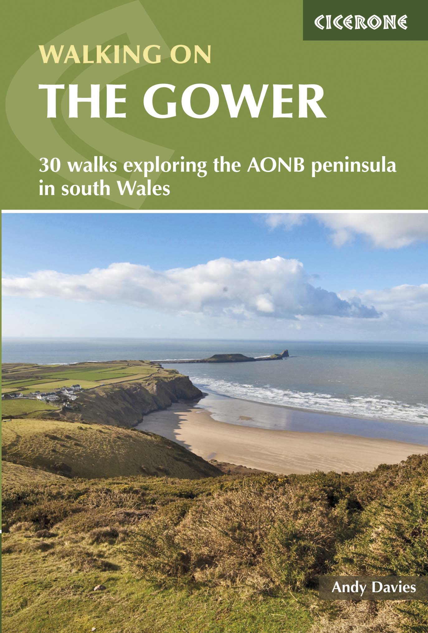
Wandelgids Walking on the Gower - Cicerone
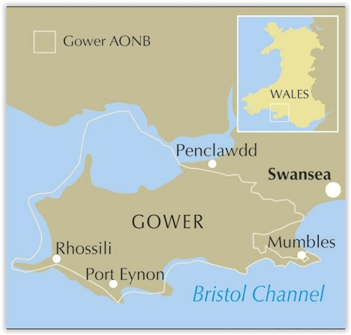
Het Gower schiereiland, een AONB regio in Zuid-Wales
Korte omschrijving
Wandelgids - Walking on the Gower - Cicerone Productomschrijving: De 30 cirkelvormige routes in deze gids beschrijft wandelingen op het Gower schiereiland, een Area of Outstanding Natural Be...

Specificaties
- Uitgever: CICERONE Press
- ISBN-13: 9781852848217
- HOOFDCATEGORIEËN: Wandelgids
- Activiteiten: Wandelen, Hiking & Trekking
- Auteur: Andrew Davies
- Regio: South Wales
- Land: Wales
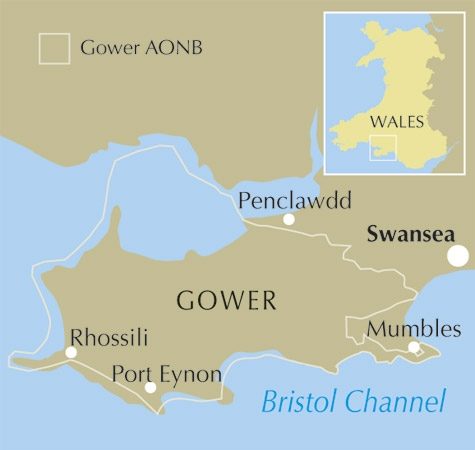
- AONB - Area of Outstanding Beauty: Gower peninsula, Wales AONB
- Blz.: 192
- Afmeting: 12x17
- Editie: 2
- Taal: Engels
Volledige omschrijving
Wandelgids - Walking on the Gower - Cicerone
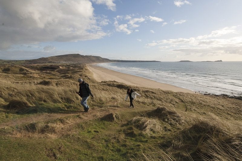
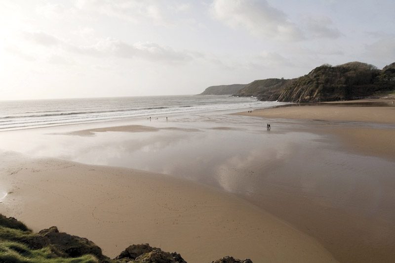
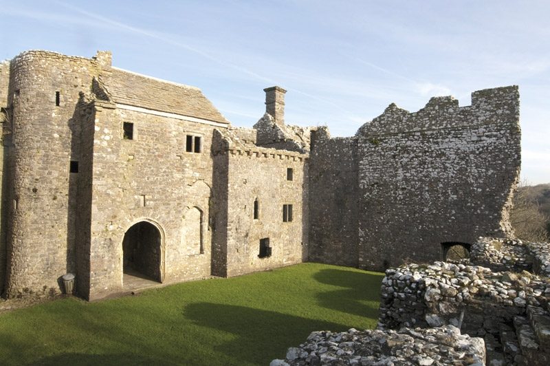
Productomschrijving: De 30 cirkelvormige routes in deze gids beschrijft wandelingen op het Gower schiereiland, een Area of Outstanding Natural Beauty AONB, in Zuid-Wales. Ze hebben betrekking op de ruige kustlijn, de stranden en binnenlandse valleien. De wandelingen beschrijven een verscheidenheid aan landschappen en variëren van 2 ½ tot 14 mijl in lengte. De gids staat vol met historische en geologische informatie over het gebied op een schiereiland!
Product description: The 30 circular routes in this guide to walking on the Gower peninsula, an Area of Outstanding Natural Beauty in South Wales, cover the rugged coastline, beaches and inland valleys and ridges. The walks visit a variety of landscapes and range from 2½ to 14 miles long. Packed with historical and geological information.
Seasons:
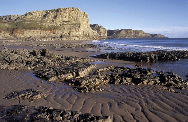
Wild winter storms promise dramatic seascapes; in springtime cliffs and valleys are carpeted in flowers; summer months allow a refreshing dip along a coastal walk.
Centres:
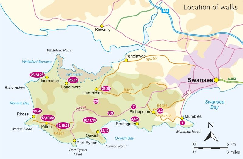
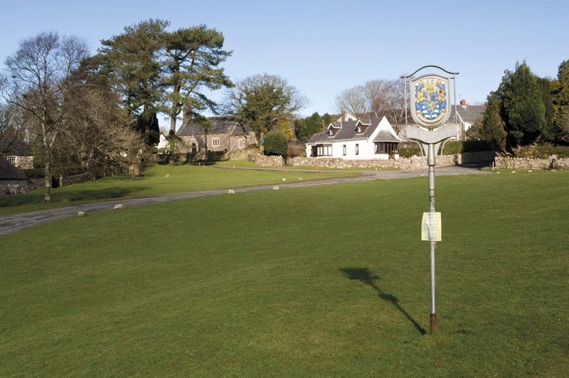
Mumbles is the largest village at the eastern end of Gower.
Difficulty:
Only short ascents but some of the footpaths are uneven in places; a variety of routes with differing lengths to suit every ability.
Must See:
Gower is an exceptional area for coastal landscapes, wildlife and geology; scenic unspoilt beaches combine with a rich cultural history.
Locatie op kaart
Overzichtskaarten

Area's of Outstanding Natural Beauty - AONB's UK
Area's of Outstanding Natural Beauty - AONB's UK

Producten op de overzichtskaart
Klik op een product om naar de detailpagina te gaan.
- Wandelgids - Guide to the Cotswolds AONB - AA
- Wandelkaart 24 - Chilterns AONB - AA
- Fietskaart- en Mtb kaart - The Cotswolds - Goldeneye
- Wandelgids - Cotswold classic walks guidebook - Goldeneye
- Wandelgids - Exploring the Cotswolds - Goldeneye
- Wandelgids - Cotswold Classic Walks - Goldeneye
- Wandelkaart - Cotswolds- Malverns & Forest of Dean - Goldeneye
- Wandelgids - The Cotswold Way 30 classic routes - Cicerone
- Wandelgids - Kent walking guide - Cicerone
- Wandelgids - North Downs Way Nat. trail - Cicerone
- Wandelgids - Chilterns walking guide - Cicerone
- Wandelgids - Suffolk coast & Heaths walks - Cicerone
- Wandelgids - North Downs Way - Map Booklet - Cicerone
- Wandelgids - North Pennines AONB walking guide - Cicerone
- Wandelgids - Ridgeway National Trail - Cicerone
- Wandelgids - Forest of Bowland & Pendle - Cicerone
- Wandelgids - Hampshire's Test Way walking guide - Cicerone
- Wandelgids & Fietsgids - The Cotswold AONB - Cicerone
- Wandelgids - Walking on the Gower - Cicerone
- Wandelgids - North Wessex Downs - Cicerone Press
- Wandelgids - Walking on the North Wessex Downs - Cicerone
- Wandelgids - Silverdale & Arnside AONB - Cicerone
- Wandelgids - North Downs Way- 246 km - Trailblazer
- Wandelkaart OL2 - Yorkshire Dales- Southern & Western Areas - OSI
- Wandelkaart OL19 - Howgill Fells and Upper Eden Valley - OSI
- Wandelkaart OL21 - South Pennines - Yorkshire - OSI
- Wandelkaart OL31 - North Pennines- Teesdale & Weardale - OSI
- Wandelkaart OL40 - The Broads - OSI
- Wandelkaart OL41 - Forest of Bowland & Ribblesdale - OSI
- Wandelkaart OL45 - The Cotswolds AONB- Gloucestershire - OSI
- Wandelkaart 108 - Lower Tamer Valley & Plymouth- Cornwall- OSI
- Wandelkaart 115 - Exmouth & Sidmouth- Devon - OSI
- Wandelkaart 137 - Ashford- Kent downs AONB- England - OSI
- Wandelkaart 140 - Quantock Hills AONB- Somerset - OSI
- Wandelkaart 140 - Quantock Hills AONB & Bridgwater- Devon - OSI
- Wandelkaart 147 - Sevenoaks & Tonbridge- Kent - OSI
- Wandelkaart 164 - Gower AONB & Gwyr- South Wales - OSI
- Wandelkaart 164 - Gower AONB & Gwyr- Wales - OSI
- Wandelkaart 171 - Chiltern Hills West & Henley-on-Thames OSI
- Wandelkaart 171 - Chiltern Hills West AONB- Wycombe - OSI
- Wandelkaart 172 - Chiltern Hills East AONB- Wycombe - OSI
- Wandelkaart 181 - Chiltern Hills AONB North- England - OSI
- Wandelkaart 181 - Chiltern Hills North AONB- Wycombe - OSI
- Wandelkaart 190 - Malvern Hills & Bredon Hill - OSI
- Wandelkaart 190 - Malvern Hills AONB & Bredon Hill - OSI
- Wandelkaart 203 - Ludlow- Shropshire Hills AONB - OSI
- Wandelkaart 217 - Long Mynd & Wenlock Edge- Schropshire- OSI
- Wandelkaart 254 - Lleyn Peninsular East- North Wales - OSI
- Wandelkaart 261 - Boston- Lincolnshire AONB - OSI
- Wandelkaart 262 - Anglesey West- Wales AONB - OSI
- Wandelkaart 263 - Anglesey East AONB- Wales - OSI
- Wandelkaart 273 - Lincolnshire Wolds South AONB - OSI
- Wandelkaart 282 - Lincolnshire Wolds North AONB - OSI
- Wandelkaart 298 - Nidderdale AONB- Yorkshire - OSI
- Wandelkaart 298 - Nidderdale AONB North Yorkshire - OSI
- Wandelkaart 300 - Howardian Hills AONB - OSI
- Wandelkaart 300 - Howardian Hills AONB & Malton - OSI
- Wandelkaart - Mourne Mountains N. Ireland - Harvey maps
- Wandelkaart - Fietskaart Forest of Bowland - Harvey maps
- Wandelkaart XT40 - Anglesey Coastal Path N. Wales - Harvey Maps
- Wandelkaart XT40 - Pennine Way Noord - Harvey Maps
- Wandelkaart XT40 - Pennine Way Zuid - Harvey Maps
- Wandelgids Cotswold - Way Two-way trekking guide - Knife Edge
- Reisgids Oxford & the Cotswolds AONB - Edicola
- Reisgids Cotswolds England - Rough Guides
- Travelguide Oxford & The Cotswolds pocket guide - Lonely Planet
- Wandelgids - The Ridgeway National trail - Trailblazer
Artikelen uit dezelfde regio
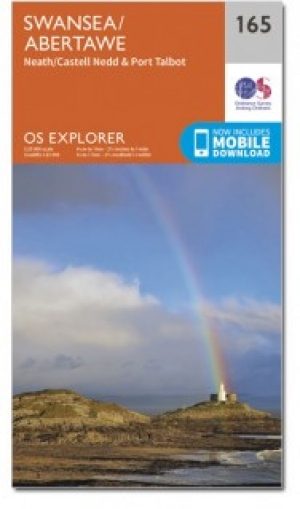
Wandelkaart 165 Swansea & Abertawe- South Wales - OSI • 9780319243589
Wandelkaart Swansea & Abertawe - South Wales Omvat ook: Neath & Port Talbot. Productbeschrijving: Kaart nummer 165 in de OS Explorer kaarten reeks is ideaal voor het verkennen van het zuiden van Wales rond Swansea en Port Talbot. Wandel tot aan Mumbles Head en kijk uit over de geweldige Swansea Bay, of neem een kijkje in en rond de stad van Swansea zelf. Andere hoogtepunten van het geb…
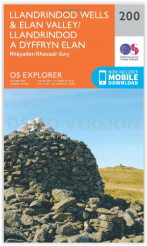
Wandelkaart 200 Llandrindod Wells & Elan Valley - OSI • 9780319243930
Wandelkaart Llandrindod Wells & Elan Valley - Wales Omvat ook: Rhayader. Productbeschrijving: Deze dubbelzijdige kaart toont Llandrindod Wells tot de Claerwen Reservoir, met inbegrip van de steile heuvels rond de Rivey Wye (Afon Gwy). De Wye Valley Walk recreatieve pad is één van de belangrijkste wandelpaden in het gebied, maar er zijn wel nog vele andere opties om te gaan verkennen, m…
Wandelkaart XT25 Brecon Beacons Oost - Harvey Maps • 9781851376711
Wandelkaart Brecon Beacons Oost - Harvey Maps Productomschrijving: Gedetailleerde kaart voor bergwandelaars van het oostelijke deel van het Brecon Beacons National Park. Inclusief de Pen y Fan en de Black Mountains. - De kaart is sterk, licht, duurzaam en 100% waterbestendig - Inclusief opengestelde wegen - Opent direct aan beide zijden van het blad - Eenvoudig opnieuw te vou…

Wandelkaart 151 Cardiff & Bridgend- Wales - OSI • 9780319243442
Wandelkaart Cardiff & Bridgend - Wales Productbeschrijving: Vale of Glamorgan 151 / Cardiff & Bridgend, Wales - Kaart nummer 151 in de OS Explorer reeks heeft betrekking op Cardiff en Bridgend in Zuid-Wales. Dit populaire gebied van Wales omvat steden waaronder Porthcawl, Cowbridge en Barry, met wandelingen met inbegrip van de Valeways Millenium heritage Trail, Bridgend circulaire Wal…

Wandelkaart 187 Llandovery & Llanynddyfri - OSI • 9780319470596
Wandelkaart Llandovery & Llanynddyfri - South Wales Omvat ook: Llanwrtyd Wells & Llyn Brianne. Productbeschrijving: OS Explorer kaart 187 toont Claerwen Resevior aan de Tywi Forest en Llandovery. De Wereldkampioenschappen Bog snorkelen worden hier jaarlijks gehouden in de buurt van Llanwrtyd Wells. De OS Explorer kaart voor Llandovery is beschikbaar in zowel de standaard papieren versi…