
Wandelkaart 261 Boston- Lincolnshire AONB - OSI
Omvat de steden van Sittard- Billinghay & Heckington
Korte omschrijving
Wandelkaart Boston - Lincolnshire AONB England Omvat ook: Tattershall, Billinghay & Heckington. Productbeschrijving: Boston, Lincolshire omvat een dubbelzijdige OS Explorer kaart 261. De...

Specificaties
- Uitgever: Ordnance Survey
- ISBN-13: 9780319471333
- HOOFDCATEGORIEËN: Wandelkaart
- Activiteiten: Wandelen, Hiking & Trekking
- Regio: lincolnshire
- Land: England
- Waterafstotende kaart: Ordnance Survey ACTIVE Explorer Weatherproof Maps
- AONB - Area of Outstanding Beauty: Lincolnshire Wolds AONB
- Schaal: 1:25000
- Afmeting: 13x24
- Taal: Engels
- Reeks: Explorer ACTIVE Series OSI
Volledige omschrijving
Wandelkaart Boston - Lincolnshire AONB England
Omvat ook: Tattershall, Billinghay & Heckington.
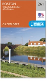
Productbeschrijving: Boston, Lincolshire omvat een dubbelzijdige OS Explorer kaart 261. Deze kaart toont ook de noordzijde van de Macmillan way, met zijn recreatieve paden. Hoogtepunten van het gebied zijn de steden van Sittard, Billinghay en Heckington, en de kustlijn rond de Wash. De OS Explorer kaart voor Boston is beschikbaar in zowel de standaard papieren versie als de weerbestendige 'Actief' versie.
Productdiscription: Boston, Lincolshire is covered by the double sided OS Explorer Map 261. This also shows the northern end of the Macmillan Way Recreational Path. Highlights of the area include the towns of Tattershall, Billinghay and Heckington, the coastline around The Wash. The OS Explorer map for Boston is available in both the standard paper version and weatherproof 'Active' version.
Locatie op kaart
Gekoppelde artikelen

Wandelkaart 261 Boston & Lincolnshire- England - OSI • 9780319244586
standaard versieWandelkaart Boston- Lincolnshire England Omvat ook: Tattershall, Billinghay & Heckington. 261 / Boston, Lincolnshire, England - Boston, Lincolshire is gedekt door deze dubbelzijdige OS Explorer kaart 261. Hij toont de noordzijde van de Macmillan way recreatie route aan. Hoogtepunten van het gebied zijn de steden van Sittard, Billinghay en Heckington, de kustlijn rond The Wash. De OS Ex…

Wandelkaart 261 Boston- Lincolnshire AONB - OSI • 9780319471333
weatherproof versieWandelkaart Boston - Lincolnshire AONB England Omvat ook: Tattershall, Billinghay & Heckington. Productbeschrijving: Boston, Lincolshire omvat een dubbelzijdige OS Explorer kaart 261. Deze kaart toont ook de noordzijde van de Macmillan way, met zijn recreatieve paden. Hoogtepunten van het gebied zijn de steden van Sittard, Billinghay en Heckington, en de kustlijn rond de Wash. De OS Ex…
Overzichtskaarten

Area's of Outstanding Natural Beauty - AONB's UK
Area's of Outstanding Natural Beauty - AONB's UK

Producten op de overzichtskaart
Klik op een product om naar de detailpagina te gaan.
- Wandelgids - Guide to the Cotswolds AONB - AA
- Wandelkaart 24 - Chilterns AONB - AA
- Fietskaart- en Mtb kaart - The Cotswolds - Goldeneye
- Wandelgids - Cotswold classic walks guidebook - Goldeneye
- Wandelgids - Exploring the Cotswolds - Goldeneye
- Wandelgids - Cotswold Classic Walks - Goldeneye
- Wandelkaart - Cotswolds- Malverns & Forest of Dean - Goldeneye
- Wandelgids - The Cotswold Way 30 classic routes - Cicerone
- Wandelgids - Kent walking guide - Cicerone
- Wandelgids - North Downs Way Nat. trail - Cicerone
- Wandelgids - Chilterns walking guide - Cicerone
- Wandelgids - Suffolk coast & Heaths walks - Cicerone
- Wandelgids - North Downs Way - Map Booklet - Cicerone
- Wandelgids - North Pennines AONB walking guide - Cicerone
- Wandelgids - Ridgeway National Trail - Cicerone
- Wandelgids - Forest of Bowland & Pendle - Cicerone
- Wandelgids - Hampshire's Test Way walking guide - Cicerone
- Wandelgids & Fietsgids - The Cotswold AONB - Cicerone
- Wandelgids - Walking on the Gower - Cicerone
- Wandelgids - North Wessex Downs - Cicerone Press
- Wandelgids - Walking on the North Wessex Downs - Cicerone
- Wandelgids - Silverdale & Arnside AONB - Cicerone
- Wandelgids - North Downs Way- 246 km - Trailblazer
- Wandelkaart OL2 - Yorkshire Dales- Southern & Western Areas - OSI
- Wandelkaart OL19 - Howgill Fells and Upper Eden Valley - OSI
- Wandelkaart OL21 - South Pennines - Yorkshire - OSI
- Wandelkaart OL31 - North Pennines- Teesdale & Weardale - OSI
- Wandelkaart OL40 - The Broads - OSI
- Wandelkaart OL41 - Forest of Bowland & Ribblesdale - OSI
- Wandelkaart OL45 - The Cotswolds AONB- Gloucestershire - OSI
- Wandelkaart 108 - Lower Tamer Valley & Plymouth- Cornwall- OSI
- Wandelkaart 115 - Exmouth & Sidmouth- Devon - OSI
- Wandelkaart 137 - Ashford- Kent downs AONB- England - OSI
- Wandelkaart 140 - Quantock Hills AONB- Somerset - OSI
- Wandelkaart 140 - Quantock Hills AONB & Bridgwater- Devon - OSI
- Wandelkaart 147 - Sevenoaks & Tonbridge- Kent - OSI
- Wandelkaart 164 - Gower AONB & Gwyr- South Wales - OSI
- Wandelkaart 164 - Gower AONB & Gwyr- Wales - OSI
- Wandelkaart 171 - Chiltern Hills West & Henley-on-Thames OSI
- Wandelkaart 171 - Chiltern Hills West AONB- Wycombe - OSI
- Wandelkaart 172 - Chiltern Hills East AONB- Wycombe - OSI
- Wandelkaart 181 - Chiltern Hills AONB North- England - OSI
- Wandelkaart 181 - Chiltern Hills North AONB- Wycombe - OSI
- Wandelkaart 190 - Malvern Hills & Bredon Hill - OSI
- Wandelkaart 190 - Malvern Hills AONB & Bredon Hill - OSI
- Wandelkaart 203 - Ludlow- Shropshire Hills AONB - OSI
- Wandelkaart 217 - Long Mynd & Wenlock Edge- Schropshire- OSI
- Wandelkaart 254 - Lleyn Peninsular East- North Wales - OSI
- Wandelkaart 261 - Boston- Lincolnshire AONB - OSI
- Wandelkaart 262 - Anglesey West- Wales AONB - OSI
- Wandelkaart 263 - Anglesey East AONB- Wales - OSI
- Wandelkaart 273 - Lincolnshire Wolds South AONB - OSI
- Wandelkaart 282 - Lincolnshire Wolds North AONB - OSI
- Wandelkaart 298 - Nidderdale AONB- Yorkshire - OSI
- Wandelkaart 298 - Nidderdale AONB North Yorkshire - OSI
- Wandelkaart 300 - Howardian Hills AONB - OSI
- Wandelkaart 300 - Howardian Hills AONB & Malton - OSI
- Wandelkaart - Mourne Mountains N. Ireland - Harvey maps
- Wandelkaart - Fietskaart Forest of Bowland - Harvey maps
- Wandelkaart XT40 - Anglesey Coastal Path N. Wales - Harvey Maps
- Wandelkaart XT40 - Pennine Way Noord - Harvey Maps
- Wandelkaart XT40 - Pennine Way Zuid - Harvey Maps
- Wandelgids Cotswold - Way Two-way trekking guide - Knife Edge
- Reisgids Oxford & the Cotswolds AONB - Edicola
- Reisgids Cotswolds England - Rough Guides
- Travelguide Oxford & The Cotswolds pocket guide - Lonely Planet
- Wandelgids - The Ridgeway National trail - Trailblazer
Artikelen uit dezelfde regio

Wandelkaart 274 Skegness- Alford & Spilsby - OSI • 9780319244715
Wandelkaart Skegness- Alford & Spilsby - Lincolnshire England Omvat ook: Chapel St Leonards & Wainfleet All Saints. Productbeschrijving: Aan de oostkust van Engeland gelegen toont OS Explorer kaart 274 de steden Skegness, Alford en Splisby als ook het omliggende gebied. Het gebied is vooral bekend als een badplaats - de eerste Butlins werden hier geopend in 1936, maar begeeft u zich bu…

Wandelkaart 248 Bourne & Heckington England - OSI • 9780319471203
Wandelkaart Bourne & Heckington - Lincolnshire England Omvat ook: Billingborough & Morton. Productbeschrijving: OS Explorer kaart 248 toont de steden Bourne, Morton, Billingborough en Heckington, als deel van de Macmillan way na de rivier Glen. Het gebied is grotendeels zeer laag gelegen, met een groot gebied van Fenlands gekenmerkt door drainage sloten. De OS Explorer kaart voor Bourn…

Wandelkaart 122 Skegness & Horncastle England - OSI • 9780319474457
Wandelkaart Skegness & Horncastle - Lincolnshire England Productbeschrijving: De Landranger-kaart is all purpose kaart volgepakt met informatie om u een gebied echt te helpen leren kennen. Elke kaart heeft een oppervlakte van 40 km door 40 km (25 mijl door 25 mijl). Deze kaart van Skegness & Horncastle omvat ook Mablethorpe, Alford, Sutton op zee, Spilsby, Sittard, Friskney, Belchford, gro…

Wandelkaart 284 Grimsby- Cleethorpes & Immingham - OSI • 9780319244814
Wandelkaart Grimsby- Cleethorpes & Immingham - Lincolnshire Productbeschrijving: 284 / Grimsby, Cleethorpes & Immingham, Lincolnshire, England - Deze zeer gedetailleerde kaart omvat alle de administratieve klein grenzen, nederzettingen als geïsoleerde boerderijen, die de navigatie op het platteland veel gemakkelijker maken. Steile hellingen op de wegen worden aangeduid. Diverse beziens…

Wandelkaart 282 Lincolnshire Wolds North- England - OSI • 9780319244791
Wandelkaart Lincolnshire Wolds North - England Omvat ook: Louth & Market Rasen. Productbeschrijving: Kaart nummer 282 dekt Lincolnshire Woud Noord, Louth en Market Rasen. Hoogtepunten zijn The Wolds, de Viking way en Wanderlust Way. Omvat ook Hainton, Brookenby, Alvingham en Marshchapel. De OS Explorer kaart voor Lincolnshire Wolds Noord is beschikbaar in zowel de standaard papieren ve…