
Reisgids Oxford & The Cotswolds pocket guide - Lonely Planet
Your passport to the most relevant & up-to-date advice

Korte omschrijving
Oxford & The Cotswolds pocket guide - Lonely Planet Product description: Lonely Planet's Pocket Oxford & the Cotswolds is your passport to the most relevant, up-to-date advice on what to see...

Specificaties
- Uitgever: Lonely Planet Publications
- ISBN-13: 9781787016934
- HOOFDCATEGORIEËN: Reisgids
- Activiteiten: Toerisme
- Auteur: Catherine Le Nevez, Greg Ward
- Regio: Oxfordshire west England
- Land: England
- AONB - Area of Outstanding Beauty: Cotswolds AONB
- Blz.: 160
- Afmeting: 11x15
- Editie: 1
- Taal: Engels
Volledige omschrijving
Oxford & The Cotswolds pocket guide - Lonely Planet
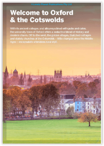
Product description: Lonely Planet's Pocket Oxford & the Cotswolds is your passport to the most relevant, up-to-date advice on what to see and skip, and what hidden discoveries await you. Wander the honey-toned streets of Oxford, follow in the footsteps of Betjeman and Wilde on a tour of Magdalen College and explore picture-perfect Cotswold villages - all with your trusted travel companion. Get to the heart of Oxford & the Cotswolds and begin your journey now!
Inside Lonely Planet's Pocket Oxford & the Cotswolds:
- Full-colour maps and images throughout
- Highlights and itineraries help you tailor your trip to your personal needs and interests
- Insider tips to save time and money and get around like a local, avoiding crowds and trouble spots
- Essential info at your fingertips - hours of operation, phone numbers, websites, transit tips, prices
- Honest reviews for all budgets - eating, sleeping, sightseeing, going out, shopping, hidden gems that most guidebooks miss
- Free, convenient pull-out map (included in print version)
- User-friendly layout with helpful icons, and organised by neighbourhood to help you pick the best spots to spend your time
Locatie op kaart
Overzichtskaarten

Area's of Outstanding Natural Beauty - AONB's UK
Area's of Outstanding Natural Beauty - AONB's UK

Producten op de overzichtskaart
Klik op een product om naar de detailpagina te gaan.
- Wandelgids - Guide to the Cotswolds AONB - AA
- Wandelkaart 24 - Chilterns AONB - AA
- Fietskaart- en Mtb kaart - The Cotswolds - Goldeneye
- Wandelgids - Cotswold classic walks guidebook - Goldeneye
- Wandelgids - Exploring the Cotswolds - Goldeneye
- Wandelgids - Cotswold Classic Walks - Goldeneye
- Wandelkaart - Cotswolds- Malverns & Forest of Dean - Goldeneye
- Wandelgids - The Cotswold Way 30 classic routes - Cicerone
- Wandelgids - Kent walking guide - Cicerone
- Wandelgids - North Downs Way Nat. trail - Cicerone
- Wandelgids - Chilterns walking guide - Cicerone
- Wandelgids - Suffolk coast & Heaths walks - Cicerone
- Wandelgids - North Downs Way - Map Booklet - Cicerone
- Wandelgids - North Pennines AONB walking guide - Cicerone
- Wandelgids - Ridgeway National Trail - Cicerone
- Wandelgids - Forest of Bowland & Pendle - Cicerone
- Wandelgids - Hampshire's Test Way walking guide - Cicerone
- Wandelgids & Fietsgids - The Cotswold AONB - Cicerone
- Wandelgids - Walking on the Gower - Cicerone
- Wandelgids - North Wessex Downs - Cicerone Press
- Wandelgids - Walking on the North Wessex Downs - Cicerone
- Wandelgids - Silverdale & Arnside AONB - Cicerone
- Wandelgids - North Downs Way- 246 km - Trailblazer
- Wandelkaart OL2 - Yorkshire Dales- Southern & Western Areas - OSI
- Wandelkaart OL19 - Howgill Fells and Upper Eden Valley - OSI
- Wandelkaart OL21 - South Pennines - Yorkshire - OSI
- Wandelkaart OL31 - North Pennines- Teesdale & Weardale - OSI
- Wandelkaart OL40 - The Broads - OSI
- Wandelkaart OL41 - Forest of Bowland & Ribblesdale - OSI
- Wandelkaart OL45 - The Cotswolds AONB- Gloucestershire - OSI
- Wandelkaart 108 - Lower Tamer Valley & Plymouth- Cornwall- OSI
- Wandelkaart 115 - Exmouth & Sidmouth- Devon - OSI
- Wandelkaart 137 - Ashford- Kent downs AONB- England - OSI
- Wandelkaart 140 - Quantock Hills AONB- Somerset - OSI
- Wandelkaart 140 - Quantock Hills AONB & Bridgwater- Devon - OSI
- Wandelkaart 147 - Sevenoaks & Tonbridge- Kent - OSI
- Wandelkaart 164 - Gower AONB & Gwyr- South Wales - OSI
- Wandelkaart 164 - Gower AONB & Gwyr- Wales - OSI
- Wandelkaart 171 - Chiltern Hills West & Henley-on-Thames OSI
- Wandelkaart 171 - Chiltern Hills West AONB- Wycombe - OSI
- Wandelkaart 172 - Chiltern Hills East AONB- Wycombe - OSI
- Wandelkaart 181 - Chiltern Hills AONB North- England - OSI
- Wandelkaart 181 - Chiltern Hills North AONB- Wycombe - OSI
- Wandelkaart 190 - Malvern Hills & Bredon Hill - OSI
- Wandelkaart 190 - Malvern Hills AONB & Bredon Hill - OSI
- Wandelkaart 203 - Ludlow- Shropshire Hills AONB - OSI
- Wandelkaart 217 - Long Mynd & Wenlock Edge- Schropshire- OSI
- Wandelkaart 254 - Lleyn Peninsular East- North Wales - OSI
- Wandelkaart 261 - Boston- Lincolnshire AONB - OSI
- Wandelkaart 262 - Anglesey West- Wales AONB - OSI
- Wandelkaart 263 - Anglesey East AONB- Wales - OSI
- Wandelkaart 273 - Lincolnshire Wolds South AONB - OSI
- Wandelkaart 282 - Lincolnshire Wolds North AONB - OSI
- Wandelkaart 298 - Nidderdale AONB- Yorkshire - OSI
- Wandelkaart 298 - Nidderdale AONB North Yorkshire - OSI
- Wandelkaart 300 - Howardian Hills AONB - OSI
- Wandelkaart 300 - Howardian Hills AONB & Malton - OSI
- Wandelkaart - Mourne Mountains N. Ireland - Harvey maps
- Wandelkaart - Fietskaart Forest of Bowland - Harvey maps
- Wandelkaart XT40 - Anglesey Coastal Path N. Wales - Harvey Maps
- Wandelkaart XT40 - Pennine Way Noord - Harvey Maps
- Wandelkaart XT40 - Pennine Way Zuid - Harvey Maps
- Wandelgids Cotswold - Way Two-way trekking guide - Knife Edge
- Reisgids Oxford & the Cotswolds AONB - Edicola
- Reisgids Cotswolds England - Rough Guides
- Travelguide Oxford & The Cotswolds pocket guide - Lonely Planet
- Wandelgids - The Ridgeway National trail - Trailblazer
Artikelen uit dezelfde regio

Fietskaart & Mtb kaart The Cotswolds - Goldeneye • 9781859652589
Fietskaart en Mtb kaart - The Cotswolds - Goldeneye Productomschrijving: De Cotswolds is een AONB streek, (Area of Outstanding Natural Beauty) in centraal Engeland. Het gebied omvat de graafschappen Somerset, Warwickshire, Wiltshire, Oxfordshire & Worcestershire, maar het grootste deel ligt in Gloucestershire. Er wordt sinds eeuwen kalksteen uit de steengroeven gewonnen in deze regio, en d…

Wandelkaart 172 Chiltern Hills East AONB- Oxfordshire- OSI • 9780319470442
Wandelkaart Chiltern Hills East AONB - Oxfordshire England Omvat ook: High Wycombe, Maidenhead & Rickmansworth. Productbeschrijving: Kaart nummer 172 in de OS Explorer kaarten reeks omvat High Wycombe, Maidenhead, Rickmansworth, Gerrards Cross, Northwood, Slough, Uxbridge, Hillingdon, Amersham, Chorleywood, Ruislip en Marlow, de oostelijke Chiltern Hills AONB en het pad van de Thames. …

Wandelkaart 191 Banbury Bicester & Chipping Norton- OSI • 9780319470633
Wandelkaart Banbury- Bicester & Chipping Norton England Omvat ook: Brackley. Productbeschrijving: Kaart nummer 191 in de OS Explorer kaarten reeks heeft betrekking op een gedeelte van de Cotswolds en de Macmillan Way en Wychwood way recreatieve paden. Hoogtepunten van het gebied zijn de steden van Banbury, Chipping Norton, Brackley en Bicester, en de Oxford Canal Walk. De OS Explorer k…

Reisgids Cotswolds AONB - Rough Guides • 9781839059728
The Cotswolds AONB - Rough Guides Productomschrijving: Deze omvat het Cotswolds gebied in zuid-oost Engeland. Een gebied van uitmuntend natuurschoon, of in andere meer lokalere woorden, een AONB area, of Area of Outstanding Natural Beauty. Bij ons is dat bijvoorbeeld de westhoek, het Zwin, enz... Deze reisgids biedt u deze regio inclusief de locaties van Stratford-Uppon-Avon & Oxford die a…

Wandelkaart Cotswolds- Malverns & Forest of Dean - Goldeneye • 9781859652893
Cotswolds- Malverns & Forest of Dean - Goldeneye Productomschrijving: Een samenstelling van wandelkaart en bijhorende wandelgids, over enkele van de meest bezochte wandellocaties van Engeland, zowel de Cotwolds als Marvern Hills zijn beiden geklasseerd als AONB regio's of meerbepaald, Gebieden van uitmuntend natuurschoon. deze gebieden, met de Forest of Dean inbegrepen zijn allemaal bij el…