
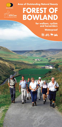
Wandelkaart & Fietskaart Forest of Bowland - Harvey maps
Deze kaart van de Forest of Bowland is 2-in-1
Korte omschrijving
Wandelkaart - Fietskaart Forest of Bowland - Harvey maps Productomschrijving: Deze kaart van de Forest of Bowland is 2-in-1. Aan de ene kant is een wandelkaart; aan de andere een kaart gesch...

Specificaties
- Uitgever: HARVEY MAPS
- ISBN-13: 9781851374731
- HOOFDCATEGORIEËN: Fietskaart, Wandelkaart
- Activiteiten: Fietsen / VTT / MTB, Wandelen, Hiking & Trekking
- Regio: Forest of Bowland, England, Lanacshire, England, North Yorkshire, Engeland
- Land: England
- Regionale parken: Forest of Bowland
- AONB - Area of Outstanding Beauty: Forest of Bowland AONB
- Schaal: 1:25000
- Afmeting: 14x24
- Taal: Engels
Volledige omschrijving
Wandelkaart - Fietskaart Forest of Bowland - Harvey maps
Productomschrijving: Deze kaart van de Forest of Bowland is 2-in-1. Aan de ene kant is een wandelkaart; aan de andere een kaart geschikt voor fietsers.
De Forest of Bowland heeft veel te bieden voor wandelaars, ruiters en fietsers, en deze praktische kaart zal u helpen om dit prachtige deel van Engeland te verkennen. De wandelaarskaart op 1: 25.000 schaal geeft, voor de eerste keer, gedetailleerde informatie over hoe te genieten van het Land op de hoge fells van Bowland en all-vermogenroutes in het laagland, terwijl de 1:55,000 schaalkaarten het geheel toont van de AONB in één kaart - perfect voor de planning van langere afstandswandelingen". Forest of Bowland Area of Outstanding Natural Beauty.
Bevat aanbevolen fietsroutes, toegangspunten, recht van overpad en gereduceerde routes evenals voorlichting over faciliteiten en diensten. Het is duidelijk en gemakkelijk te lezen, evenals de GPS compatibel en gedrukt op waterdichtpapier. Nieuwe generatie HARVEY Superwalker, XT25 waterproof, werden ontworpen om de meest praktische tools te zijn voor GPS-navigatie. Het formaat geeft meer toewijzingen op het blad zonder de kaart zwaarder en volumineuser te maken. De kaartvouw werd ontwikkeld waarmee u direct naar elk deel en aan weerszijden van het blad, eenvoudig kan bladeren zonder te moeten vechten tegen de wind. De Superwalker-XT25 is gebaseerd op de originele HARVEY mapping, met alle informatie die een wandelaar zou verwachten op een kaart van schaal 1: 25.000. Het geheel van de Arran coast Route wordt ook getoond op deze kaart.
De duidelijkheid van de toewijzingen zijn verbeterd, zodat meer mensen zonder het gebruik van een bril zouden kunnen lezen. De kaart is rijk aan informatie, die relevant is voor de wandelaar. Ervaar de tevredenheid van fijne navigatie met de Superwalker XT25 serie, nu gedrukt op 100% waterdicht- en bijna onverwoestbaar papier, ongeacht het weer!
Locatie op kaart
Overzichtskaarten

Area's of Outstanding Natural Beauty - AONB's UK
Area's of Outstanding Natural Beauty - AONB's UK

Producten op de overzichtskaart
Klik op een product om naar de detailpagina te gaan.
- Wandelgids - Guide to the Cotswolds AONB - AA
- Wandelkaart 24 - Chilterns AONB - AA
- Fietskaart- en Mtb kaart - The Cotswolds - Goldeneye
- Wandelgids - Cotswold classic walks guidebook - Goldeneye
- Wandelgids - Exploring the Cotswolds - Goldeneye
- Wandelgids - Cotswold Classic Walks - Goldeneye
- Wandelkaart - Cotswolds- Malverns & Forest of Dean - Goldeneye
- Wandelgids - The Cotswold Way 30 classic routes - Cicerone
- Wandelgids - Kent walking guide - Cicerone
- Wandelgids - North Downs Way Nat. trail - Cicerone
- Wandelgids - Chilterns walking guide - Cicerone
- Wandelgids - Suffolk coast & Heaths walks - Cicerone
- Wandelgids - North Downs Way - Map Booklet - Cicerone
- Wandelgids - North Pennines AONB walking guide - Cicerone
- Wandelgids - Ridgeway National Trail - Cicerone
- Wandelgids - Forest of Bowland & Pendle - Cicerone
- Wandelgids - Hampshire's Test Way walking guide - Cicerone
- Wandelgids & Fietsgids - The Cotswold AONB - Cicerone
- Wandelgids - Walking on the Gower - Cicerone
- Wandelgids - North Wessex Downs - Cicerone Press
- Wandelgids - Walking on the North Wessex Downs - Cicerone
- Wandelgids - Silverdale & Arnside AONB - Cicerone
- Wandelgids - North Downs Way- 246 km - Trailblazer
- Wandelkaart OL2 - Yorkshire Dales- Southern & Western Areas - OSI
- Wandelkaart OL19 - Howgill Fells and Upper Eden Valley - OSI
- Wandelkaart OL21 - South Pennines - Yorkshire - OSI
- Wandelkaart OL31 - North Pennines- Teesdale & Weardale - OSI
- Wandelkaart OL40 - The Broads - OSI
- Wandelkaart OL41 - Forest of Bowland & Ribblesdale - OSI
- Wandelkaart OL45 - The Cotswolds AONB- Gloucestershire - OSI
- Wandelkaart 108 - Lower Tamer Valley & Plymouth- Cornwall- OSI
- Wandelkaart 115 - Exmouth & Sidmouth- Devon - OSI
- Wandelkaart 137 - Ashford- Kent downs AONB- England - OSI
- Wandelkaart 140 - Quantock Hills AONB- Somerset - OSI
- Wandelkaart 140 - Quantock Hills AONB & Bridgwater- Devon - OSI
- Wandelkaart 147 - Sevenoaks & Tonbridge- Kent - OSI
- Wandelkaart 164 - Gower AONB & Gwyr- South Wales - OSI
- Wandelkaart 164 - Gower AONB & Gwyr- Wales - OSI
- Wandelkaart 171 - Chiltern Hills West & Henley-on-Thames OSI
- Wandelkaart 171 - Chiltern Hills West AONB- Wycombe - OSI
- Wandelkaart 172 - Chiltern Hills East AONB- Wycombe - OSI
- Wandelkaart 181 - Chiltern Hills AONB North- England - OSI
- Wandelkaart 181 - Chiltern Hills North AONB- Wycombe - OSI
- Wandelkaart 190 - Malvern Hills & Bredon Hill - OSI
- Wandelkaart 190 - Malvern Hills AONB & Bredon Hill - OSI
- Wandelkaart 203 - Ludlow- Shropshire Hills AONB - OSI
- Wandelkaart 217 - Long Mynd & Wenlock Edge- Schropshire- OSI
- Wandelkaart 254 - Lleyn Peninsular East- North Wales - OSI
- Wandelkaart 261 - Boston- Lincolnshire AONB - OSI
- Wandelkaart 262 - Anglesey West- Wales AONB - OSI
- Wandelkaart 263 - Anglesey East AONB- Wales - OSI
- Wandelkaart 273 - Lincolnshire Wolds South AONB - OSI
- Wandelkaart 282 - Lincolnshire Wolds North AONB - OSI
- Wandelkaart 298 - Nidderdale AONB- Yorkshire - OSI
- Wandelkaart 298 - Nidderdale AONB North Yorkshire - OSI
- Wandelkaart 300 - Howardian Hills AONB - OSI
- Wandelkaart 300 - Howardian Hills AONB & Malton - OSI
- Wandelkaart - Mourne Mountains N. Ireland - Harvey maps
- Wandelkaart - Fietskaart Forest of Bowland - Harvey maps
- Wandelkaart XT40 - Anglesey Coastal Path N. Wales - Harvey Maps
- Wandelkaart XT40 - Pennine Way Noord - Harvey Maps
- Wandelkaart XT40 - Pennine Way Zuid - Harvey Maps
- Wandelgids Cotswold - Way Two-way trekking guide - Knife Edge
- Reisgids Oxford & the Cotswolds AONB - Edicola
- Reisgids Cotswolds England - Rough Guides
- Travelguide Oxford & The Cotswolds pocket guide - Lonely Planet
- Wandelgids - The Ridgeway National trail - Trailblazer
Artikelen uit dezelfde regio

Wandelkaart 99 Northallerton & Ripon- N. Yorkshire - OSI • 9780319474228
Wandelkaart Northallerton & Ripon - North Yorkshire England Productbeschrijving: Ligt tussen de Yorkshire Dales en de North York Moors, het gebied gedekt door OS Landranger kaart 99 wordt vaak vergeten, maar omvat wel de oude kathedraal stad van Ripon, Northallerton en andere kleinere steden. De OS Landranger kaarten reeks heeft betrekking op Groot-Brittannië met 204 gedetailleerde kaarte…

Wandelgids Forest of Bowland walking guide - Cicerone • 9781852842512
Wandelgids - Forest of Bowland walking guide - Cicerone Productomschrijving: Gids voor wandelingen in het Forest of Bowland, Lancashire, Noord-Engeland, een Area of Outstanding Natural Beauty. 30 routes in het hele Forest met inbegrip van de zachte uitlopers in het zuiden en noorden, op de top van de moerassen en in de valleien. De Forest of Bowland, is een wilde en dunbevolkte regio van z…

Wandelkaart 297 Lower Wharefedale & Washburn Valley- OSI • 9780319471692
Wandelkaart Lower Wharefedale & Washburn Valley - North Yorkshire Omvat ook: Harrogate & Ilkley Moor. Productbeschrijving: Kaart nummer 297 in de OS Explorer reeks heeft betrekking op het Nidderdale gebied van buitengewone natuurlijke schoonheid AONB en het Yorkshire Dales National Park. De stad van Harrogate is omgeven door het Harrogate Ringway recreatieve pad, terwijl de Dales Way l…

Mountainbikegids Yorkshire Dales mountain biking - Cicerone • 9781852846763
Mountainbikegids - Yorkshire Dale mountain biking - Cicerone Productomschrijving: Een handige gids over 30 korte, middellange, lange en volledig-dag MTB routes over het Yorkshire Dales National Park, de speeltuin van de bergfietser van Noord-Engeland. Circulaire ritten bezoeken de grote valleien en nemen lussen rond twee van de drie pieken, Whernside en Pen-y-Gent. Kies een route door midd…

Wandelkaart 105 York & Selby North Yorkshire - OSI • 9780319474280
Wandelkaart York & Selby - North Yorkshire - OSI Productbeschrijving: OS Landranger kaart 105 toont York, een bruisende en levendige stad boordevol culturele attracties om te bezoeken. Hoogtepunten zijn de York Minster, York Museum en het nemen van een boottocht van York langs de prachtige rivier de Ouse. De markt stad van Selby ligt ten zuiden van York samen met de andere omliggende dorpe…