
Wandelgids Exploring the Cotswolds - Goldeneye
Bath- Broadway- Burford- Cheltenham- Chipping Campden & Malvern
Korte omschrijving
Exploring the Cotswolds - Goldeneye Productomschrijving: Dit Cotswold Boek is anders. Het is een onafhankelijke stem, omdat alle inzendingen worden gekozen op basis van verdienste, en verdie...

Specificaties
- Uitgever: Goldeneye
- ISBN-13: 9781859652862
- HOOFDCATEGORIEËN: Wandelgids
- Activiteiten: Wandelen, Hiking & Trekking
- Auteur: William Fricker
- Regio: Gloucestershire, Egland, Oxfordshire West England, Somerset South West England, Warwickshire, West Midlands, Wiltshire, West England, Worcestershire, West England
- Land: England
- AONB - Area of Outstanding Beauty: Cotswolds AONB
- Blz.: 224
- Afmeting: 13x22
- Editie: 5, 6
- Taal: Engels
Volledige omschrijving
Exploring the Cotswolds - Goldeneye
Productomschrijving: Dit Cotswold Boek is anders. Het is een onafhankelijke stem, omdat alle inzendingen worden gekozen op basis van verdienste, en verdienste alleen. In ons digitale tijdperk waar (reis) informatie wordt verstrekt door enorme reclame budgetten. Hierbij een verfrissende en verhelderende kijk op wat de Cotswolds de bezoeker en bewoner te bieden heeft.
Engelse omschrijving: This Cotswold Book is different. It is an independent voice, as all entries are chosen on merit, and merit alone. In our Digital Age where (travel) information is provided by vast advertising budgets. Herewith, a refreshing and enlightening take on what the Cotswolds has to offer the visitor and resident.
This book includes: Bath, Broadway, Burford, Cheltenham, Chipping Campden, Malvern, Stratford-Upon-Avon, Witney and Woodstock.
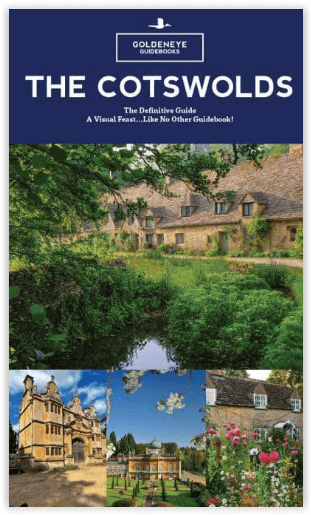
340+ Images (Photographs & Illustrations)
23 Pages of Touring Maps
Scenic Villages, Light Bite Cafes, Gardens and Country Houses
Where To Stay, Where To Eat & Drink, What To See & Do
Where To Have Fun!
“In photography, layout and design, Goldeneye Guides look unbeatable.” Sebastian Faulks
A Visual Feast - Like No Other Guidebook!
Locatie op kaart
Overzichtskaarten

Area's of Outstanding Natural Beauty - AONB's UK
Area's of Outstanding Natural Beauty - AONB's UK

Producten op de overzichtskaart
Klik op een product om naar de detailpagina te gaan.
- Wandelgids - Guide to the Cotswolds AONB - AA
- Wandelkaart 24 - Chilterns AONB - AA
- Fietskaart- en Mtb kaart - The Cotswolds - Goldeneye
- Wandelgids - Cotswold classic walks guidebook - Goldeneye
- Wandelgids - Exploring the Cotswolds - Goldeneye
- Wandelgids - Cotswold Classic Walks - Goldeneye
- Wandelkaart - Cotswolds- Malverns & Forest of Dean - Goldeneye
- Wandelgids - The Cotswold Way 30 classic routes - Cicerone
- Wandelgids - Kent walking guide - Cicerone
- Wandelgids - North Downs Way Nat. trail - Cicerone
- Wandelgids - Chilterns walking guide - Cicerone
- Wandelgids - Suffolk coast & Heaths walks - Cicerone
- Wandelgids - North Downs Way - Map Booklet - Cicerone
- Wandelgids - North Pennines AONB walking guide - Cicerone
- Wandelgids - Ridgeway National Trail - Cicerone
- Wandelgids - Forest of Bowland & Pendle - Cicerone
- Wandelgids - Hampshire's Test Way walking guide - Cicerone
- Wandelgids & Fietsgids - The Cotswold AONB - Cicerone
- Wandelgids - Walking on the Gower - Cicerone
- Wandelgids - North Wessex Downs - Cicerone Press
- Wandelgids - Walking on the North Wessex Downs - Cicerone
- Wandelgids - Silverdale & Arnside AONB - Cicerone
- Wandelgids - North Downs Way- 246 km - Trailblazer
- Wandelkaart OL2 - Yorkshire Dales- Southern & Western Areas - OSI
- Wandelkaart OL19 - Howgill Fells and Upper Eden Valley - OSI
- Wandelkaart OL21 - South Pennines - Yorkshire - OSI
- Wandelkaart OL31 - North Pennines- Teesdale & Weardale - OSI
- Wandelkaart OL40 - The Broads - OSI
- Wandelkaart OL41 - Forest of Bowland & Ribblesdale - OSI
- Wandelkaart OL45 - The Cotswolds AONB- Gloucestershire - OSI
- Wandelkaart 108 - Lower Tamer Valley & Plymouth- Cornwall- OSI
- Wandelkaart 115 - Exmouth & Sidmouth- Devon - OSI
- Wandelkaart 137 - Ashford- Kent downs AONB- England - OSI
- Wandelkaart 140 - Quantock Hills AONB- Somerset - OSI
- Wandelkaart 140 - Quantock Hills AONB & Bridgwater- Devon - OSI
- Wandelkaart 147 - Sevenoaks & Tonbridge- Kent - OSI
- Wandelkaart 164 - Gower AONB & Gwyr- South Wales - OSI
- Wandelkaart 164 - Gower AONB & Gwyr- Wales - OSI
- Wandelkaart 171 - Chiltern Hills West & Henley-on-Thames OSI
- Wandelkaart 171 - Chiltern Hills West AONB- Wycombe - OSI
- Wandelkaart 172 - Chiltern Hills East AONB- Wycombe - OSI
- Wandelkaart 181 - Chiltern Hills AONB North- England - OSI
- Wandelkaart 181 - Chiltern Hills North AONB- Wycombe - OSI
- Wandelkaart 190 - Malvern Hills & Bredon Hill - OSI
- Wandelkaart 190 - Malvern Hills AONB & Bredon Hill - OSI
- Wandelkaart 203 - Ludlow- Shropshire Hills AONB - OSI
- Wandelkaart 217 - Long Mynd & Wenlock Edge- Schropshire- OSI
- Wandelkaart 254 - Lleyn Peninsular East- North Wales - OSI
- Wandelkaart 261 - Boston- Lincolnshire AONB - OSI
- Wandelkaart 262 - Anglesey West- Wales AONB - OSI
- Wandelkaart 263 - Anglesey East AONB- Wales - OSI
- Wandelkaart 273 - Lincolnshire Wolds South AONB - OSI
- Wandelkaart 282 - Lincolnshire Wolds North AONB - OSI
- Wandelkaart 298 - Nidderdale AONB- Yorkshire - OSI
- Wandelkaart 298 - Nidderdale AONB North Yorkshire - OSI
- Wandelkaart 300 - Howardian Hills AONB - OSI
- Wandelkaart 300 - Howardian Hills AONB & Malton - OSI
- Wandelkaart - Mourne Mountains N. Ireland - Harvey maps
- Wandelkaart - Fietskaart Forest of Bowland - Harvey maps
- Wandelkaart XT40 - Anglesey Coastal Path N. Wales - Harvey Maps
- Wandelkaart XT40 - Pennine Way Noord - Harvey Maps
- Wandelkaart XT40 - Pennine Way Zuid - Harvey Maps
- Wandelgids Cotswold - Way Two-way trekking guide - Knife Edge
- Reisgids Oxford & the Cotswolds AONB - Edicola
- Reisgids Cotswolds England - Rough Guides
- Travelguide Oxford & The Cotswolds pocket guide - Lonely Planet
- Wandelgids - The Ridgeway National trail - Trailblazer
Artikelen uit dezelfde regio

Wandelkaart 168 Stroud- Tetbury & Malmesbury - OSI • 9780319243619
Wandelkaart Stroud- Tetbury & Malmesbury - Gloucestershire Omvat ook: De Cotswolds AONB- the Cotswold Way & The Monarch Way Productbeschrijving: Kaart nummer 168 in de OS Explorer kaarten reeks omvat Stroud, Tetbury, Malmesbury en Nailsworth. Hoogtepunten van het gebied zijn onder andere: de Cotswolds AONB, Cotswold Way, Monarch Way en the Thames Path. De OS Explorer kaart voor Stroud,…

Wandelkaart 179 Gloucester Cheltenham & Stroud - OSI • 9780319243725
Wandelkaart Gloucester- Cheltenham & Stroud - Gloucestershire Productbeschrijving: Gloucester & Cheltenham 179 / Gloucester, Cheltenham & Stroud, Gloucestershire, England - Kaart nummer 179 in de OS Explorer reeks heeft betrekking op de omgeving van Gloucester, Cheltenham, Stroud. Hoogtepunten van het gebied zijn onder meer: The Cotswolds AONB gebied van uitzonderlijke natuurlijke scho…

Wandelkaart 138 Kidderminster & Wyre Forest - OSI • 9780319262368
Wandelkaart Kidderminster & Wyre Forest - England Productbeschrijving: OS Landranger kaart 138 van Kidderminster & Wyre Forest omvat ook Bridgnorth, Abdon Stanton Lacy, Bayton, Stoke Bliss, Brimfield, Ludlow, Highley, Six Ashes, Chetton, en Much Wenlock. De OS Landranger kaarten reeks heeft betrekking op Groot-Brittannië met 204 gedetailleerde kaarten, perfect voor dagtochten en korte pauz…

Reisgids Cotswolds AONB - Rough Guides • 9781839059728
The Cotswolds AONB - Rough Guides Productomschrijving: Deze omvat het Cotswolds gebied in zuid-oost Engeland. Een gebied van uitmuntend natuurschoon, of in andere meer lokalere woorden, een AONB area, of Area of Outstanding Natural Beauty. Bij ons is dat bijvoorbeeld de westhoek, het Zwin, enz... Deze reisgids biedt u deze regio inclusief de locaties van Stratford-Uppon-Avon & Oxford die a…

Wandelkaart 206 Edge Hill & Fenny Compton - OSI • 9780319243992
Wandelkaart Edge Hill & Fanny Compton - Warwickshire Productbeschrijving: Badby, Kineton & Middle Tysoe. 206 / Edge Hill & Fenny Compton, Warwickshire, England - Kaart nummer 206 in de OS Explorer kaart reeks is ideaal voor het ontdekken van het noordelijke deel van de Cotswolds. Dit gebied van uitzonderlijke natuurlijke schoonheid AONB kan worden bezocht dmv het aflopen van de Centen…