
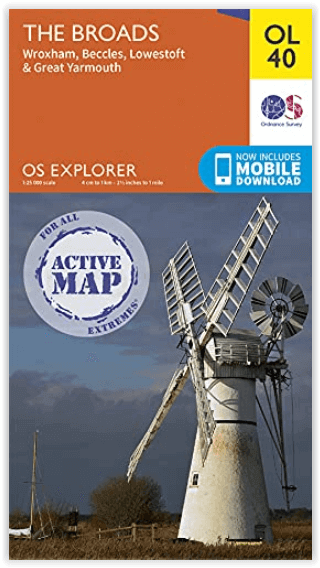
Wandelkaart OL40 The Broads - OSI
The Broads National Park
Korte omschrijving
Wandelkaart The Broads National Park - OSI Productomschrijving: Kaart OL40 in de OS Explorer serie bestrijkt The Broads, een lid van de familie van nationale parken. De rivieren zijn de Bure...

Specificaties
- Uitgever: Ordnance Survey
- ISBN-13: 9780319475485
- HOOFDCATEGORIEËN: Wandelkaart
- Activiteiten: Wandelen, Hiking & Trekking
- Regio: Norfolk East England, Suffolk East Anglia
- Land: England
- Waterafstotende kaart: Ordnance Survey ACTIVE Explorer Weatherproof Maps
- Nationale parken: Broads National Park, England
- AONB - Area of Outstanding Beauty: Norfolk Coast AONB
- Schaal: 1:25000
- Afmeting: 13x24
- Taal: Engels
- Reeks: Explorer ACTIVE Series OSI
Volledige omschrijving
Wandelkaart The Broads National Park - OSI
Productomschrijving: Kaart OL40 in de OS Explorer serie bestrijkt The Broads, een lid van de familie van nationale parken. De rivieren zijn de Bure, Ant, Thurne, Yare, Chet en Waveney. De kaart toont ook de kusten van Norfolk en Suffolk en de badplaatsen Great Yarmouth en Lowestoft. Een ander hoogtepunt van het gebied is de stad Norwich.
Inclusief mobiele downloadBij deze kaart ontvangt u een code voor gebruik op uw iOS- of Android-smartphone of -tablet. Meer informatie vindt u bij Veelgestelde vragen over mobiel downloaden.
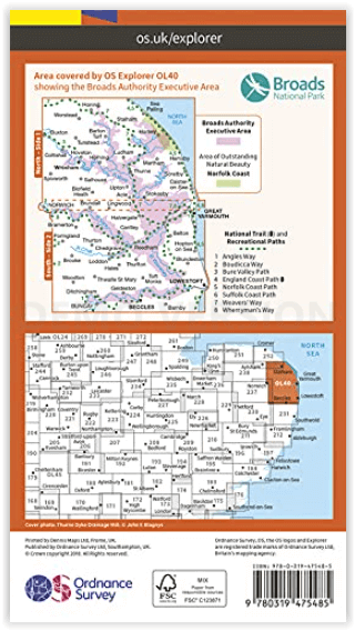
Nationale wandelroutes:
- Angles Way - Boucicca Way - Bure Valley Path - England Coast Path - Norfolk Coast PAth - Suffolk Coast Path - Weaver's Way - Wherryman's Way
Engelse omschrijving: Map sheet OL40 in the OS Explorer series covers the Broads, a member of the national park family. Its rivers are the Bure, Ant, Thurne, Yare, Chet and Waveney. The map also shows the Norfolk and Suffolk coasts and the seaside towns of Great Yarmouth and Lowestoft. Another highlight of the area is the city of Norwich.
Includes mobile downloadWith this map you will receive a code for use on your iOS or Android smartphone or tablet. Find our more at Mobile Download FAQ.
.png)
Locatie op kaart
Overzichtskaarten

Area's of Outstanding Natural Beauty - AONB's UK
Area's of Outstanding Natural Beauty - AONB's UK

Producten op de overzichtskaart
Klik op een product om naar de detailpagina te gaan.
- Wandelgids - Guide to the Cotswolds AONB - AA
- Wandelkaart 24 - Chilterns AONB - AA
- Fietskaart- en Mtb kaart - The Cotswolds - Goldeneye
- Wandelgids - Cotswold classic walks guidebook - Goldeneye
- Wandelgids - Exploring the Cotswolds - Goldeneye
- Wandelgids - Cotswold Classic Walks - Goldeneye
- Wandelkaart - Cotswolds- Malverns & Forest of Dean - Goldeneye
- Wandelgids - The Cotswold Way 30 classic routes - Cicerone
- Wandelgids - Kent walking guide - Cicerone
- Wandelgids - North Downs Way Nat. trail - Cicerone
- Wandelgids - Chilterns walking guide - Cicerone
- Wandelgids - Suffolk coast & Heaths walks - Cicerone
- Wandelgids - North Downs Way - Map Booklet - Cicerone
- Wandelgids - North Pennines AONB walking guide - Cicerone
- Wandelgids - Ridgeway National Trail - Cicerone
- Wandelgids - Forest of Bowland & Pendle - Cicerone
- Wandelgids - Hampshire's Test Way walking guide - Cicerone
- Wandelgids & Fietsgids - The Cotswold AONB - Cicerone
- Wandelgids - Walking on the Gower - Cicerone
- Wandelgids - North Wessex Downs - Cicerone Press
- Wandelgids - Walking on the North Wessex Downs - Cicerone
- Wandelgids - Silverdale & Arnside AONB - Cicerone
- Wandelgids - North Downs Way- 246 km - Trailblazer
- Wandelkaart OL2 - Yorkshire Dales- Southern & Western Areas - OSI
- Wandelkaart OL19 - Howgill Fells and Upper Eden Valley - OSI
- Wandelkaart OL21 - South Pennines - Yorkshire - OSI
- Wandelkaart OL31 - North Pennines- Teesdale & Weardale - OSI
- Wandelkaart OL40 - The Broads - OSI
- Wandelkaart OL41 - Forest of Bowland & Ribblesdale - OSI
- Wandelkaart OL45 - The Cotswolds AONB- Gloucestershire - OSI
- Wandelkaart 108 - Lower Tamer Valley & Plymouth- Cornwall- OSI
- Wandelkaart 115 - Exmouth & Sidmouth- Devon - OSI
- Wandelkaart 137 - Ashford- Kent downs AONB- England - OSI
- Wandelkaart 140 - Quantock Hills AONB- Somerset - OSI
- Wandelkaart 140 - Quantock Hills AONB & Bridgwater- Devon - OSI
- Wandelkaart 147 - Sevenoaks & Tonbridge- Kent - OSI
- Wandelkaart 164 - Gower AONB & Gwyr- South Wales - OSI
- Wandelkaart 164 - Gower AONB & Gwyr- Wales - OSI
- Wandelkaart 171 - Chiltern Hills West & Henley-on-Thames OSI
- Wandelkaart 171 - Chiltern Hills West AONB- Wycombe - OSI
- Wandelkaart 172 - Chiltern Hills East AONB- Wycombe - OSI
- Wandelkaart 181 - Chiltern Hills AONB North- England - OSI
- Wandelkaart 181 - Chiltern Hills North AONB- Wycombe - OSI
- Wandelkaart 190 - Malvern Hills & Bredon Hill - OSI
- Wandelkaart 190 - Malvern Hills AONB & Bredon Hill - OSI
- Wandelkaart 203 - Ludlow- Shropshire Hills AONB - OSI
- Wandelkaart 217 - Long Mynd & Wenlock Edge- Schropshire- OSI
- Wandelkaart 254 - Lleyn Peninsular East- North Wales - OSI
- Wandelkaart 261 - Boston- Lincolnshire AONB - OSI
- Wandelkaart 262 - Anglesey West- Wales AONB - OSI
- Wandelkaart 263 - Anglesey East AONB- Wales - OSI
- Wandelkaart 273 - Lincolnshire Wolds South AONB - OSI
- Wandelkaart 282 - Lincolnshire Wolds North AONB - OSI
- Wandelkaart 298 - Nidderdale AONB- Yorkshire - OSI
- Wandelkaart 298 - Nidderdale AONB North Yorkshire - OSI
- Wandelkaart 300 - Howardian Hills AONB - OSI
- Wandelkaart 300 - Howardian Hills AONB & Malton - OSI
- Wandelkaart - Mourne Mountains N. Ireland - Harvey maps
- Wandelkaart - Fietskaart Forest of Bowland - Harvey maps
- Wandelkaart XT40 - Anglesey Coastal Path N. Wales - Harvey Maps
- Wandelkaart XT40 - Pennine Way Noord - Harvey Maps
- Wandelkaart XT40 - Pennine Way Zuid - Harvey Maps
- Wandelgids Cotswold - Way Two-way trekking guide - Knife Edge
- Reisgids Oxford & the Cotswolds AONB - Edicola
- Reisgids Cotswolds England - Rough Guides
- Travelguide Oxford & The Cotswolds pocket guide - Lonely Planet
- Wandelgids - The Ridgeway National trail - Trailblazer
Artikelen uit dezelfde regio

Wandelkaart 210 Newmarket & Havehill- Barrow - OSI • 9780319470824
Wandelkaart Newmarket & Havehill- Barrow - Suffolk England Omvat ook: Barrow, Clare & Kedington. Productbeschrijving: Kaart nummer 210 in de OS Explorer kaarten reeks is ideaal voor het ontdekken van het gebied rond het oosten van Cambridgeshire en ten westen van Suffolk, rond de paardenrennen stad van Newmarket. De Stour Valley naast de rivier Stour, of verken de steden Haverhill, New…

Reisgids Norfolk & Suffolk - Rough Guides • 9781839050749
Norfolk & Suffolk - Rough Guides Productomschrijving: De Rough Guide to Norfolk & Suffolk richt zich op een van de meest populaire regio's van het Verenigd Koninkrijk. In full colour, met tientallen prachtige foto's, zal het u inspireren om dit diverse en prachtige gebied te verkennen. Levendige, onderhoudende verslagen in de kenmerkende eerlijke, openhartige stijl van de Rough Guides…

Wandelkaart 197 Ipswich Felixstowe & Harwich - OSI • 9780319243909
Wandelkaart Ipswich- Felixstowe & Harwich - Suffolk England Productbeschrijving: Ipswich is een stad en Engels district in het graafschap Suffolk. 197 / Ipswich, Felixstowe & Harwich, Suffolk, England - Kaart nummer 197 is een all purpose kaart vol gepakt met informatie om u het gebied te helpen leren kennen. De 204 Landranger-kaarten bestrijken het land. Elke kaart heeft een oppervlak…

Wandelkaart 229 Thetford Forest in The Brecks - OSI • 9780319244227
Wandelkaart Thetford Forest in The Brecks - Norfolk England Productbeschrijving: Thetford Forest is een site van bijzonder wetenschappelijk belang, die nog steeds een breed scala aan activiteiten biedt, zoals fietsen, wandelen en openlucht concerten. Het is een bekende bestemming voor mountainbikers van alle niveaus. Verder weg, is er het Nofolk kust pad National Trail, een relatief gemakk…

Wandelkaart 134 Norwich & The Broads NP - OSI • 9780319263570
Norwich & The Broads National Park - OSI Productomschrijving: Het Broads National Park is een groot waterrijk gebied en omvat een netwerk van rivieren in de graafschappen Norfolk en Suffolk. Er zijn veel natuurreservaten en mogelijkheden om te wandelen, fietsen en vissen. Veel van het prachtige landschap van de Broads kan het best worden bewonderd per boot en bij verschillende lokale centr…