
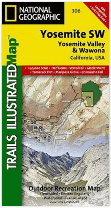
Wandelkaart 306 Yosemite SW- Yosemite Valley - Nat Geo
Yosemite Valley is een populaire toeristische bestemming
Korte omschrijving
Yosemite SW- Yosemite Valley & Wawona - Nat Geo Productomschrijving: De Yosemite Valley is een populaire toeristische bestemming, die elk jaar miljoenen bezoekers ontvangt. De gletsjervallei...

Specificaties
- Uitgever: National Geographic
- ISBN-13: 9781566953627
- HOOFDCATEGORIEËN: Wandelkaart
- Activiteiten: Wandelen, Hiking & Trekking
- Regio: Californië, USA
- Land: Verenigde Staten van Amerika (USA)
- Nationale parken: Yosemeti NP, California USA
- Schaal: 1:40000
- Afmeting: 10x19
- Taal: Engels
Volledige omschrijving
Yosemite SW- Yosemite Valley & Wawona - Nat Geo
Productomschrijving: De Yosemite Valley is een populaire toeristische bestemming, die elk jaar miljoenen bezoekers ontvangt. De gletsjervallei, omlijst door ontzagwekkende granietformaties als El Capitan en Half Dome, staat bekend om zijn dramatische watervallen, reusachtige sequoia's en biologische diversiteit. National Geographic's Trails Illustrated kaart van Yosemite SW: Yosemite Valley en Wawona levert ongeëvenaarde details en waardevolle informatie om u te helpen bij uw verkenning van deze spectaculaire wildernis. Gemaakt in samenwerking met lokale landbeheerders, toont deze deskundig onderzochte kaart belangrijke gebieden van belang, waaronder Yosemite Valley, Wawona, White Wolf, Merced en South Fork Merced rivieren, en Sierra National Forest.
Ontworpen met een breed scala van bezoekers in het achterhoofd, bevat deze kaart gedetailleerde en gemakkelijk te lezen paden met kilometerstanden tussen kruispunten, een nauwkeurig wegennet, kampeerterreinen, trailheads, overnachtingsmogelijkheden, toiletten, en eetgelegenheden. Delen van de Pacific Crest en John Muir trails zijn duidelijk gemarkeerd. Een verscheidenheid aan nuttige informatie over wildernis wandelen en kamperen, vergunningen, veiligheid van beren, en overlevingstips is ook opgenomen. De kaartbasis bevat hoogtelijnen en hoogtes voor toppen en vele meren.
Engelse omschrijving: The Yosemite Valley is a popular tourist destination, hosting millions of visitors each year. The glacial valley framed by such awe-inspiring granite formations as El Capitan and Half Dome is known for its dramatic waterfalls, giant sequoia groves, and biological diversity. National Geographic's Trails Illustrated map of Yosemite SW: Yosemite Valley and Wawona delivers unmatched detail and valuable information to assist you in your exploration of this spectacular wilderness. Created in partnership with local land management agencies, this expertly researched map features key areas of interest including Yosemite Valley, Wawona, White Wolf, Merced and South Fork Merced rivers, and Sierra National Forest.
Designed with a wide range of visitors in mind, this map features detailed and easy to read trails that include mileage between intersections, accurate road network, campgrounds, trailheads, lodging, restrooms, and food services. Sections of the Pacific Crest and John Muir trails are clearly marked. A variety of helpful information about wilderness hiking and camping, permits, bear safety, and survival tips is included as well. The map base includes contour lines and elevations for summits and many lakes.
Every Trails Illustrated map is printed on "Backcountry Tough" waterproof, tear-resistant paper. A full UTM grid is printed on the map to aid with GPS navigation.
Other features found on this map include: Bridalveil Fall, Chowchilla Mountains, El Capitan, Illilouette Falls, Lower Yosemite Fall, Nevada Fall, Ribbon Fall, Sierra National Forest, Silver Strand Falls, Stanislaus National Forest, Upper Yosemite Falls, Vernal Fall, Yosemite National Park, Yosemite Valley.
Locatie op kaart
Overzichtskaarten

NAT GEO California trail maps
NAT GEO California trail maps

Producten op de overzichtskaart
Klik op een product om naar de detailpagina te gaan.
- Wandelkaart 205 Sequoia & Kings Canyon NP - California
- Wandelkaart 206 Yosemite NP - California - Nat Geo
- Wandelkaart 218 Redwood National & State Parks - Nat Geo
- Wandelkaart 221 Death Valley NP - Nevada - Natgeo
- Wandelkaart 226 Joshua Tree NP - California - Nat Geo
- Wandelkaart 256 Mojave National park California - Nat Geo
- Wandelkaart 306 Yosemite SW- Yosemite Valley - Nat Geo
- Wandelkaart 307 Yosemite NP North West - Nat Geo
- Wandelkaart 308 Yosemite NE- Tuolumne Meadows - Nat Geo
- Wandelkaart 309 Yosemite SE - Ansel Adams Wilderness - Nat Geo
- Wandelkaart 322 Mount Whitney California - Nat Geo
- Wandelkaart 803 Lake Tahoe Basin - California - Nat Geo
- Wandelkaart 804 Tahoe National Forest West - Nat Geo
- Wandelkaart 805 Tahoe Nat. Forest East - Sierra Buttes - Nat Geo
- Wandelkaart 809 Mammoth Lakes - Mono Divide - Nat Geo
- Wandelkaart 810 Shaver Lake - Sierra National Forest - Nat Geo

NAT GEO Montana trails map
NAT GEO Montana trails map

Producten op de overzichtskaart
Klik op een product om naar de detailpagina te gaan.
- Wandelkaart 215 Glacier & Waterton Lakes NP - Montana - Nat Geo
- Wandelkaart 301 Longs Peak -Trails Illustrated N. Trails - Nat Geo
- Wandelkaart 302 Yellowstone NP & Old Faithful - Nat Geo
- Wandelkaart 303 Mammoth Hot Springs- Yellowstone - Nat Geo
- Wandelkaart 304 Tower & Canyon Yellowstone NP - Nat Geo
- Wandelkaart 306 Yosemite SW- Yosemite Valley - Nat Geo
- Wandelkaart 314 Many Glacier NP- Waterton lakes - Montana
Artikelen uit dezelfde regio

Reisgids USA Southwest & National Parks - DK Eyewitness • 9780241365519
USA Southwest & National Parks Omvat: Arizona, Las Vegas, Southern Utah, the Four Corners & New Mexico. Productomschrijving: Staar naar de diepten van de Grand Canyon, ervaar de glitter en glamour van de Las Vegas strip, beklim de rotsachtige overspanningen van Arches National Park of wandel door het historische Santa Fe: alles wat u moet weten is overzichtelijk weergegeven in kleurgec…

Reisgids Wat & hoe Californië - Kosmos • 9789043934503
Reisgids Californië - Kosmos Productomschrijving: Uitgebreide verkenning van de iconische steden van Californië: Los Angeles, San Francisco en San Diego. Ontdek de bruisende cultuur van LA, van Hollywood tot de stranden van Santa Monica. In San Francisco bewonder je de beroemde Golden Gate Bridge, de historische wijk Fisherman's Wharf en de karakteristieke kabeltrams. San Diego biedt e…

Reisgids California wine country USA - Top 10 - Eyewitness • 9781409326823
California wine country USA - Top 10 - Eyewitness Productomschrijving: Explore California's world-class wineries, take a leisurely tour on the Napa Valley Wine Train, cycle along the Silverado Trail or venture to the Russian River for the renowned River Jazz and Blues Festival. From Top 10 festivals to the Top 10 beaches - discover the best of California Wine Country with this easy-to-use …

Reisgids California - DK Eyewitness • 9780241309292
Reisgids California - DK Eyewitness Productomschrijving: Tour a winery in Napa, hike to the waterfalls in Yosemite National Park or ride a classic cable car in San Francisco: everything you need to know is clearly laid out within colour-coded chapters. Discover the best of California with this indispensable travel guide. Detailed chapters with area maps cover: Los Angeles; South Centra…

Reisgids Geoguide Californie - Gallimard • 9782742464708
Reisgids Californie - Gallimard Productomschrijving: De meest bezocht staat van America, de meest zonnige als je de Amerikanen mag geloven. Ze noemen hun eigen staat, de Sunshine state. Dat is durven. Van De bruisende stad van Los Angeles, tot San Francisco & San Diego, de daarbuiten liggen nationale parken, en zelfs Las Vegas die in Amerikaanse termen niet ver afligt? Franse omschrijv…