
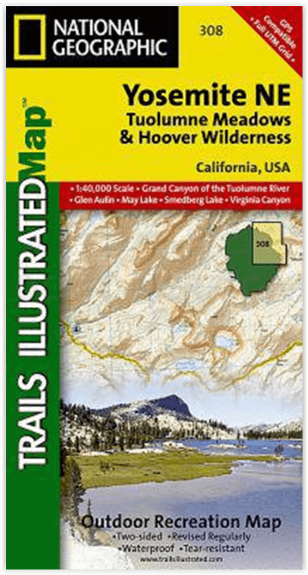
Wandelkaart 308 Yosemite NE- Tuolumne Meadows - Nat Geo
Om te voldoen aan de behoeften van outdoor enthousiastelingen
Korte omschrijving
Yosemite North East - Tuolumne Meadows - Nat Geo Productomschrijving: National Geographic's Trails Illustrated kaart van Yosemite NE: Tuolumne Meadows and Hoover Wilderness is ontworpen om t...

Specificaties
- Uitgever: National Geographic
- ISBN-13: 9781566953696
- HOOFDCATEGORIEËN: Wandelkaart
- Activiteiten: Wandelen, Hiking & Trekking
- Regio: Californië, USA
- Land: Verenigde Staten van Amerika (USA)
- Nationale parken: Yosemeti NP, California USA
- Schaal: 1:40000
- Afmeting: 10x19
- Taal: Engels
Volledige omschrijving
Yosemite North East - Tuolumne Meadows - Nat Geo
Productomschrijving: National Geographic's Trails Illustrated kaart van Yosemite NE: Tuolumne Meadows and Hoover Wilderness is ontworpen om te voldoen aan de behoeften van outdoor enthousiastelingen door het combineren van waardevolle informatie met ongeëvenaarde details van deze prachtige regio van het park. Deskundig onderzocht en gemaakt in samenwerking met lokale landbeheerders, bevat deze kaart belangrijke punten van belang, waaronder Twin Lakes, Tuolumne River, Grand Canyon of the Tuolumne, en delen van Ansel Adams Wilderness, Mono Basin National Forest Scenic Area, en Yosemite Wilderness.
Met kilometers aan gemarkeerde paden, inclusief delen van de Pacific Crest en John Muir paden, kan deze kaart u van de gebaande paden af leiden en weer terug in enkele van de meest adembenemende landschappen in de Sierras. Trail kilometers tussen de kruispunten zal u helpen kiezen het pad dat voor u geschikt is. Camping, wandelen, wildernis vergunning, en de veiligheid informatie is opgenomen om u te helpen bij het genieten van alles wat het park te bieden heeft. De kaartbasis bevat hoogtelijnen en hoogtes voor toppen, passen en vele meren. Recreatievoorzieningen zijn duidelijk aangegeven, waaronder campings, picknickplaatsen, trailheads, paardenstallen, skigebieden en meer.
Engelse omschrijving: National Geographic's Trails Illustrated map of Yosemite NE: Tuolumne Meadows and Hoover Wilderness is designed to meet the needs of outdoor enthusiasts by combining valuable information with unmatched detail of this magnificent region of the park. Expertly researched and created in partnership with local land management agencies, this map features key points of interest including Twin Lakes, Tuolumne River, Grand Canyon of the Tuolumne, and portions of Ansel Adams Wilderness, Mono Basin National Forest Scenic Area, and Yosemite Wilderness.
With miles of mapped trails including portions of the Pacific Crest and John Muir trails, this map can guide you off the beaten path and back again in some of the most breathtaking scenery in the Sierras. Trail mileage between intersections will help you choose the path that's right for you. Camping, hiking, wilderness permit, and safety information is included to help guide you in enjoying all the park has to offer. The map base includes contour lines and elevations for summits, passes, and many lakes. Recreation features are clearly marked, including campgrounds, picnic areas, trailheads, horse stables, ski areas, and more.
Every Trails Illustrated map is printed on "Backcountry Tough" waterproof, tear-resistant paper. A full UTM grid is printed on the map to aid with GPS navigation.
Other features found on this map include: Ansel Adams Wilderness, Excelsior Mountain, Hoover Wilderness, Inyo National Forest, Matterhorn Peak, Mount Dana, Tioga Pass, Toiyabe National Forest, Yosemite National Park.
Locatie op kaart
Overzichtskaarten

NAT GEO California trail maps
NAT GEO California trail maps

Producten op de overzichtskaart
Klik op een product om naar de detailpagina te gaan.
- Wandelkaart 205 Sequoia & Kings Canyon NP - California
- Wandelkaart 206 Yosemite NP - California - Nat Geo
- Wandelkaart 218 Redwood National & State Parks - Nat Geo
- Wandelkaart 221 Death Valley NP - Nevada - Natgeo
- Wandelkaart 226 Joshua Tree NP - California - Nat Geo
- Wandelkaart 256 Mojave National park California - Nat Geo
- Wandelkaart 306 Yosemite SW- Yosemite Valley - Nat Geo
- Wandelkaart 307 Yosemite NP North West - Nat Geo
- Wandelkaart 308 Yosemite NE- Tuolumne Meadows - Nat Geo
- Wandelkaart 309 Yosemite SE - Ansel Adams Wilderness - Nat Geo
- Wandelkaart 322 Mount Whitney California - Nat Geo
- Wandelkaart 803 Lake Tahoe Basin - California - Nat Geo
- Wandelkaart 804 Tahoe National Forest West - Nat Geo
- Wandelkaart 805 Tahoe Nat. Forest East - Sierra Buttes - Nat Geo
- Wandelkaart 809 Mammoth Lakes - Mono Divide - Nat Geo
- Wandelkaart 810 Shaver Lake - Sierra National Forest - Nat Geo
Artikelen uit dezelfde regio

Wandelkaart 804 Tahoe National Forest West - Nat Geo • 9781566954259
Tahoe National Forest West - Nat Geo Omvat: Donner Pass, Eldorado National Forest, Granite Chief Wilderness, Mosquito Ridge, Plumas National Forest, Sawtooth Ridge, Tahoe National Forest, Truckee. Engelse omschrijving: Expertly researched and created in partnership with the U.S. Forest Service and others, National Geographic's Trails Illustrated map of Yuba and American Rivers region o…

Wandelkaart 811 Angeles National Forest - Natgeo • 9781566955775
Wandelkaart Angeles National Forest, California USA (9781566955775) National Geographic Productomschrijving: Een bosgebied in de onmiskenbare San Gabriel Mountains in het zuiden van de Amerikaanse staat Californië. Het bestaat uit twee delen die van elkaar gescheiden worden door de Soledad Canyon. Het Angeles National Forest reikt tot net over de grens met San Bernardino County in het oost…

Reisgids California - Insight Guides ENG • 9781839053306
Reisgids California - Insight Guides Productomschrijving: Van het beslissen wanneer je gaat tot kiezen wat je gaat zien als je aankomt, dit is alles wat je nodig hebt om je reis te plannen en het beste van Californië te ervaren, met diepgaande insiderinformatie over must-see topattracties zoals Hollywood en verborgen culturele juweeltjes zoals de Pacific Coast Highway. Engelse om…

Reisgids West Coast USA - Insight Guides ENG • 9781786718310
West Coast USA - Insight Guides Productomschrijving: Deze reisgids is een rijk geïllustreerde inspirerende versie over de westkust van de VS en een prachtig souvenir van uw reis. Perfect voor reizigers die op zoek zijn naar een diepere duik in de geschiedenis en cultuur van de bestemming en ideaal om u te inspireren en te helpen bij het plannen van uw reis. Met zijn grote selectie van…

Wandelgids The California Mission Trails - Cicerone • 9781786311139
The California Mission Trails - Cicerone Productomschrijving: Gids over het wandelen en fietsen van de 1289 km lange California Missions Trail tussen San Francisco Bay en San Diego. De pelgrimsroute voert langs 21 historische Spaanse missies en kan worden voltooid in 50-60 wandeldagen of 2-3 weken fietsen. Met 1:100.000 kaarten, routebeschrijving en details van accommodatie en faciliteiten…