
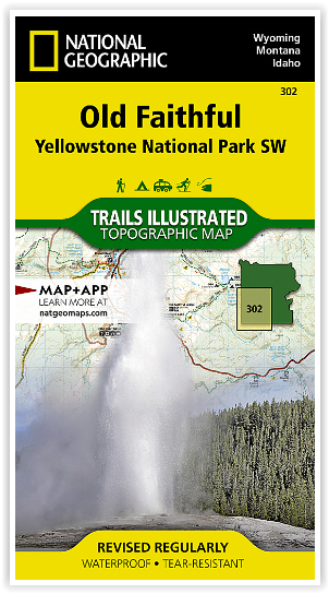
Wandelkaart 302 Yellowstone NP & Old Faithful - Nat Geo
Old Faithful geyser area & the West Thumb of Yellowstone Lake

Korte omschrijving
Yellowstone National Park & Old Faithful - Nat Geo Omvat: Craig Pass, Gallatin National Forest, Grand Teton National Park, Heart Lake, Jedediah Smith Wilderness, John D. Rockefeller, Jr. Mem...

Specificaties
- Uitgever: National Geographic
- ISBN-13: 9781566954334
- HOOFDCATEGORIEËN: Wandelkaart
- Activiteiten: Wandelen, Hiking & Trekking
- Regio: Idaho, USA, Montana, USA, Wyoming, USA
- Land: Verenigde Staten van Amerika (USA)
- Waterafstotende kaart: Nat Geo waterproof series
- Nationale parken: Yellowstone NP, Wyoming USA
- Schaal: 1:63360
- Afmeting: 10x19
- Editie: 7
- Taal: Engels
Volledige omschrijving
Yellowstone National Park & Old Faithful - Nat Geo
Omvat: Craig Pass, Gallatin National Forest, Grand Teton National Park, Heart Lake, Jedediah Smith Wilderness, John D. Rockefeller, Jr. Memorial Parkway, Lewis Lake, Mount Sheridan, Pitchstone Plateau, Red Mountains, Shoshone Lake, Targhee National Forest, Teton National Forest, Teton Wilderness, Yellowstone National Park.
Engelse omschrijving: National Geographic's Trails Illustrated map of the Old Faithful area of Yellowstone National Park is designed to meet the needs of outdoor enthusiasts with unmatched detail of the south-west section of the national park. Expertly researched and created in partnership with local land management agencies, this map features key points of interest including the Old Faithful geyser area, the West Thumb of Yellowstone Lake, South Entrance Station, West Yellowstone, Heart Lake, and John D. Rockefeller Jr. Memorial Parkway. The Continental Divide Trail is also covered on this map.
With many miles of mapped trails and marked Bear Management Zones the Old Faithful map can guide you off the beaten path and back again. The clearly marked trails include mileages between intersections. The map base includes contour lines and elevations for summits, passes and many lakes. Some of the many recreation features include: visitor centers, campgrounds, trailheads, horse rentals, boat ramps, and interpretive trails.
Every Trails Illustrated map is printed on "Backcountry Tough" waterproof, tear-resistant paper. A full UTM grid is printed on the map to aid with GPS navigation.
Locatie op kaart
Overzichtskaarten

NAT GEO Montana trails map
NAT GEO Montana trails map

Producten op de overzichtskaart
Klik op een product om naar de detailpagina te gaan.
- Wandelkaart 215 Glacier & Waterton Lakes NP - Montana - Nat Geo
- Wandelkaart 301 Longs Peak -Trails Illustrated N. Trails - Nat Geo
- Wandelkaart 302 Yellowstone NP & Old Faithful - Nat Geo
- Wandelkaart 303 Mammoth Hot Springs- Yellowstone - Nat Geo
- Wandelkaart 304 Tower & Canyon Yellowstone NP - Nat Geo
- Wandelkaart 306 Yosemite SW- Yosemite Valley - Nat Geo
- Wandelkaart 314 Many Glacier NP- Waterton lakes - Montana

NAT GEO Wyoming trail map
NAT GEO Wyoming trail map

Producten op de overzichtskaart
Klik op een product om naar de detailpagina te gaan.
- Wandelkaart 201 Yellowstone NP- Wyoming - Nat Geo
- Wandelkaart 202 Grand Teton NP- Wyoming - Nat Geo
- Wandelkaart 302 Yellowstone NP & Old Faithful - Nat Geo
- Wandelkaart 303 Mammoth Hot Springs- Yellowstone - Nat Geo
- Wandelkaart 304 Tower & Canyon Yellowstone NP - Nat Geo
- Wandelkaart 305 Yellowstone Lake - Yellowstone NP - Nat Geo
Artikelen uit dezelfde regio

Wandelkaart 215 Glacier & Waterton Lakes NP - Montana - Nat Geo • 9781566953184
TOPO Wandelkaart 215 - Glacier & Waterton Lakes NP Productomschrijving: Glacier National Park is een nationaal park in de Amerikaanse staat Montana. Het park sluit nadeloos aan op het Canadese Waterten Lakes NP net over de grens in Alberta Canada. Het park ligt in de Rocky Mountains op de grens met Canada. Zes bergtoppen bereiken er een hoogte van meer dan 3000 meter. Engelse omschrijv…

Wandelkaart 201 Yellowstone NP- Wyoming - Nat Geo • 9781566952958
TOPO Wandelkaart 201 - Yellowstone NP- Wyoming - Nat geo Productomschrijving: Yellowstone National Park, wat een prachtig concept voor een nationaal park, een par van formaat, en een nationaal park in de Verenigde Staten, hoofdzakelijk in Wyoming, maar met kleine gedeeltes in de aangrenzende staten Montana en Idaho. Engelse omschrijving: National Geographic's Trails Illustrated map of …

Wandelkaart 721 Absaroka - Beartooth Wilderness - Montana • 9781566955812
Wandelkaart 721 - Absaroka - Beartooth Wilderness - Montana Productomschrijving: In het Amerikaanse Montana en Wyoming, ligt dit prachtige Absorka Wilderness gebied, waar er dag van vandaag nog steeds wilde paarden rondlopen. Het gebied staat bekend voor zij schitterende vergezichten, en horizon om U tegen te zeggen. De kaart is gedetailleerd en beschikt over alle noodzakelijk details om e…

Wandelkaart 238 Black Hills National Forest SD-South - Nat Geo • 9781566953474
Wandelkaart - Black Hills National Forest SD-South - Nat Geo Productomschrijving: Een regionaal park gelegen op de grens van Noord-Dakota en Wyoming. Wat wij regionaal noemen is in Amerikaanse normen slechts een paar bomen, wij noemen parken van dergelijke grote nationale parken. Engelse omschrijving: National Geographic's Trails Illustrated map of Kenai Fjords National Park is an esse…

Reisgids Yellowstone & Grand Teton National Parks - Lonely Planet • 9781838699819
Reisgids Yellowstone & Grand Teton - Lonely Planet Productomschrijving: Lonely Planet Yellowstone & Grand Teton National Parks is je paspoort voor het meest relevante, actuele advies over wat je moet zien en overslaan, en welke verborgen ontdekkingen er op je wachten. Spot wolven en grizzly's in Lamar Valley, zie geisers uitbarsten in Old Faithful en Upper Geyser Basin, of ga het water op …