
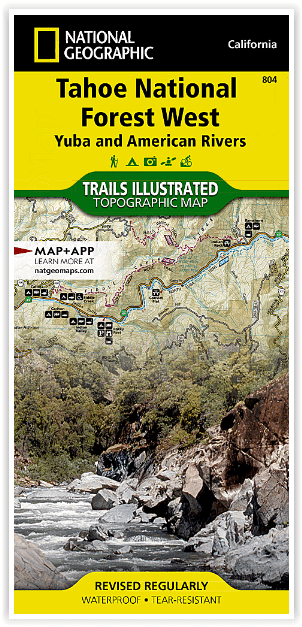
Wandelkaart 804 Tahoe National Forest West - Nat Geo
Yuba & American Rivers
Korte omschrijving
Tahoe National Forest West - Nat Geo Omvat: Donner Pass, Eldorado National Forest, Granite Chief Wilderness, Mosquito Ridge, Plumas National Forest, Sawtooth Ridge, Tahoe National Forest, Tr...

Specificaties
- Uitgever: National Geographic
- ISBN-13: 9781566954259
- HOOFDCATEGORIEËN: Wandelkaart
- Activiteiten: Wandelen, Hiking & Trekking
- Regio: Californië, USA
- Land: Verenigde Staten van Amerika (USA)
- Waterafstotende kaart: Nat Geo waterproof series
- Schaal: 1:63360
- Afmeting: 10x19
- Taal: Engels
Volledige omschrijving
Tahoe National Forest West - Nat Geo
Omvat: Donner Pass, Eldorado National Forest, Granite Chief Wilderness, Mosquito Ridge, Plumas National Forest, Sawtooth Ridge, Tahoe National Forest, Truckee.
Engelse omschrijving: Expertly researched and created in partnership with the U.S. Forest Service and others, National Geographic's Trails Illustrated map of Yuba and American Rivers region of Tahoe National Forest provides an unparalleled tool for exploring this historically significant region of the Sierras. Whatever the season, you'll find this map a useful tool in pursuing a host of recreational activities from skiing and snowmobiling to camping and boating. The map features many key points of interest, including French Meadows and New Bullards Bar Reservoirs, Granite Chief Wilderness, South Yuba River Recreation Area, Malakoff Diggins State Historic Park, Donner Memorial State Park and the western rim of the Lake Tahoe Basin Management Unit.
The Tahoe National Forest West map can guide you off the beaten path and back again with miles of clearly marked trails including portions of the Pacific Crest, Pioneer, and Tahoe Rim trails. To help you choose the path that's right for you, trails are color coded according to the designated usage and mileage between intersections is indicated. The Yuba Donner scenic byways is noted for those wishing to take in the scenery by car. Many recreation features are noted as well, including ski areas, campgrounds, trailheads, wildlife viewing areas, boat launches, and swimming and fishing areas. The map base includes contour lines and elevations for summits, passes and many lakes.
Every Trails Illustrated map is printed on "Backcountry Tough" waterproof, tear-resistant paper. A full UTM grid is printed on the map to aid with GPS navigation.
Locatie op kaart
Overzichtskaarten

NAT GEO California trail maps
NAT GEO California trail maps

Producten op de overzichtskaart
Klik op een product om naar de detailpagina te gaan.
- Wandelkaart 205 Sequoia & Kings Canyon NP - California
- Wandelkaart 206 Yosemite NP - California - Nat Geo
- Wandelkaart 218 Redwood National & State Parks - Nat Geo
- Wandelkaart 221 Death Valley NP - Nevada - Natgeo
- Wandelkaart 226 Joshua Tree NP - California - Nat Geo
- Wandelkaart 256 Mojave National park California - Nat Geo
- Wandelkaart 306 Yosemite SW- Yosemite Valley - Nat Geo
- Wandelkaart 307 Yosemite NP North West - Nat Geo
- Wandelkaart 308 Yosemite NE- Tuolumne Meadows - Nat Geo
- Wandelkaart 309 Yosemite SE - Ansel Adams Wilderness - Nat Geo
- Wandelkaart 322 Mount Whitney California - Nat Geo
- Wandelkaart 803 Lake Tahoe Basin - California - Nat Geo
- Wandelkaart 804 Tahoe National Forest West - Nat Geo
- Wandelkaart 805 Tahoe Nat. Forest East - Sierra Buttes - Nat Geo
- Wandelkaart 809 Mammoth Lakes - Mono Divide - Nat Geo
- Wandelkaart 810 Shaver Lake - Sierra National Forest - Nat Geo
Artikelen uit dezelfde regio

Reisgids California wine country USA - Top 10 - Eyewitness • 9781409326823
California wine country USA - Top 10 - Eyewitness Productomschrijving: Explore California's world-class wineries, take a leisurely tour on the Napa Valley Wine Train, cycle along the Silverado Trail or venture to the Russian River for the renowned River Jazz and Blues Festival. From Top 10 festivals to the Top 10 beaches - discover the best of California Wine Country with this easy-to-use …
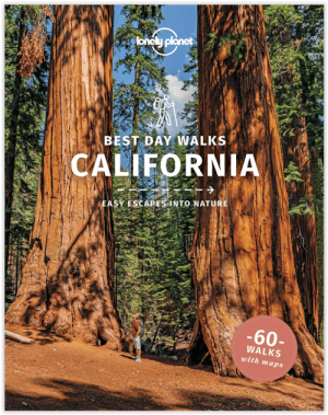
Wandelgids Best Day Walks California - Lonely Planet • 9781838691172
Best Day Walks California - Lonely Planet Productomschrijving: Lonely Planet's Best Day Walks Californië is uw paspoort met 60 gemakkelijke wandel ontsnappingen in de natuur. Strek je benen weg van de stad door een wandeling te kiezen die bij je past, van een paar uur tot een hele dag, van gemakkelijk tot zwaar. Verken Yosemite National Park, bewonder de sequoia's en wandel door Gold Count…
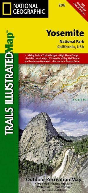
Wandelkaart 206 Yosemite NP - California - Nat Geo • 9781566952996
TOPO Wandelkaart 206 - Yosemite NP- California - Nat geo Productomschrijving: Yosemite National Park, wat een parel van schoonheid en tegelijk wereld bekend, is een nationaal park in het oosten van de Amerikaanse staat Californië. Hij ligt op de westelijke flanken van de centrale Sierra Nevada, in het oosten van Tuolumne, Mariposa en Madera County. Engelse omschrijving: Explore the maj…

Wandelkaart 810 Shaver Lake - Sierra National Forest - Nat Geo • 9781566952422
Shaver Lake - Sierra National Forest - Nat Geo Omvat: Ansel Adams Wilderness, Bass Lake, Chowchilla Mountains, Courtright Reservoir, Dinkey Lakes Wilderness, John Muir Wilderness, Kaiser Wilderness, Mammoth Pool Reservoir, Nelson Mountain, Sequoia National Forest, Shaver Lake, Sierra National Forest, Wishon Reservoir, Yosemite National Park. Engelse omschrijving: National Geographic's …

Reisgids Los Angeles & Southern California - Rough Guides • 9781848365834
Reisgids Los Angeles & Southern California - Rough Guides Productomschrijving: The Rough Guide to Los Angeles & Southern California is the definitive guide to the region. Whether you're looking for inspiring accommodation or great places to eat, you'll find the solution with hundreds of restaurant, hotel, nightlife and shop reviews. Along with a thorough look at LA's top tourist areas, fro…