
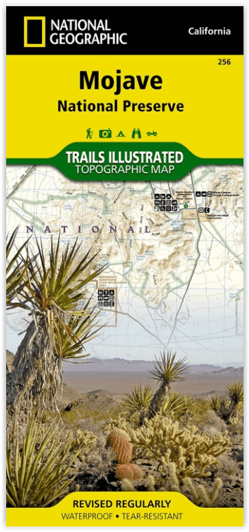
Wandelkaart 256 Mojave National park California - Nat Geo
De samenloop van de Mojave- Sonoran en Great Basin woestijn
Korte omschrijving
Wandelkaart - Mojave National park California - Nat Geo Productomschrijving: Gelegen op de samenloop van de Mojave, Sonoran, en Great Basin woestijn regio's, Mojave National Preserve is een ...

Specificaties
- Uitgever: National Geographic
- ISBN-13: 9781566953832
- HOOFDCATEGORIEËN: Wandelkaart
- Activiteiten: Wandelen, Hiking & Trekking
- Regio: Californië, USA
- Land: Verenigde Staten van Amerika (USA)
- Nationale parken: Mojave NP, California USA
- Schaal: 1:125000
- Afmeting: 11x24
- Taal: Engels
Volledige omschrijving
Wandelkaart - Mojave National park California - Nat Geo
Productomschrijving: Gelegen op de samenloop van de Mojave, Sonoran, en Great Basin woestijn regio's, Mojave National Preserve is een van de meest diverse woestijn omgevingen in de wereld. Verken de Joshua Tree bossen, zandduinen, vulkanische sintelkegels, kilometershoge bergen en uitgestrekte vergezichten van deze unieke regio met National Geographic's Trails Illustrated kaart van Mojave National Preserve. Deze kaart is gemaakt in samenwerking met lokale landbeheerders en bevat belangrijke bezienswaardigheden zoals Kelso Depot, Hole-in-the-Wall, Mitchell Caverns, Rock Springs, Clark Mountain, Cinder Cone Lava Beds, en de historische Mojave Road.
Engelse omschrijving: Located at the confluence of the Mojave, Sonoran, and Great Basin desert regions, Mojave National Preserve is one of the most diverse desert environments in the world. Explore the Joshua Tree forests, sand dunes, volcanic cinder cones, mile-high mountains, and vast vistas of this unique region with National Geographic's Trails Illustrated map of Mojave National Preserve. Created in partnership with local land management agencies, this expertly researched map features key areas of interest including Kelso Depot, Hole-in-the-Wall, Mitchell Caverns, Rock Springs, Clark Mountain, Cinder Cone Lava Beds, and the historic Mojave Road.
Designed with a wide range of visitors in mind, this map features detailed and easy-to-read trails, accurate road network, safety tips, and contact information for local agencies. A handy summary of over twenty points of interest will help you plan your visit. Park regulations and base temperature charts for Soda Springs and Granite Mountains are also included. Recreation features and amenities are clearly marked, including campgrounds, trailheads, interpretive trails, ranger stations, gas stations, lodging, and food services. The map base includes contour lines and elevations for summits.
Every Trails Illustrated map is printed on "Backcountry Tough" waterproof, tear-resistant paper. A full UTM grid is printed on the map to aid with GPS navigation.
Other features found on this map include: Bristol Mountains, Clark Mountain, Devils Playground, Granite Mountains, Ivanpah Lake, Mojave Desert, Mojave National Preserve, Mojave River, Providence Mountains, Shadow Valley, Silver Lake, Soda Lake.
Locatie op kaart
Overzichtskaarten

NAT GEO California trail maps
NAT GEO California trail maps

Producten op de overzichtskaart
Klik op een product om naar de detailpagina te gaan.
- Wandelkaart 205 Sequoia & Kings Canyon NP - California
- Wandelkaart 206 Yosemite NP - California - Nat Geo
- Wandelkaart 218 Redwood National & State Parks - Nat Geo
- Wandelkaart 221 Death Valley NP - Nevada - Natgeo
- Wandelkaart 226 Joshua Tree NP - California - Nat Geo
- Wandelkaart 256 Mojave National park California - Nat Geo
- Wandelkaart 306 Yosemite SW- Yosemite Valley - Nat Geo
- Wandelkaart 307 Yosemite NP North West - Nat Geo
- Wandelkaart 308 Yosemite NE- Tuolumne Meadows - Nat Geo
- Wandelkaart 309 Yosemite SE - Ansel Adams Wilderness - Nat Geo
- Wandelkaart 322 Mount Whitney California - Nat Geo
- Wandelkaart 803 Lake Tahoe Basin - California - Nat Geo
- Wandelkaart 804 Tahoe National Forest West - Nat Geo
- Wandelkaart 805 Tahoe Nat. Forest East - Sierra Buttes - Nat Geo
- Wandelkaart 809 Mammoth Lakes - Mono Divide - Nat Geo
- Wandelkaart 810 Shaver Lake - Sierra National Forest - Nat Geo
Artikelen uit dezelfde regio

Wandelkaart 812 Los Padres Nat. Forest East - Natgeo • 9781566955805
TOPO Wandelkaart 812 - Los Padres Nat. Forest East - Natgeo Productomschrijving: Los Padres National Forest is een bosgebied in Amerika, meerbepaald in oost- en centraal California. Het bos is uitermate gekend voor mountainbikers en hikers. Engelse omschrijving: One of the most diverse National Forests in the United States, Los Padres National Forest provides recreation opportunities f…

Wandelkaart 322 Mount Whitney California - Nat Geo • 9781566956468
Wandelkaart Mount Whitney California - Nat Geo Productomschrijving: Mount Whitney is universeel bekend als de hoogste piek in de aangrenzende Verenigde Staten, evenals het hoogste punt in Californië. National Geographic's Trails Illustrated kaart van Mount Whitney levert ongeëvenaarde details en waardevolle informatie om je te helpen bij je verkenning van dit prachtige gebied. Deze ka…

Wandelkaart 221 Death Valley NP - Nevada - Natgeo • 9781566953214
TOPO Wandelkaart 221 - Death Valley NP - Nevada - Nat Geo Productomschrijving: Death Valley National Park is een Amerikaans nationaal park die de California—Nevada grens aanraakt, ten oosten van de Sierra Nevada. De grenzen omvatten Death Valley, het noordelijk deel van Panamint Valley, het zuidelijk deel van Eureka Valley, en het de meerderheid van Saline Valley. Engelse omschrijving…

Wandelkaart 804 Tahoe National Forest West - Nat Geo • 9781566954259
Tahoe National Forest West - Nat Geo Omvat: Donner Pass, Eldorado National Forest, Granite Chief Wilderness, Mosquito Ridge, Plumas National Forest, Sawtooth Ridge, Tahoe National Forest, Truckee. Engelse omschrijving: Expertly researched and created in partnership with the U.S. Forest Service and others, National Geographic's Trails Illustrated map of Yuba and American Rivers region o…

Wandelgids Best Day Walks California - Lonely Planet • 9781838691172
Best Day Walks California - Lonely Planet Productomschrijving: Lonely Planet's Best Day Walks Californië is uw paspoort met 60 gemakkelijke wandel ontsnappingen in de natuur. Strek je benen weg van de stad door een wandeling te kiezen die bij je past, van een paar uur tot een hele dag, van gemakkelijk tot zwaar. Verken Yosemite National Park, bewonder de sequoia's en wandel door Gold Count…