
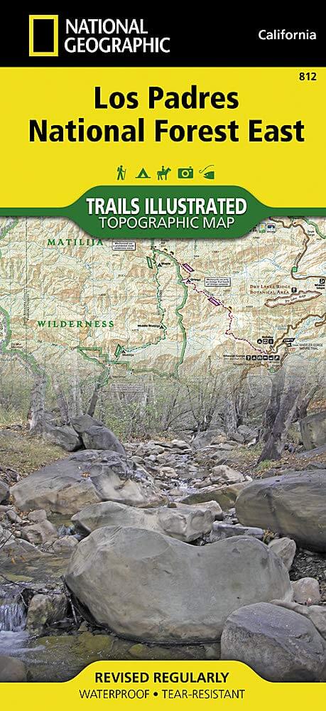
Wandelkaart 812 Los Padres Nat. Forest East - Natgeo
Het bos is uitermate gekend voor mountainbikers en hikers
Korte omschrijving
TOPO Wandelkaart 812 - Los Padres Nat. Forest East - Natgeo Productomschrijving: Los Padres National Forest is een bosgebied in Amerika, meerbepaald in oost- en centraal California. Het bos ...

Specificaties
- Uitgever: National Geographic
- ISBN-13: 9781566955805
- HOOFDCATEGORIEËN: Wandelkaart
- Regio: Californië, USA
- Land: Verenigde Staten van Amerika (USA)
- Regionale parken: Los Padres National Forest, California USA
- Schaal: 1:80000
- Afmeting: 10x19
- Taal: Engels
Volledige omschrijving
TOPO Wandelkaart 812 - Los Padres Nat. Forest East - Natgeo
Productomschrijving: Los Padres National Forest is een bosgebied in Amerika, meerbepaald in oost- en centraal California. Het bos is uitermate gekend voor mountainbikers en hikers.
Engelse omschrijving: One of the most diverse National Forests in the United States, Los Padres National Forest provides recreation opportunities for a enormous population base in central and southern California. National Geographic's Trails Illustrated map of Los Padres National Forest East will serve outdoor enthusiasts looking to enjoy the wide range of activities that the National Forest has to offer. Expertly researched and created in partnership with the U.S. Forest Service, California State Parks and others, the maps covers with unparalleled detail the area from Santa Barbara in the west to the National Forest's eastern boundary with Angeles National Forest. Coverage includes many popular points of interest, including Chumash, Dick Smith, Matilija and Sespe Wilderness Area; Sisquoc, Sespe Creek and Piru Creek Scenic Rivers; Fort Tejon and El Presidio de Santa Barbara State Historic Parks; Hungry Valley Recreation Area; and Carpinteria State Beach.
Navigate the area by following mapped trails, including many National Recreation Trails, shown with mileage markers and labeled according to designated usage, whether exploring on foot, horseback, mountain bike, motorcycle or ATV. To aid in your navigation, the map displays contour lines, elevations, labeled peaks and summits, water features, numbered Forest Service roads and OHV routes, and color-coded boundaries between different land management agencies. Among the many recreation spots pinpointed include areas for camping, picnics, boat launching, fishing, swimming, surfing, widlife viewing and winter recreation. The Jacinto Reyes and San Marcos Pass Road Scenic Byways are marked for those wishing to explore the by car. Every Trails Illustrated map is printed on "Backcountry Tough" waterproof, tear-resistant paper. A full UTM grid is printed on the map to aid with GPS navigation.
Other features found on this map include: Angeles National Forest, Carpinteria, Chumash Wilderness, Dick Smith Wilderness, Fillmore, Lake Casitas, Lake Piru, Los Padres National Forest, Matilija Wilderness, Piru Creek, Pyramid Lake, San Emigdio Mountains, San Rafael Wilderness, Santa Barbara, Santa Ynez Mountains, Sespe Creek, Sespe Wilderness, Tejon Pass.
.png)
Locatie op kaart
Artikelen uit dezelfde regio

Wandelkaart 809 Mammoth Lakes - Mono Divide - Nat Geo • 9781566952668
TOPO Wandelkaart 809 - Mammoth Lakes - Mono Divide - National Geographic Productomschrijving: Mammoth Lakes is een stadje in Mono County, California, de enige geintegreerde community in de regio. Gelegen direct ten oosten van Mammoth Mountain. Engelse omschrijving: Explore the magnificent alpine landscape of Mammoth Lakes, Mono Divide with National Geographic's Trails Illustrated map. …
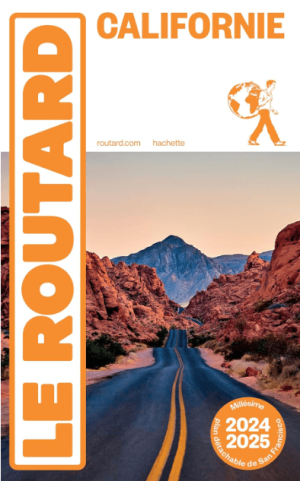
Reisgids Californie 2024-25 - Le Routard • 9782017888208
Reisgids Californie - Hahette Productomschrijving: De nieuwe update van Le Routard, Frankrijks nummer 1 reisgids! De legendarische westkust, bakermat van film, surfen en technologie. Tussen de Stille Oceaan, de bergen, de wijngaarden en de woestijn maak je een onvergetelijke roadtrip van San Francisco naar Los Angeles langs de grote nationale parken. Franse omschrijving: Nouvelle…

Reisgids Geoguide Californie - Gallimard • 9782742464708
Reisgids Californie - Gallimard Productomschrijving: De meest bezocht staat van America, de meest zonnige als je de Amerikanen mag geloven. Ze noemen hun eigen staat, de Sunshine state. Dat is durven. Van De bruisende stad van Los Angeles, tot San Francisco & San Diego, de daarbuiten liggen nationale parken, en zelfs Las Vegas die in Amerikaanse termen niet ver afligt? Franse omschrijv…

Wandelkaart 810 Shaver Lake - Sierra National Forest - Nat Geo • 9781566952422
Shaver Lake - Sierra National Forest - Nat Geo Omvat: Ansel Adams Wilderness, Bass Lake, Chowchilla Mountains, Courtright Reservoir, Dinkey Lakes Wilderness, John Muir Wilderness, Kaiser Wilderness, Mammoth Pool Reservoir, Nelson Mountain, Sequoia National Forest, Shaver Lake, Sierra National Forest, Wishon Reservoir, Yosemite National Park. Engelse omschrijving: National Geographic's …

Reisgids San Francisco & Northern California - DK Eyewitness • 9780241360071
San Francisco & Northern California Omvat: Presidio, Pacific Heights and the Marina, Fisherman's Wharf and North Beach, Chinatown and Nob Hill, Financial District and Union Square, Civic Center, Haight Ashbury and the Mission, Golden Gate Park and Land's End, and sights beyond the city, plus major parts of Northern California including Carmel, Mendocino, Napa Wine Country, Lake Tahoe & Yos…