Wandelkaart 307 Consett & Derwent reservoir - OSI
De Pennines- Consett- en Derwent Reservoir
Korte omschrijving
Wandelkaart Consett & Derwent reservoir - Northumberland Omvat ook: Stanhope 307 / Consett & Derwent reservoir, Northumberland, England - Op de noordoostelijke rand van de Pennines bestr...

Specificaties
- Uitgever: Ordnance Survey
- ISBN-13: 9780319245590
- HOOFDCATEGORIEËN: Wandelkaart
- Activiteiten: Wandelen, Hiking & Trekking
- Regio: Northhumberland, Engeland
- Land: England
- Schaal: 1:25000
- Afmeting: 13x23
- Taal: Engels
- Reeks: Explorer Series OSI
Volledige omschrijving
Wandelkaart Consett & Derwent reservoir - Northumberland
Omvat ook: Stanhope
307 / Consett & Derwent reservoir, Northumberland, England - Op de noordoostelijke rand van de Pennines bestrijkt deze OS Explorer kaart 307 Consett, de Derwent Reservoir, en een aantal kleinere reservoirs. Zie als u zichzelf naar de top van de Bolt's Law op 540m kunt krijgen. De OS Explorer kaart voor Consett & Derwent Reservoir is beschikbaar in zowel de standaard papieren versie als de weerbestendige 'Actief' versie.
307 / Consett & Derwent reservoir, Northumberland, England - On the north-east edge of the Pennines, OS Explorer Map sheet 307 covers Consett, the Derwent Reservoir, and a number of smaller reservoirs. See if you can make your way to the top of Bolt's Law, at 540 m. The OS Explorer map for Consett & Derwent Reservoir is available in both the standard paper version and weatherproof 'Active' version.
Locatie op kaart
Gekoppelde artikelen
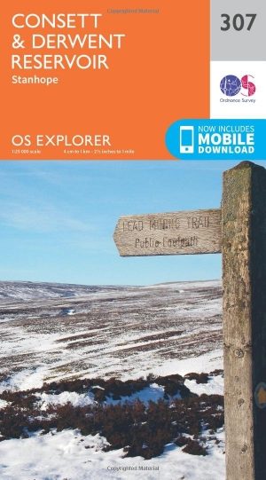
Wandelkaart 307 Consett & Derwent reservoir - OSI • 9780319245590
standaard versieWandelkaart Consett & Derwent reservoir - Northumberland Omvat ook: Stanhope 307 / Consett & Derwent reservoir, Northumberland, England - Op de noordoostelijke rand van de Pennines bestrijkt deze OS Explorer kaart 307 Consett, de Derwent Reservoir, en een aantal kleinere reservoirs. Zie als u zichzelf naar de top van de Bolt's Law op 540m kunt krijgen. De OS Explorer kaart voor Consett…

Wandelkaart 307 Consett & Derwent Reservior - OSI • 9780319471791
weatherproof versieWandelkaart Consett & Derwent Reservior - Durham England Omvat ook: Stanhope. Productbeschrijving: Op de noordoostelijke rand van de Pennines bestrijkt OS Explorer kaart 307 Consett, de Derwent Reservoir, en een aantal kleinere reservoirs. Zie als u zich kunt wenden tot Bolt's Law, op 540 m. De OS Explorer kaart voor Consett & Derwent Reservoir is beschikbaar in zowel de standaard papi…
Overzichtskaarten
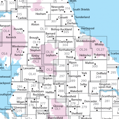
OSI Explorer & Explorer Active - Noord Engeland - Lake District
OSI Explorer & Explorer Active - Noord Engeland - Lake District

Producten op de overzichtskaart
Klik op een product om naar de detailpagina te gaan.
- Wandelkaart 275 Liverpool- South West England - OSI
- Wandelkaart 276 Bolton- Wigan & Warrington- Machester - OSI
- Wandelkaart 277 Manchester & Salford - OSI
- Wandelkaart 278 Sheffield & Barnsley- South Yorkshire - OSI
- Wandelkaart 279 Doncaster- South Yorkshire - OSI
- Wandelkaart 280 Isle of Axholme- Lincolnshire - OSI
- Wandelkaart 281 Ancholme Valley- Lincolnshire - OSI
- Wandelkaart 283 Louth & Mablethorpe- Lincolnshire - OSI
- Wandelkaart 284 Grimsby- Cleethorpes & Immingham - OSI
- Wandelkaart 285 Southport & Chorley- Merseyside - OSI
- Wandelkaart 286 Blackpool & Preston- Lancashire - OSI
- Wandelkaart 287 West Pennine Moors- Lankashire - OSI
- Wandelkaart 288 Bradford & Huddersfield- West Yorkshire - OSI
- Wandelkaart 289 Leeds- Harrogate- Wetherby & Pontefract - OSI
- Wandelkaart 290 York- Selby & Tadcaster- North Yorkshire - OSI
- Wandelkaart 291 Goole & Gilberdyke- Yorkshire - OSI
- Wandelkaart 292 Withernsea & Spurn Head- East Riding - OSI
- Wandelkaart 293 Kingston upon Hull & Beverley - OSI
- Wandelkaart 294 Market Weighton & central Yorkshire Wolds - OSI
- Wandelkaart 295 Bridlington- Driffield & Hornsea - OSI
- Wandelkaart 296 Lancaster- Morecambe & Fleetwood - OSI
- Wandelkaart 297 Lower Wharfedale & Washburn Valley - OSI
- Wandelkaart 298 Nidderdale AONB- Yorkshire - OSI
- Wandelkaart 299 Ripon & Boroughbridge- North Yorkshire - OSI
- Wandelkaart 300 Howardian Hills AONB & Malton - OSI
- Wandelkaart 301 Scarborough- Bridlington & Flamborough
- Wandelkaart 302 Northallerton & Thirsk- North Yorkshire
- Wandelkaart 303 Whitehaven & Workington - OSI
- Wandelkaart 304 Darlington & Richmond- North Cleveland
- Wandelkaart 305 Bishop Auckland & Durham - OSI
- Wandelkaart 306 Middlesbrough & Hartlepool - OSI
- Wandelkaart 307 Consett & Derwent reservoir - OSI
- Wandelkaart 308 Durham & Sunderland- England - OSI
- Wandelkaart 314 Solway Firth- Wigton & Silloth - OSI
- Wandelkaart 315 Carlisle- Brampton- Longtown - OSI
- Wandelkaart 316 Newcastle upon Tyne- Northumberland- OSI
- Wandelkaart OL2 Yorkshire Dales- Southern & Western Areas - OSI
- Wandelkaart OL19 Howgill Fells and Upper Eden Valley - OSI
- Wandelkaart OL21 South Pennines - Yorkshire - OSI
- Wandelkaart OL26 North York Moors - Western area - OSI
- Wandelkaart OL27 North York Moors- Eastern area - OSI
- Wandelkaart OL30 Yorkshire Dales - Yorkshire England - OSI
- Wandelkaart OL31 North Pennines- Teesdale & Weardale - OSI
- Wandelkaart OL41 Forest of Bowland & Ribblesdale - OSI
- Wandelkaart OL43 Hadrian's Wall - OSI
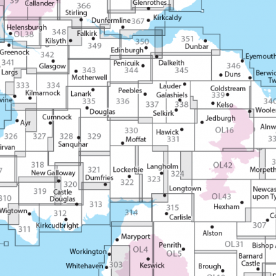
OSI Explorer & Explorer Active - Zuid Scotisch Borders
OSI Explorer & Explorer Active - Zuid Scotisch Borders

Producten op de overzichtskaart
Klik op een product om naar de detailpagina te gaan.
- Wandelkaart 307 Consett & Derwent reservoir - OSI
- Wandelkaart 308 Durham & Sunderland - England - OSI
- Wandelkaart 309 Stranraer & The Rhins - Dumfries - OSI
- Wandelkaart 310 Glenluce & Kirkcowan - Schotland - OSI
- Wandelkaart 311 Wigtown- Whithorn & The Machars - OSI
- Wandelkaart 312 Kirkcudbright & Castle Douglas - OSI
- Wandelkaart 313 Dumfries & Dalbeattie- Schotland - OSI
- Wandelkaart 314 Solway Firth- Wigton & Silloth - OSI
- Wandelkaart 315 Carlisle- Brampton & Longtown - OSI
- Wandelkaart 316 Newcastle upon Tyne - Northumberland - OSI
- Wandelkaart 137 Ballantrae South Ayrshire- Schotland- OSI
- Wandelkaart 318 Galloway Forest Park North- Ayrshire
- Wandelkaart 319 Galloway Forest Park South - OSI
- Wandelkaart 320 Castle Douglas & Loch Ken - OSI
- Wandelkaart 321 Nithsdale & Dumfries & Thornhill - OSI
- Wandelkaart 322 Annandale- Dumfries & Galoway - OSI
- Wandelkaart 323 Eskdale & Castle O'er Forest- Schotland - OSI
- Wandelkaart 324 Liddesdale & Kershope Forest - OSI
- Wandelkaart 325 Morpeth & Blyth - Northumberland - OSI
- Wandelkaart 326 Ayr & Troon - South Ayrshire - OSI
- Wandelkaart 327 Cumnock & Dalmellington - OSI
- Wandelkaart 328 Sanquhar & New Cumnock - OSI
- Wandelkaart 329 Lowther Hills- Sanquhar & Leadhills - OSI
- Wandelkaart 330 Moffat & St Mary's Loch - Dumfries - OSI
- Wandelkaart 331 Teviotdale South - Schotisch Borders - OSI
- Wandelkaart 332 Alnwick Amble - Northumberland - OSI
- Wandelkaart 333 Kilmarnock & Irvine - East Ayrshire - OSI
- Wandelkaart 334 East Kilbride- Galston & Darvel - Glasgow - OSI
- Wandelkaart 335 Lanark & Tinto Hills - South Lankashire - OSI
- Wandelkaart 336 Biggar & Broughton - South Lanarkshire - OSI
- Wandelkaart 337 Peebles & Interleithen - Schotish Borders - OSI
- Wandelkaart 338 Galashiels- Selkirk & Melrose - OSI
- Wandelkaart 339 Kelso- Coldstream & Lower Tweed Valley - OSI
- Wandelkaart 340 Holy Island & Bamburgh - OSO
- Wandelkaart 341 Greenock- Largs & Millport - OSI
- Wandelkaart 342 Glasgow Schotland - OSI
- Wandelkaart 343 Motherwell & Coatbridge- Glasgow - OSI
- Wandelkaart 344 Pentland Hills RP- Edinburgh - OSI
- Wandelkaart 345 Lammermuir Hills - Edinburgh - OSI
- Wandelkaart 346 Berwick-upon-Tweed - Northumberland - OSI
- Wandelkaart 349 Falkirk- Cumbernauld & Livingston - OSI
- Wandelkaart 350 Edinburgh - East Schotland - OSI
- Wandelkaart 351 Dunbar & North Berwick - Edinburgh - OSI
- Wandelkaart 361 Isle of Arran - OSI
- Wandelkaart 362 Cowal West & Isle of Bute - OSI
- Wandelkaart OL16 Cheviot Hills Northumberland - OSI
- Wandelkaart OL42 Kielder Water & Forest - OSI
- Wandelkaart OL43 Hadrian's Wall - OSI
- Wandelkaart OL37 Cowal East- Dunoon & Iverary - OSI
- Wandelkaart OL38 Loch Lomond South & Dumbarton - OSI
Artikelen uit dezelfde regio

Wandelkaart 325 Morpeth & Blyth Northumberland - OSI • 9780319245774
Wandelkaart Morpeth & Blyth - Northumberland England Opmvat ook: Ashington & Longframlington Productomschrijving: Ten noorden van Newcastle, in de omgeving van Morpeth, is de regio die word gedekt door deze OS Explorer kaart 325. De North Sea Trail en St. Oswald's Way recreatieve paden zijn beide gedekt deels door deze kaart. De OS Explorer kaart voor Morpeth & Blyth is beschikbaar in …
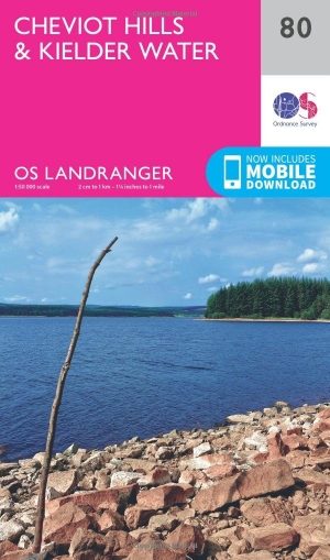
Wandelkaart 80 Cheviot Hills & Kielder Water - England - OSI • 9780319261781
Wandelkaart Cheviot Hills & Kielder Water - England Productbeschrijving: Omgeven door het prachtige Northumberland National Park en Cheviot hills, maakt de Walliser way voor een prachtige wandel tocht door het platteland niet ver van de Schotse grens. OS Landranger kaart 80 is de ideale metgezel, en toont de belangrijkste wandel- en fietsroutes in de regio. Waarom niet eens het Kielder Wat…


Wandelgids Hadrian's Wall Path - Rucksack readres • 9781898481430
Wandelgids Hadrian's Wall Path - North England Productomschrijving: Hadrians Wall Path loopt voor 86 mijl vanaf Bowness-op-Solway naar Wallsend langs de lijn van de Romeinse muur, voltooid in AD122 onder keizer Hadrianus. Deze National Trail doorkruist van Noord-Engeland van Ierse Zee naar de Noordzee en biedt vele mogelijkheden om te kijken naar de forten, de milecastles en de interpretat…

Wandelkaart 75 Berwick-upon-Tweed - OSI • 9780319473986
Wandelkaart Berwick-upon-Tweed - Northumberland England Productbeschrijving: Gelegen dichtbij de Schotse grens, is Berwick-upon-Tweed de meest noordelijke stad in Engeland, en verschijnt op deze kaart met nummer 75 in de OS Landranger-kaarten reeks. Er is een magnitude aan activiteiten en bezienswaardigheden te ontdekken in de omgeving. De enorme uitgestrektheid van Northumberland plattela…
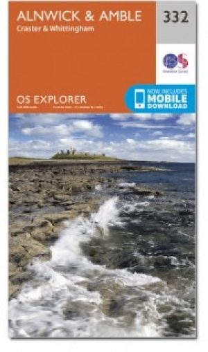
Wandelkaart 332 Alnwick & Amble Northumberland - OSI • 9780319472040
Wandelkaart Alnwick & Amble - Northumberland England Omvat ook: Craster & Whittingham. Productbeschrijving: Kaart nummer 332 in de OS Explorer kaarten reeks heeft betrekking op de Northumbrian kust van Embleton Bay naar Amble en landinwaarts tot zover de bron van de rivier de Aln looptt. Plaatsen om te bezoeken zijn onder andere: Craster, kasteel van Alnwick, Warkworth Castle, Craster …


