
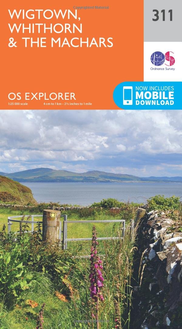
Wandelkaart 311 Wigtown Whithorn & The Machars - OSI
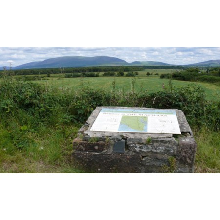
De Machars zijn een gebied met glooiende groene heuvels
Korte omschrijving
Wandelkaart Wigtown- Whithorn - Dumfries & Galloway Productbeschrijving: OS Explorer kaart 331 omvat Whithorn en The Machars. De Machars zijn een gebied met glooiende groene heuvels waarvan ...

Specificaties
- Uitgever: Ordnance Survey
- ISBN-13: 9780319245637
- HOOFDCATEGORIEËN: Wandelkaart
- Activiteiten: Wandelen, Hiking & Trekking
- Regio: Dumfries & Galloway, Schotland
- Land: Schotland
- Schaal: 1:25000
- Afmeting: 13x23
- Taal: Engels
- Reeks: Explorer Series OSI
Volledige omschrijving
Wandelkaart Wigtown- Whithorn - Dumfries & Galloway
Productbeschrijving: OS Explorer kaart 331 omvat Whithorn en The Machars. De Machars zijn een gebied met glooiende groene heuvels waarvan sommige met belangrijke vroege oude nederzettingen. Wigton Bay is een Site van bijzonder wetenschappelijk belang zowel als een natuurreservaat terwijl Luce Bay een speciale beschermingszone is. De OS Explorer kaart voor kleine, Whithorn & The Machars is beschikbaar in zowel de standaard papieren versie als de weerbestendige 'Actief' versie.
Productdiscription: OS Explorer map 331 covers Wigtown, Whithorn and The Machars. The Machars are an area or rolling green hills that have some important evidence or early settlements. Wigtown Bay is both a Site of Special Scientific Interest and a Nature Reserve while Luce Bay is a Special Area of Conservation. The OS Explorer map for Wigtown, Whithorn & The Machars is available in both the standard paper version and weatherproof 'Active' version.
Locatie op kaart
Gekoppelde artikelen

Wandelkaart 311 Wigtown Whithorn & The Machars - OSI • 9780319245637
standaard versieWandelkaart Wigtown- Whithorn - Dumfries & Galloway Productbeschrijving: OS Explorer kaart 331 omvat Whithorn en The Machars. De Machars zijn een gebied met glooiende groene heuvels waarvan sommige met belangrijke vroege oude nederzettingen. Wigton Bay is een Site van bijzonder wetenschappelijk belang zowel als een natuurreservaat terwijl Luce Bay een speciale beschermingszone is. De OS Ex…

Wandelkaart 311 Wigtown & Whithorn Schotland - OSI • 9780319471838
weatherproof versieWandelkaart Wigtown- Whithorn - Dumfries & Galloway Productbeschrijving: OS Explorer kaart 331 omvat Whithorn en The Machars. De Machars zijn een gebied van glooiende groene heuvels, waarvan sommige belangrijk bewijzen werden achterlaten in de vorm van nederzettingen. Little Bay is een Site van bijzonder wetenschappelijk belang alsook een natuurreservaat, terwijl Luce Bay een speciale besc…
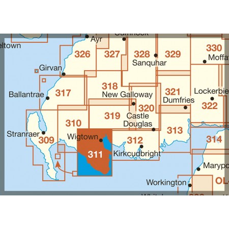
Overzichtskaarten

OSI Explorer & Explorer Active - Zuid Scotisch Borders
OSI Explorer & Explorer Active - Zuid Scotisch Borders

Producten op de overzichtskaart
Klik op een product om naar de detailpagina te gaan.
- Wandelkaart 307 Consett & Derwent reservoir - OSI
- Wandelkaart 308 Durham & Sunderland - England - OSI
- Wandelkaart 309 Stranraer & The Rhins - Dumfries - OSI
- Wandelkaart 310 Glenluce & Kirkcowan - Schotland - OSI
- Wandelkaart 311 Wigtown- Whithorn & The Machars - OSI
- Wandelkaart 312 Kirkcudbright & Castle Douglas - OSI
- Wandelkaart 313 Dumfries & Dalbeattie- Schotland - OSI
- Wandelkaart 314 Solway Firth- Wigton & Silloth - OSI
- Wandelkaart 315 Carlisle- Brampton & Longtown - OSI
- Wandelkaart 316 Newcastle upon Tyne - Northumberland - OSI
- Wandelkaart 137 Ballantrae South Ayrshire- Schotland- OSI
- Wandelkaart 318 Galloway Forest Park North- Ayrshire
- Wandelkaart 319 Galloway Forest Park South - OSI
- Wandelkaart 320 Castle Douglas & Loch Ken - OSI
- Wandelkaart 321 Nithsdale & Dumfries & Thornhill - OSI
- Wandelkaart 322 Annandale- Dumfries & Galoway - OSI
- Wandelkaart 323 Eskdale & Castle O'er Forest- Schotland - OSI
- Wandelkaart 324 Liddesdale & Kershope Forest - OSI
- Wandelkaart 325 Morpeth & Blyth - Northumberland - OSI
- Wandelkaart 326 Ayr & Troon - South Ayrshire - OSI
- Wandelkaart 327 Cumnock & Dalmellington - OSI
- Wandelkaart 328 Sanquhar & New Cumnock - OSI
- Wandelkaart 329 Lowther Hills- Sanquhar & Leadhills - OSI
- Wandelkaart 330 Moffat & St Mary's Loch - Dumfries - OSI
- Wandelkaart 331 Teviotdale South - Schotisch Borders - OSI
- Wandelkaart 332 Alnwick Amble - Northumberland - OSI
- Wandelkaart 333 Kilmarnock & Irvine - East Ayrshire - OSI
- Wandelkaart 334 East Kilbride- Galston & Darvel - Glasgow - OSI
- Wandelkaart 335 Lanark & Tinto Hills - South Lankashire - OSI
- Wandelkaart 336 Biggar & Broughton - South Lanarkshire - OSI
- Wandelkaart 337 Peebles & Interleithen - Schotish Borders - OSI
- Wandelkaart 338 Galashiels- Selkirk & Melrose - OSI
- Wandelkaart 339 Kelso- Coldstream & Lower Tweed Valley - OSI
- Wandelkaart 340 Holy Island & Bamburgh - OSO
- Wandelkaart 341 Greenock- Largs & Millport - OSI
- Wandelkaart 342 Glasgow Schotland - OSI
- Wandelkaart 343 Motherwell & Coatbridge- Glasgow - OSI
- Wandelkaart 344 Pentland Hills RP- Edinburgh - OSI
- Wandelkaart 345 Lammermuir Hills - Edinburgh - OSI
- Wandelkaart 346 Berwick-upon-Tweed - Northumberland - OSI
- Wandelkaart 349 Falkirk- Cumbernauld & Livingston - OSI
- Wandelkaart 350 Edinburgh - East Schotland - OSI
- Wandelkaart 351 Dunbar & North Berwick - Edinburgh - OSI
- Wandelkaart 361 Isle of Arran - OSI
- Wandelkaart 362 Cowal West & Isle of Bute - OSI
- Wandelkaart OL16 Cheviot Hills Northumberland - OSI
- Wandelkaart OL42 Kielder Water & Forest - OSI
- Wandelkaart OL43 Hadrian's Wall - OSI
- Wandelkaart OL37 Cowal East- Dunoon & Iverary - OSI
- Wandelkaart OL38 Loch Lomond South & Dumbarton - OSI
Artikelen uit dezelfde regio

Wandelkaart 78 Nithsdale & Annandale Schotland - OSI • 9780319474013
Wandelkaart Nithsdale & Annandale - Schotland Productbeschrijving: OS Landranger kaart 78 toont Nithsdale en Annandale, de steden Sanquhar, Moffat, Lockerbie, Lochmaben, de Lowther Hills en het bos van Ae. De OS Landranger kaarten reeks heeft betrekking op Groot-Brittannië met 204 gedetailleerde kaarten, perfect voor dagtochten en korte pauzes. Elke kaart bevat alle informatie die u nodig …

Wandelkaart 78 Nithsdale & Annandale- Schotland - OSI • 9780319261767
Wandelkaart Nithsdale & Annandale - Schotland Productbeschrijving: OS Landranger kaart 78 toont Nithsdale en Annandale, de steden Sanquhar, Moffat, Lockerbie, Lochmaben, de Lowther Hills en het bos van Ae (gesproken als 'hooi' zonder de 'h'). Het gebied staat bekend voor zijn goeie berg- en fietspaden, terwijl u een bezoek brengt aan de Sanquhar Tolbooth Museum of Crawick Multiverse gebeel…

Wandelkaart 309 Stranraer & The Rhins Dumfries - OSI • 9780319245613
Wandelkaart Stranraer & The Rhins - Dumfries & Galloway Productbeschrijving: Kaart nummer 309 omvat Stranraer en The Rhins. Hoogtepunten zijn onder andere kasteel Kennedy, Loch Ryan en Luce Bay. Bevat ook delen van de Southern Upland Way (E2 Europese Long Distance pad), Penwhirn Reservoir, Stoneykirk en Port Logan. De OS Explorer kaart voor Stranraer & The Rhins is beschikbaar in zowel de …

Wandelkaart 84 Dumfries & Castle Douglas Schotland - OSI • 9780319261828
Wandelkaart Dumfries & Castle Douglas - Schotland Productbeschrijving: OS Landranger kaart 84 toont Dumfries & Castle Douglas, en omvat ook Parton, Crossmicheal, Shawhead, Tokaj, Kirkcudbright, Ringford en deel van de Galloway Forest Park. De kust rond de Solway Firth is aangewezen en Area of Outstanding Natural Beauty - AONB De OS Landranger kaarten reeks heeft betrekking op Groot-Bri…

Wandelkaart 318 Galloway Forest Park North - OSI • 9780319471906
Wandelkaart Galloway Forest Park North - Schotland Omvat ook: Glen Trool & Loch Doon St John’s Town of Dalry. Productbeschrijving: OS Explorer kaart nummer 318 toont het noordelijk deel van het Gallowway Forest Park, Doon Loch, Loch Trool, de Southern Upland Way en de E2 Europese Long Distance pad. De OS Explorer kaart voor Galloway Forest Park North is beschikbaar in zowel de standaar…