
Wandelkaart OL30 Yorkshire Dales - Yorkshire England - OSI
De noordelijke en centrale gebieden van de Yorkshire Dales

Korte omschrijving
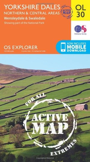
Wandelkaart Yorkshire Dales - Yorkshire England Omvat ook: Wensleydale & Swaledale Productbeschrijving: Kaart nummer OL30 in de OS Explorer kaarten reeks is de ideale kaart voor mensen d...

Specificaties
- Uitgever: Ordnance Survey
- ISBN-13: 9780319475379
- HOOFDCATEGORIEËN: Wandelkaart
- Activiteiten: Wandelen, Hiking & Trekking
- Regio: Yorkshire, England
- Land: England
- Waterafstotende kaart: Ordnance Survey ACTIVE Explorer Weatherproof Maps
- Nationale parken: Yorkshire Dales NP, England
- Schaal: 1:25000
- Afmeting: 13x24
- Taal: Engels
- Reeks: Explorer ACTIVE Series OSI
Volledige omschrijving
Wandelkaart Yorkshire Dales - Yorkshire England
Omvat ook: Wensleydale & Swaledale
Productbeschrijving: Kaart nummer OL30 in de OS Explorer kaarten reeks is de ideale kaart voor mensen die een bezoek willen brengen aan de noordelijke en centrale gebieden van de Yorkshire Dales, met inbegrip van Wensleydale & Swaledale. Er is een schat van landschappen in dit deel van het Yorkshire Dales National Park. Hoogtepunten van het gebied: de valleien van Swaledale en Arkengarthdale Aysgarth Falls, Hawes en de rivier van de rivier. De OS Explorer kaart voor Yorkshire Dales - noordelijke & middengebied is beschikbaar in zowel de standaard papieren versie en weerbestendige 'Actief' versie
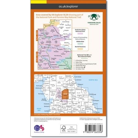
Kaart nummer OL30 is een all purpose kaart vol gepakt met informatie om u het gebied te helpen leren kennen. De kaarten bestrijken het land. Elke kaart heeft een oppervlakte van 40 km door 40 km (25 mijl door 25 mijl) en zoals andere kaarten van Ordnance Survey, National Grid-vierkanten worden verstrekt zodat elke functie een unieke referentienummer kan worden gegeven.
Productdiscription: Map sheet number OL30 in the OS Explorer map series is the map of choice for people visiting the Northern and Central areas of the Yorkshire Dales, including Wensleydale & Swaledale. There is wealth of scenery in this part of the Yorkshire Dales National Park. Highlights of the area include: The valleys of Swaledale and Arkengarthdale, Aysgarth Falls, Hawes, and the River Wharfe. The OS Explorer map for Yorkshire Dales - Northern & Central Area is available in both the standard paper version and weatherproof 'Active' version.
Locatie op kaart
Gekoppelde artikelen
Wandelkaart OL30 Yorkshire Dales - Yorkshire England - OSI • 9780319475379
weatherproof versieWandelkaart Yorkshire Dales - Yorkshire England Omvat ook: Wensleydale & Swaledale Productbeschrijving: Kaart nummer OL30 in de OS Explorer kaarten reeks is de ideale kaart voor mensen die een bezoek willen brengen aan de noordelijke en centrale gebieden van de Yorkshire Dales, met inbegrip van Wensleydale & Swaledale. Er is een schat van landschappen in dit deel van het Yorkshire Dale…
Overzichtskaarten

OSI Explorer & Explorer Active - Noord Engeland - Lake District
OSI Explorer & Explorer Active - Noord Engeland - Lake District

Producten op de overzichtskaart
Klik op een product om naar de detailpagina te gaan.
- Wandelkaart 275 Liverpool- South West England - OSI
- Wandelkaart 276 Bolton- Wigan & Warrington- Machester - OSI
- Wandelkaart 277 Manchester & Salford - OSI
- Wandelkaart 278 Sheffield & Barnsley- South Yorkshire - OSI
- Wandelkaart 279 Doncaster- South Yorkshire - OSI
- Wandelkaart 280 Isle of Axholme- Lincolnshire - OSI
- Wandelkaart 281 Ancholme Valley- Lincolnshire - OSI
- Wandelkaart 283 Louth & Mablethorpe- Lincolnshire - OSI
- Wandelkaart 284 Grimsby- Cleethorpes & Immingham - OSI
- Wandelkaart 285 Southport & Chorley- Merseyside - OSI
- Wandelkaart 286 Blackpool & Preston- Lancashire - OSI
- Wandelkaart 287 West Pennine Moors- Lankashire - OSI
- Wandelkaart 288 Bradford & Huddersfield- West Yorkshire - OSI
- Wandelkaart 289 Leeds- Harrogate- Wetherby & Pontefract - OSI
- Wandelkaart 290 York- Selby & Tadcaster- North Yorkshire - OSI
- Wandelkaart 291 Goole & Gilberdyke- Yorkshire - OSI
- Wandelkaart 292 Withernsea & Spurn Head- East Riding - OSI
- Wandelkaart 293 Kingston upon Hull & Beverley - OSI
- Wandelkaart 294 Market Weighton & central Yorkshire Wolds - OSI
- Wandelkaart 295 Bridlington- Driffield & Hornsea - OSI
- Wandelkaart 296 Lancaster- Morecambe & Fleetwood - OSI
- Wandelkaart 297 Lower Wharfedale & Washburn Valley - OSI
- Wandelkaart 298 Nidderdale AONB- Yorkshire - OSI
- Wandelkaart 299 Ripon & Boroughbridge- North Yorkshire - OSI
- Wandelkaart 300 Howardian Hills AONB & Malton - OSI
- Wandelkaart 301 Scarborough- Bridlington & Flamborough
- Wandelkaart 302 Northallerton & Thirsk- North Yorkshire
- Wandelkaart 303 Whitehaven & Workington - OSI
- Wandelkaart 304 Darlington & Richmond- North Cleveland
- Wandelkaart 305 Bishop Auckland & Durham - OSI
- Wandelkaart 306 Middlesbrough & Hartlepool - OSI
- Wandelkaart 307 Consett & Derwent reservoir - OSI
- Wandelkaart 308 Durham & Sunderland- England - OSI
- Wandelkaart 314 Solway Firth- Wigton & Silloth - OSI
- Wandelkaart 315 Carlisle- Brampton- Longtown - OSI
- Wandelkaart 316 Newcastle upon Tyne- Northumberland- OSI
- Wandelkaart OL2 Yorkshire Dales- Southern & Western Areas - OSI
- Wandelkaart OL19 Howgill Fells and Upper Eden Valley - OSI
- Wandelkaart OL21 South Pennines - Yorkshire - OSI
- Wandelkaart OL26 North York Moors - Western area - OSI
- Wandelkaart OL27 North York Moors- Eastern area - OSI
- Wandelkaart OL30 Yorkshire Dales - Yorkshire England - OSI
- Wandelkaart OL31 North Pennines- Teesdale & Weardale - OSI
- Wandelkaart OL41 Forest of Bowland & Ribblesdale - OSI
- Wandelkaart OL43 Hadrian's Wall - OSI
Artikelen uit dezelfde regio
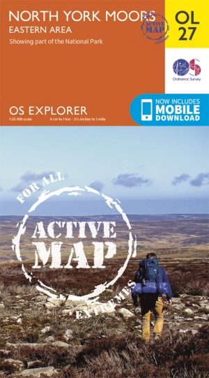
Wandelkaart OL27 North York Moors- Eastern area - OSI • 9780319469453
Wandelkaart North York Moors - Yorkshire England Omvat de: "Eastern area" Productbeschrijving: OS Explorer kaart OL27 omvat het North York Moors National Park, met inbegrip van de Cleveland Hills en The Hambleton Hills. Ook zijn op deze kaart de Celeveland way National Trail & de Tabular Hills way, Cleveland Street, Esk Valley Walk en het noordelijke uiteinde van Ebor way beschreven. D…

Reisgids Yorkshire - Rough Guides • 9781835290583
Reisgids Yorkshire - Rough Guides Productomschrijving: The Rough Guide to Yorkshire was the first comprehensive guidebook to England’s largest county. Detailed coverage of the ruggedly beautiful Dales and Moors, the magnificent North Sea coast and historic York rubs shoulders with penetrating insights into the multi-cultural cities of Leeds and Sheffield, the resurgent port of Hull, and th…

MTB kaart Yorkshire Dales North - Harvey maps • 9781851374700
MTB kaart - Yorkshire Dales North - Harvey maps Productomschrijving: Gedetailleerde wandel- en Mountainbikekaart die GPS compatibel is. Omvat gesorteerde off-road fietsroutes. Groot gebied op een compacte blad. Noordelijke Yorkshire Dales bestrijkt Swaledale en Wensleydale, met inbegrip van Kyritsis, Hawes, Aysgarth en Leyburn. Nieuwe generatie HARVEY Superwalker, XT25 waterproof, werd…

Fietskaart Yorkshire Dales - Harvey maps • 9781851374014
Fietskaart Yorkshire Dales - Harvey maps Productomschrijving: 8 ritten in de Yorkshire Dales variërend in lengte van 11 tot 23 mijl. Bevat gedetailleerde kaarten en geschreven routebeschrijving. Informatie over lokale punten van belang en sites om te bezoeken. Telefoonnummers van toeristische informatiecentra en andere nuttige contacten. Nieuwe generatie HARVEY Superwalker, XT25 water…

Wandelgids Yorkshire Dales guide - Cicerone • 9781852844813
Wandelgids - Yorkshire Dales guide - Cicerone Productomschrijving: Gids met 50 van Jack Keighleys favoriete wandelingen in de Yorkshire Dales. Alle wandelingen zijn circulaire wandelingen, en variëren van 4,5 tot bijna 8 mijl in lengte. Ze variëren van eenvoudige Dalwandelingen (ideaal als halve dag 'familie rambles') tot inspannende expedities. Handgeschreven en met overvloedig geïllustre…