
Wandelkaart 327 Cumnock & Dalmellington - OSI
Omvat de Galloway Forest Park & de rivier de Ayr
Korte omschrijving
Wandelkaart Cumnock & Dalmellington - East Ayrshire Schotland Omvat ook: Mauchline & Patna. 327 / Cumnock & Dalmellington, Aest Ayrshire, Schotland - OS Explorer 327 toont Cumnock en het...

Specificaties
- Uitgever: Ordnance Survey
- ISBN-13: 9780319245798
- HOOFDCATEGORIEËN: Wandelkaart
- Activiteiten: Wandelen, Hiking & Trekking
- Regio: Ayrshire Lanark, West Schotland
- Land: Schotland
- Schaal: 1:25000
- Afmeting: 13x23
- Taal: Engels
- Reeks: Explorer Series OSI
Volledige omschrijving
Wandelkaart Cumnock & Dalmellington - East Ayrshire Schotland
Omvat ook: Mauchline & Patna.
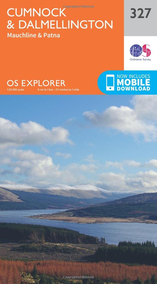
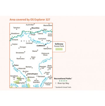
327 / Cumnock & Dalmellington, Aest Ayrshire, Schotland - OS Explorer 327 toont Cumnock en het omliggende gebied. Hoogtepunten zijn delen van de Galloway Forest Park, de rivier de Ayr en de heuvels rond Dalmellington en Loch Doon, die een aantal grote en prachitge wandelkansen bieden. De OS Explorer kaart voor Cumnock & Dalmellington is beschikbaar in zowel de standaard papieren versie als de weerbestendige 'Actief' versie.
327 / Cumnock & Dalmellington, Aest Ayrshire, Schotland - OS Explorer 327 shows Cumnock and the surrounding area. Highlights include parts of the Galloway Forest Park, the River Ayr and the hills surrounding Dalmellington and Loch Doon, which provide some great walking opportunities. The OS Explorer map for Cumnock & Dalmellington is available in both the standard paper version and weatherproof 'Active' version.
Locatie op kaart
Gekoppelde artikelen

Wandelkaart 327 Cumnock & Dalmellington - OSI • 9780319245798
standaard versieWandelkaart Cumnock & Dalmellington - East Ayrshire Schotland Omvat ook: Mauchline & Patna. 327 / Cumnock & Dalmellington, Aest Ayrshire, Schotland - OS Explorer 327 toont Cumnock en het omliggende gebied. Hoogtepunten zijn delen van de Galloway Forest Park, de rivier de Ayr en de heuvels rond Dalmellington en Loch Doon, die een aantal grote en prachitge wandelkansen bieden. De OS Expl…

Wandelkaart 327 Cumnock & Dalmellington - OSI • 9780319471999
weatherproof versieWandelkaart Cumnock & Dalmellington - Ayrshire Schotland Omvat ook: Mauchline & Patna. Productbeschrijving: OS Explorer 327 omvat Cumnock en het omliggende gebied. Hoogtepunten zijn delen van de Galloway Forest Park, de rivier Ayr en de heuvels rond Dalmellington en Loch Doon, die op zich al een mooie wandeling beloofd. De OS Explorer kaart voor Cumnock & Dalmellington is beschikbaar i…
Overzichtskaarten

OSI Explorer & Explorer Active - Zuid Scotisch Borders
OSI Explorer & Explorer Active - Zuid Scotisch Borders

Producten op de overzichtskaart
Klik op een product om naar de detailpagina te gaan.
- Wandelkaart 307 Consett & Derwent reservoir - OSI
- Wandelkaart 308 Durham & Sunderland - England - OSI
- Wandelkaart 309 Stranraer & The Rhins - Dumfries - OSI
- Wandelkaart 310 Glenluce & Kirkcowan - Schotland - OSI
- Wandelkaart 311 Wigtown- Whithorn & The Machars - OSI
- Wandelkaart 312 Kirkcudbright & Castle Douglas - OSI
- Wandelkaart 313 Dumfries & Dalbeattie- Schotland - OSI
- Wandelkaart 314 Solway Firth- Wigton & Silloth - OSI
- Wandelkaart 315 Carlisle- Brampton & Longtown - OSI
- Wandelkaart 316 Newcastle upon Tyne - Northumberland - OSI
- Wandelkaart 137 Ballantrae South Ayrshire- Schotland- OSI
- Wandelkaart 318 Galloway Forest Park North- Ayrshire
- Wandelkaart 319 Galloway Forest Park South - OSI
- Wandelkaart 320 Castle Douglas & Loch Ken - OSI
- Wandelkaart 321 Nithsdale & Dumfries & Thornhill - OSI
- Wandelkaart 322 Annandale- Dumfries & Galoway - OSI
- Wandelkaart 323 Eskdale & Castle O'er Forest- Schotland - OSI
- Wandelkaart 324 Liddesdale & Kershope Forest - OSI
- Wandelkaart 325 Morpeth & Blyth - Northumberland - OSI
- Wandelkaart 326 Ayr & Troon - South Ayrshire - OSI
- Wandelkaart 327 Cumnock & Dalmellington - OSI
- Wandelkaart 328 Sanquhar & New Cumnock - OSI
- Wandelkaart 329 Lowther Hills- Sanquhar & Leadhills - OSI
- Wandelkaart 330 Moffat & St Mary's Loch - Dumfries - OSI
- Wandelkaart 331 Teviotdale South - Schotisch Borders - OSI
- Wandelkaart 332 Alnwick Amble - Northumberland - OSI
- Wandelkaart 333 Kilmarnock & Irvine - East Ayrshire - OSI
- Wandelkaart 334 East Kilbride- Galston & Darvel - Glasgow - OSI
- Wandelkaart 335 Lanark & Tinto Hills - South Lankashire - OSI
- Wandelkaart 336 Biggar & Broughton - South Lanarkshire - OSI
- Wandelkaart 337 Peebles & Interleithen - Schotish Borders - OSI
- Wandelkaart 338 Galashiels- Selkirk & Melrose - OSI
- Wandelkaart 339 Kelso- Coldstream & Lower Tweed Valley - OSI
- Wandelkaart 340 Holy Island & Bamburgh - OSO
- Wandelkaart 341 Greenock- Largs & Millport - OSI
- Wandelkaart 342 Glasgow Schotland - OSI
- Wandelkaart 343 Motherwell & Coatbridge- Glasgow - OSI
- Wandelkaart 344 Pentland Hills RP- Edinburgh - OSI
- Wandelkaart 345 Lammermuir Hills - Edinburgh - OSI
- Wandelkaart 346 Berwick-upon-Tweed - Northumberland - OSI
- Wandelkaart 349 Falkirk- Cumbernauld & Livingston - OSI
- Wandelkaart 350 Edinburgh - East Schotland - OSI
- Wandelkaart 351 Dunbar & North Berwick - Edinburgh - OSI
- Wandelkaart 361 Isle of Arran - OSI
- Wandelkaart 362 Cowal West & Isle of Bute - OSI
- Wandelkaart OL16 Cheviot Hills Northumberland - OSI
- Wandelkaart OL42 Kielder Water & Forest - OSI
- Wandelkaart OL43 Hadrian's Wall - OSI
- Wandelkaart OL37 Cowal East- Dunoon & Iverary - OSI
- Wandelkaart OL38 Loch Lomond South & Dumbarton - OSI

OSI Explorer & Explorer Active - Zuid West Schotland - Loch Lomond
OSI Explorer & Explorer Active - Zuid West Schotland - Loch Lomond

Producten op de overzichtskaart
Klik op een product om naar de detailpagina te gaan.
- Wandelkaart 326 Ayr & Troon- South Ayrshire - OSI
- Wandelkaart 327 Cumnock & Dalmellington - OSI
- Wandelkaart 333 Kilmarnock & Irvine- East Ayrshire - OSI
- Wandelkaart 341 Greenock- Largs & Millport - OSI
- Wandelkaart 342 Glasgow- Schotland - OSI
- Wandelkaart 352 Islay South- Argyl & Bute- Schotland - OSI
- Wandelkaart 353 Islay North- Argule & Bute Schotland - OSI
- Wandelkaart 354 Colonsay & Oronsay- Argyl & Bute - OSI
- Wandelkaart 355 Jura & Scarba- Inner Hibrids - OSI
- Wandelkaart 356 Kintyre South- Highlands-Schotland - OSI
- Wandelkaart 357 Kintyre North- Highlands-Schotland - OSI
- Wandelkaart 358 Lochgilphead & Knapdale North - OSI
- Wandelkaart 359 Oban- Kerrera & Loch Melfort - OSI
- Wandelkaart 360 Loch Awe & Inveraray- Argyl Schotland- OSI
- Wandelkaart 361 Isle of Arran - OSI
- Wandelkaart 362 Cowal West & Isle of Bute - OSI
- Wandelkaart 373 Iona- Staffa & Ross of Mull - OSI
- Wandelkaart 374 Isle of Mull North & Tobermroy - OSI
- Wandelkaart 375 Isle of Mull East- Argyl- Schotland - OSI
- Wandelkaart 377 Loch Etive & Glen Orchy- Schotland- OSI
- Wandelkaart OL37 Cowal East- Dunoon & Iverary - OSI
- Wandelkaart OL38 Loch Lomond South & Dumbarton - OSI
- Wandelkaart OL39 Loch Lomond North & Tyndrum - OSI
- Wandelkaart OL46 Trossachs- Callander & Aberfoyle - OSI
Artikelen uit dezelfde regio

Wandelkaart 333 Kilmarnock & Irvine Schotland - OSI • 9780319472057
Wandelkaart Kilmarnock & Irvine - East Ayrshire Schotland Omvat ook: Stewarton & Beith. Productbeschrijving: OS Explorer kaart 333 toont Kilmarnoch, Irving, de Firth of Clyde en omliggende gebieden. Begeeft u zich buiten het wegennet dan kunt u rustige landweggetjes en occasionele bossen verkennen, of de kust rond Irving Bay volgen. De OS Explorer kaart van Kilmarnock & Irvine is besch…

Wandelkaart 361 Isle of Arran - OSI • 9780319475775
Wandelkaart Isle of Arran - OSI Productbeschrijving: Arran is het grootste eiland in de Firth of Clyde, bergachtig, met de hoogste piek "Goat Fell", permanent op 874m. Arran word geacht alle verschillende typen landschappen in Schotland te vertegenwoordigen, van de ruige kust vlakten en grillige pieken, waardoor het een populaire bestemming is geworden. De OS Explorer kaart voor Isle van A…

Wandelkaart 372 Coll & Tiree- Ayrshire & Lanark - OSI • 9780319246191
Wandelkaart Coll & Tiree - Ayrshire & Lanark West Schotland Productbeschrijving: 372 / Coll & Tiree, Ayrshire & Lanark, West Schotland - Kaart nummer 372 omvat Coll en Tiree. Hoogtepunten zijn Calgary punt, Gunna, Gott Bay, Crossapol Bay en Hynish Bay. Omvat ook Loch Fada en Loch Cilad. De OS Explorer kaart voor Coll & Tiree is beschikbaar in zowel de standaard papieren versie als de w…

Wandelgids Ayrshire & Arran Coastal Paths - Cicerone • 9781852846329
Wandelgids - Ayrshire & Arran Coastal Paths - Cicerone Productomschrijving: Deze handige gids bevat routebeschrijvingen voor 11 dagfasen over een 150 mijl lange kustlijn, vol met prachtige zandstranden en afgelegen baaien. Het terrein varieert van strand tot open veenland en rotsachtige paden, maar is geschikt voor een redelijk fitte wandelaar. De Ayrshire and Arran kustpaden, bieden de mo…

Wandelkaart 333 Kilmarnock & Irvine East Ayrshire - OSI • 9780319245859
Wandelkaart Kilmarnock & Irvine - East Ayrshire Schotland Omvat ook: Stewarton & Beith Productomschrijving: OS Explorer kaart 333 omvat Kilmarnoch, Irving, de Firth of Clyde en de omliggende gebieden. Begeef u van de weg af, en u kunt alle soorten rustige landwegen en occasionele bossen verkennen, of de kust volgen rond Irving Bay. De OS Explorer kaart van Kilmarnock & Irvine is beschi…