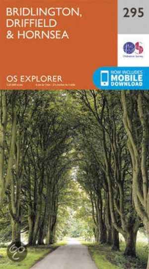
Wandelkaart 295 Bridlington Driffield & Hornsea - OSI
Hornsea langs de kust naar Bridlington
Korte omschrijving
Wandelkaart Bridlington- Driffield & Hornsea - Yorkshire Productbeschrijving: 295 / Bridlington, Driffield & Hornsea, East Riding of Yorkshire, England - Van Hornsea langs de kust naar...

Specificaties
- Uitgever: Ordnance Survey
- ISBN-13: 9780319245477
- HOOFDCATEGORIEËN: Wandelkaart
- Activiteiten: Wandelen, Hiking & Trekking
- Regio: Yorkshire, England
- Land: England
- Schaal: 1:25000
- Afmeting: 13x23
- Taal: Engels
- Reeks: Explorer Series OSI
Volledige omschrijving
Wandelkaart Bridlington- Driffield & Hornsea - Yorkshire
Productbeschrijving:
295 / Bridlington, Driffield & Hornsea, East Riding of Yorkshire, England - Van Hornsea langs de kust naar Bridlington en de binnenvaart tot Driffield. OS Explorer kaart 295 is de perfecte partner voor al uw outdoor avonturen. Het omvat ook delen van vier recreatieve paden: landtong way, Hornsea Rail Trail, Minster way en de Trans Pennineway. De OS Explorer kaart voor Bridlington, Driffield & Hornsea is beschikbaar in zowel de standaard papieren versie als de weerbestendige 'Actief' versie.
295 / Bridlington, Driffield & Hornsea, East Riding of Yorkshire, England - From Hornsea up the coast to Bridlington and inland to Driffield. OS Explorer Map 295 is the perfect partner for all your outdoor adventures. It also includes parts of four Recreational Paths: Headland Way, Hornsea Rail Trail, Minster Way and the Trans Pennine Way. The OS Explorer map for Bridlington, Driffield & Hornsea is available in both the standard paper version and weatherproof 'Active' version.
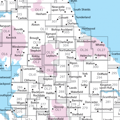
Locatie op kaart
Gekoppelde artikelen

Wandelkaart 295 Bridlington Driffield & Hornsea - OSI • 9780319245477
standaard versieWandelkaart Bridlington- Driffield & Hornsea - Yorkshire Productbeschrijving: 295 / Bridlington, Driffield & Hornsea, East Riding of Yorkshire, England - Van Hornsea langs de kust naar Bridlington en de binnenvaart tot Driffield. OS Explorer kaart 295 is de perfecte partner voor al uw outdoor avonturen. Het omvat ook delen van vier recreatieve paden: landtong way, Hornsea Rail Trail,…

Wandelkaart 295 Bridlington- Driffield & Hornsea - OSI • 9780319471678
weatherproof versieWandelkaart Bridlington- Driffield & Hornsea - Yorkshire Productbeschrijving: Van Hornsea omhoog langs de kust naar Bridlington en inwaarts naar Driffield. OS Explorer kaart 295 is de perfecte partner voor al uw outdoor avonturen. Het omvat ook delen van vier recreatieve paden: landtong way, Hornsea Rail Trail, Minster wayen de Trans Pennine way. De OS Explorer kaart voor Bridlington, Drif…
Overzichtskaarten

OSI Explorer & Explorer Active - Noord Engeland - Lake District
OSI Explorer & Explorer Active - Noord Engeland - Lake District

Producten op de overzichtskaart
Klik op een product om naar de detailpagina te gaan.
- Wandelkaart 275 Liverpool- South West England - OSI
- Wandelkaart 276 Bolton- Wigan & Warrington- Machester - OSI
- Wandelkaart 277 Manchester & Salford - OSI
- Wandelkaart 278 Sheffield & Barnsley- South Yorkshire - OSI
- Wandelkaart 279 Doncaster- South Yorkshire - OSI
- Wandelkaart 280 Isle of Axholme- Lincolnshire - OSI
- Wandelkaart 281 Ancholme Valley- Lincolnshire - OSI
- Wandelkaart 283 Louth & Mablethorpe- Lincolnshire - OSI
- Wandelkaart 284 Grimsby- Cleethorpes & Immingham - OSI
- Wandelkaart 285 Southport & Chorley- Merseyside - OSI
- Wandelkaart 286 Blackpool & Preston- Lancashire - OSI
- Wandelkaart 287 West Pennine Moors- Lankashire - OSI
- Wandelkaart 288 Bradford & Huddersfield- West Yorkshire - OSI
- Wandelkaart 289 Leeds- Harrogate- Wetherby & Pontefract - OSI
- Wandelkaart 290 York- Selby & Tadcaster- North Yorkshire - OSI
- Wandelkaart 291 Goole & Gilberdyke- Yorkshire - OSI
- Wandelkaart 292 Withernsea & Spurn Head- East Riding - OSI
- Wandelkaart 293 Kingston upon Hull & Beverley - OSI
- Wandelkaart 294 Market Weighton & central Yorkshire Wolds - OSI
- Wandelkaart 295 Bridlington- Driffield & Hornsea - OSI
- Wandelkaart 296 Lancaster- Morecambe & Fleetwood - OSI
- Wandelkaart 297 Lower Wharfedale & Washburn Valley - OSI
- Wandelkaart 298 Nidderdale AONB- Yorkshire - OSI
- Wandelkaart 299 Ripon & Boroughbridge- North Yorkshire - OSI
- Wandelkaart 300 Howardian Hills AONB & Malton - OSI
- Wandelkaart 301 Scarborough- Bridlington & Flamborough
- Wandelkaart 302 Northallerton & Thirsk- North Yorkshire
- Wandelkaart 303 Whitehaven & Workington - OSI
- Wandelkaart 304 Darlington & Richmond- North Cleveland
- Wandelkaart 305 Bishop Auckland & Durham - OSI
- Wandelkaart 306 Middlesbrough & Hartlepool - OSI
- Wandelkaart 307 Consett & Derwent reservoir - OSI
- Wandelkaart 308 Durham & Sunderland- England - OSI
- Wandelkaart 314 Solway Firth- Wigton & Silloth - OSI
- Wandelkaart 315 Carlisle- Brampton- Longtown - OSI
- Wandelkaart 316 Newcastle upon Tyne- Northumberland- OSI
- Wandelkaart OL2 Yorkshire Dales- Southern & Western Areas - OSI
- Wandelkaart OL19 Howgill Fells and Upper Eden Valley - OSI
- Wandelkaart OL21 South Pennines - Yorkshire - OSI
- Wandelkaart OL26 North York Moors - Western area - OSI
- Wandelkaart OL27 North York Moors- Eastern area - OSI
- Wandelkaart OL30 Yorkshire Dales - Yorkshire England - OSI
- Wandelkaart OL31 North Pennines- Teesdale & Weardale - OSI
- Wandelkaart OL41 Forest of Bowland & Ribblesdale - OSI
- Wandelkaart OL43 Hadrian's Wall - OSI
Artikelen uit dezelfde regio

Fietskaart Yorkshire Dales - Harvey maps • 9781851374014
Fietskaart Yorkshire Dales - Harvey maps Productomschrijving: 8 ritten in de Yorkshire Dales variërend in lengte van 11 tot 23 mijl. Bevat gedetailleerde kaarten en geschreven routebeschrijving. Informatie over lokale punten van belang en sites om te bezoeken. Telefoonnummers van toeristische informatiecentra en andere nuttige contacten. Nieuwe generatie HARVEY Superwalker, XT25 water…

Reisgids Yorkshire - Rough Guides • 9781835290583
Reisgids Yorkshire - Rough Guides Productomschrijving: The Rough Guide to Yorkshire was the first comprehensive guidebook to England’s largest county. Detailed coverage of the ruggedly beautiful Dales and Moors, the magnificent North Sea coast and historic York rubs shoulders with penetrating insights into the multi-cultural cities of Leeds and Sheffield, the resurgent port of Hull, and th…

Wandelkaart OL2 Yorkshire Dales- Southern & Western Areas - OSI • 9780319475331
Wandelkaart Yorkshire Dales- Southern & Western Areas - OSI Productomschrijving: Kaart nummer OL2 in de OS Explorer kaartenserie is de ideale kaart om te gebruiken bij het verkennen van de zuidelijke en westelijke gebieden van de Yorkshire Dales, waaronder Whernside, Ingleborough en Pen-y-ghent. Hoogtepunten: De drie pieken van Yorkshire, The Devils Bridge bij Kirkby Lonsdale, Leeds to Liv…

Wandelgids Lake District - Yorkshire Dales - Rother • 9783763344482
Wandelgids Lake District - Yorkshire Dales - Rother Productomschrijving: Het "Lake District" is een nationaal park in het graafschap Cumbria in het noordwesten van Engeland. Het is een van de dertien nationale parken in het Verenigd Koninkrijk. Het is een bergachtige streek. Alle toppen in Engeland hoger dan 900 meter boven zeeniveau liggen in dit gebied. Het hoogste punt in Engeland is de…

Wandelgids The Dales Way - Rucksack Readers • 9781898481423
Wandelgids - The Dales Way te Noord Engeland Productomschrijving: Deze charmante wandeling loopt voor 79 mijl van Ilkley in de Yorkshire Dales naar Bowness in het Lake District. De LDWA heeft gedocumenteerde routes voor wandelaars beginnend in Leeds, Harrogate en Bradford. Langs de weg ziet u de indrukwekkende spoorwegviaducten en fijne stenen bruggen, de Bolton Priorij en vele kleine kerk…


