
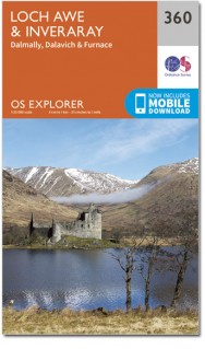
Wandelkaart 360 Loch Awe & Inveraray Argyl Schotland- OSI
Loch Awe en Loch Fyne é Inveraray- Furnace & Dalavich
Korte omschrijving
Wandelkaart Loch Awe & Inveraray - Argyl Schotland Productbeschrijving: Kaart nummer 360 in de OS Explorer kaarten reeks is ideaal voor het ontdekken van de streek rond Loch Awe en Loch Fyne...

Specificaties
- Uitgever: Ordnance Survey
- ISBN-13: 9780319246115
- HOOFDCATEGORIEËN: Wandelkaart
- Activiteiten: Wandelen, Hiking & Trekking
- Regio: Argyll & Bute, Schotland
- Land: Schotland
- Schaal: 1:25000
- Afmeting: 13x23
- Taal: Engels
- Reeks: Explorer Series OSI
Volledige omschrijving
Wandelkaart Loch Awe & Inveraray - Argyl Schotland
Productbeschrijving: Kaart nummer 360 in de OS Explorer kaarten reeks is ideaal voor het ontdekken van de streek rond Loch Awe en Loch Fyne. Dit deel van Argyll and Bute heeft veel prachtige landschappen te verkennen in detail, samen met vele kleinere Lochs en bergtoppen. Andere hoogtepunten van het gebied zijn: Inveraray, Furnace, Dalavich en Dalmally. De OS Explorer kaart voor Loch Awe & Inveraray is beschikbaar in zowel de standaard papieren versie als de weerbestendige 'Actief' versie.
Productdiscription: Map sheet number 360 in the OS Explorer map series is ideal for discovering the area around Loch Awe and Loch Fyne. This part of Argyll and Bute has lots of beautiful landscapes to explore in detail, along with many smaller Lochs and mountain peaks. Other highlights of the area include: Inveraray, Furnace, Dalavich and Dalmally. The OS Explorer map for Loch Awe & Inveraray is available in both the standard paper version and weatherproof 'Active' version.
Locatie op kaart
Gekoppelde artikelen

Wandelkaart 360 Loch Awe & Inveraray Argyl Schotland- OSI • 9780319246115
standaard versieWandelkaart Loch Awe & Inveraray - Argyl Schotland Productbeschrijving: Kaart nummer 360 in de OS Explorer kaarten reeks is ideaal voor het ontdekken van de streek rond Loch Awe en Loch Fyne. Dit deel van Argyll and Bute heeft veel prachtige landschappen te verkennen in detail, samen met vele kleinere Lochs en bergtoppen. Andere hoogtepunten van het gebied zijn: Inveraray, Furnace, Dalavic…

Wandelkaart 360 Loch Awe & Inveraray- Schotland OSI • 9780319472316
weatherproof versieWandelkaart Loch Awe & Inveraray - Argyl & Bute Schotland Omvat ook: Dalmally, Dalavich & Furnace. Productbeschrijving: Kaart nummer 360 in de OS Explorer kaarten reeks is ideaal voor het ontdekken van de streek rond Loch Awe en Loch Fyne. Dit deel van Argyll and Bute heeft veel prachtige landschappen om in detail te verkennen, samen met vele kleinere Lochs en bergtoppen. Andere hoogte…
Overzichtskaarten

OSI Explorer & Explorer Active - Zuid West Schotland - Loch Lomond
OSI Explorer & Explorer Active - Zuid West Schotland - Loch Lomond

Producten op de overzichtskaart
Klik op een product om naar de detailpagina te gaan.
- Wandelkaart 326 Ayr & Troon- South Ayrshire - OSI
- Wandelkaart 327 Cumnock & Dalmellington - OSI
- Wandelkaart 333 Kilmarnock & Irvine- East Ayrshire - OSI
- Wandelkaart 341 Greenock- Largs & Millport - OSI
- Wandelkaart 342 Glasgow- Schotland - OSI
- Wandelkaart 352 Islay South- Argyl & Bute- Schotland - OSI
- Wandelkaart 353 Islay North- Argule & Bute Schotland - OSI
- Wandelkaart 354 Colonsay & Oronsay- Argyl & Bute - OSI
- Wandelkaart 355 Jura & Scarba- Inner Hibrids - OSI
- Wandelkaart 356 Kintyre South- Highlands-Schotland - OSI
- Wandelkaart 357 Kintyre North- Highlands-Schotland - OSI
- Wandelkaart 358 Lochgilphead & Knapdale North - OSI
- Wandelkaart 359 Oban- Kerrera & Loch Melfort - OSI
- Wandelkaart 360 Loch Awe & Inveraray- Argyl Schotland- OSI
- Wandelkaart 361 Isle of Arran - OSI
- Wandelkaart 362 Cowal West & Isle of Bute - OSI
- Wandelkaart 373 Iona- Staffa & Ross of Mull - OSI
- Wandelkaart 374 Isle of Mull North & Tobermroy - OSI
- Wandelkaart 375 Isle of Mull East- Argyl- Schotland - OSI
- Wandelkaart 377 Loch Etive & Glen Orchy- Schotland- OSI
- Wandelkaart OL37 Cowal East- Dunoon & Iverary - OSI
- Wandelkaart OL38 Loch Lomond South & Dumbarton - OSI
- Wandelkaart OL39 Loch Lomond North & Tyndrum - OSI
- Wandelkaart OL46 Trossachs- Callander & Aberfoyle - OSI
Artikelen uit dezelfde regio

Wandelkaart 14 Tarbert & Loch Seaforth Schotland - OSI • 9780319261125
Wandelkaart Tarbert & Loch Seaforth - Schotland Productbeschrijving: De OS Landranger kaart 14 van Tarbert & Loch Seaforth bevat ook Maraig, Scalpay, Loch Langabhat, Grabhair, Caolas Stocinis, alsmede Tioga Moraym De OS Landranger kaarten reeks heeft betrekking op Groot-Brittannië met 204 gedetailleerde kaarten, perfect voor dagtochten en korte pauzes. Elke kaart bevat alle informatie …

Wandelkaart 47 Tobermory & North Mull- Argyl & Bute - OSI • 9780319473702
Wandelkaart Tobermory & North Mull - Argyl & Bute Schotland Productbeschrijving: OS Landranger kaart 47 heeft betrekking op het eiland Mull, onderdeel van Coll, en omvat Tobermory en Ardnamurchan. De OS Landranger kaarten reeks heeft betrekking op Groot-Brittannië met 204 gedetailleerde kaarten, perfect voor dagtochten en korte pauzes. Elke kaart bevat alle informatie die u nodig heeft om …

Wandelkaart 68 South Kintyre & Campbeltown - OSI • 9780319261668
Wandelkaart South Kintyre & Campbeltown - Schotland Productbeschrijving: OS Landranger kaart 68 toont de zuidelijke Kintyre, met inbegrip van Campbeltown, Southend, Carradale, Sanda Island en het Sound of Kilbrannan. Het schiereiland Kintyre is rondom toegangkelijk voor voetgangers, of met de fiets via de B842 en Kilkerran way, kunt u veel van het gebied zien met minimale verkeer. De O…

Wandelkaart XT25 Arrochar Alps - Harvey maps • 9781851376063
Wandelkaart - XT25 Arrochar Alps - Harvey maps Productomschrijving: De Arrochar Alps zijn een bergketen gelokalliseerd rond de "Loch Long", "Loch Fine" & "Loch Goil" in de Argyl & Bute regio in de schotse Highlands, in het Trossachs nationale park. Gelegen dicht bij de dorpen van Arrochar en Lochgoilhead, op de Cowal Peninsula in de Argyll and Bute regio in Schotland. Deze bergketen is een…

Wandelkaart 63 Firth of Clyde Argyl & Bute Schotland - OSI • 9780319261613
Wandelkaart Firth of Clyde - Schotland Productbeschrijving: De diepe wateren rond de Firth of Clyde maakten hen ideaal voor zware schepen-gebouw in het verleden. Nu veel van de zware industrie is verdwenen, heeft het gebied nu een weer oplevende wildlife, met inbegrip van zeehonden, bruinvissen, dolfijn. Kaart OS Landranger 63 omvat ook Dunoon, Greenock, Port Glasgow, Rothesay, Millport, B…