
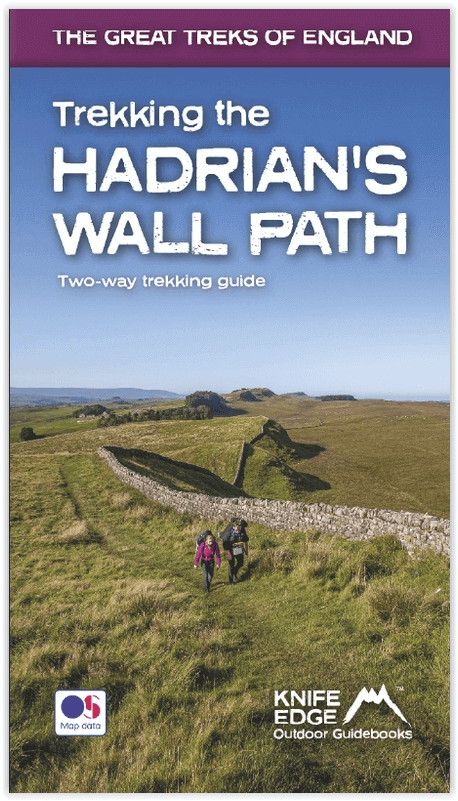
Wandelgids Hadrian's wall Path - Knife Edge
De definitieve tweerichtingsgids voor het Hadrian's Wall Path
Korte omschrijving
Wandelgids - Hadrian's wall Path - Knife Edge Productomschrijving: De definitieve tweerichtingsgids voor het Hadrian's Wall Path: zowel oostwaartse als westelijke routes worden volledig besc...

Specificaties
- Uitgever: Knife Edge Outdoor Limited
- ISBN-13: 9781912933075
- HOOFDCATEGORIEËN: Wandelgids
- Activiteiten: Wandelen, Hiking & Trekking
- Regio: Cumbria, England, Northumberland, Engeland
- Land: England
- Historische wandelroutes: Hadrian's Wall path (135 km)
- Blz.: 160
- Afmeting: 12x21
- Editie: 1
- Taal: Engels
Volledige omschrijving
Wandelgids - Hadrian's wall Path - Knife Edge
Productomschrijving: De definitieve tweerichtingsgids voor het Hadrian's Wall Path: zowel oostwaartse als westelijke routes worden volledig beschreven. 14 verschillende routes: schema's van 3, 4, 5, 6, 7, 8 en 9 dagen voor wandelaars en hardlopers. Omvat reisroutes naar het noorden en het zuiden. De moeilijkere berekeningen van tijd, afstand en hoogtewinst, worden voor u gedaan in de dit boek.
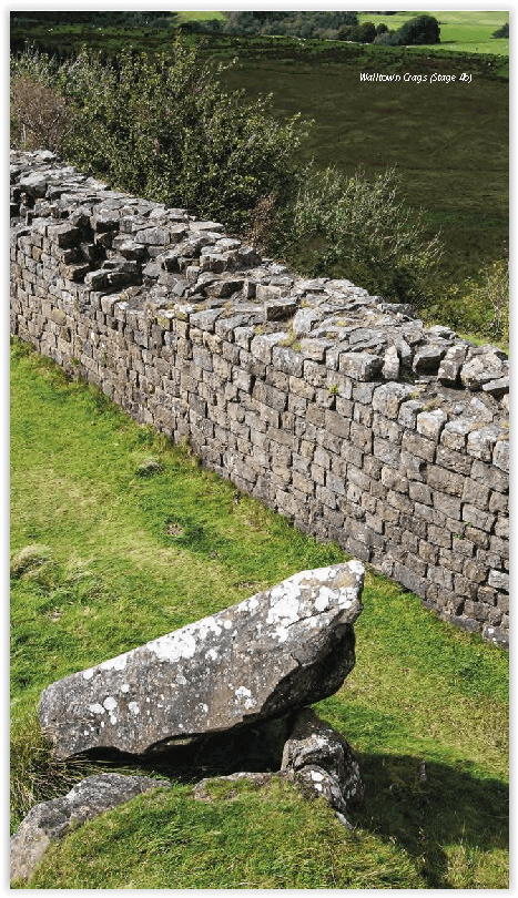
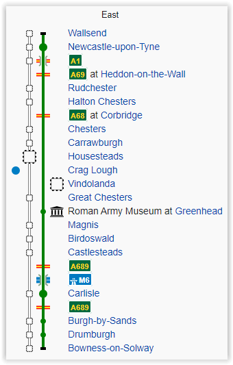
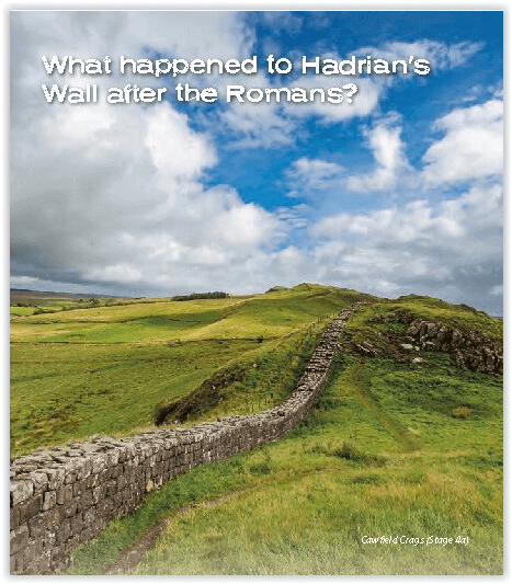
De muur van Hadrianus was een van de meest ambitieuze bouwwerken van de Romeinen. Na voltooiing liep het 73 mijl tussen de west- en oostkust van Noord-Engeland. Het doorkruiste de rotsen en heuvels van enkele van de wildste en mooiste terreinen van Groot-Brittannië. Het Hadrian's Wall-pad is een van de officiële ‘National Trails’ van Engeland. Het leidt je op een onvergetelijke ontdekkingsreis langs de route van de Muur. Ontdek de ongelooflijke overgebleven delen van de muur en zijn forten, milecastles en torentjes.
Engelse omschrijving: The definitive two-way guide to the Hadrian’s Wall Path: both eastbound and westbound routes are described in full. 14 different itineraries: schedules of 3, 4, 5, 6, 7, 8 and 9 days for walkers and runners. Includes both northbound and southbound itineraries. Difficult calculations of time, distance and altitude gain are done for you.
Hadrian’s Wall was one of the Romans’ most ambitious structures. When completed, it ran for 73 miles between the west and east coasts of Northern England. It crossed the crags and hills of some of Britain’s wildest and most beautiful terrain. The Hadrian’s Wall path is one of England’s official ‘National Trails’. It leads you on an unforgettable journey of discovery along the route of the Wall. Discover the incredible surviving sections of the Wall and its forts, milecastles and turrets.
Also includes:
Extraordinary detail on the history and construction of Hadrian’s Wall
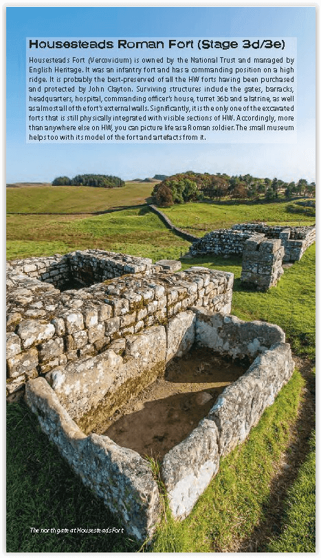
Section on the unmissable forts of Hadrian’s Wall
Detailed information on equipment and travelling light
Everything the trekker needs to know: route, costs, difficulty, weather, travel, and more
Full accommodation listings: the best inns, B&Bs and hotels
Information for both self-guided and guided trekkers
Numbered waypoints linking the Real Maps to our clear descriptions
Locatie op kaart
Overzichtskaarten

Hystorische wandel- en fietsroutes
Hystorische wandel- en fietsroutes

Producten op de overzichtskaart
Klik op een product om naar de detailpagina te gaan.
- Wandelkaart - South Downs Way - Harvey maps
- Wandelgids - North Yorkshire historic walks - Cicerone
- Wandelkaart OL13 - Brecon Beacons NP - Eastern area - OSI
- Wandelgids - Pilgrim Pathways walking guide - Trailblazer
- Wandelgids - The Great Glen Way - Trailblazer
- Wandelgids - Hadrian's wall Path - Knife Edge
- Wandelgids - Hadrian's Wall Path - Trailblazer
- Wandelkaart XT40 - Offa's Dyke Path - Harvey Maps
- Wandelkaart OL43 - Hadrian's Wall - OSI
- Wandelgids - Cleveland Way - Trailblazer
- Wandelkaart 351 - Dunbar & North Berwick- Schotland - OSI
- Wandelgids - Walking in the Forest of Dean - Cicerone
- Wandelkaart 130 - Salisburry & Stonehenge- Wiltshire - OSI
- Wandelkaart 256 - Wrexham- Wrecsam & Llangollen - OSI
- Wandelkaart 130 - Salisbury & Stonehenge- Wiltshire - OSI
- Wandelgids - John Muir Trail - Cicerone
- Wandelkaart - Rob Roy Way National trail - Harvey maps
- Wandelkaart - Hadrian's Wall Path - Harvey maps
- Wandelkaart - Offa's Dyke Path- Route Map Booklet - Cicerone
Artikelen uit dezelfde regio

Wandelgids Lake District North - Cicerone Press • 9781786310460
Walks & scrambles Lake District North - Cicerone Productomschrijving: omvat 100 klauterroutes in het noorden van het Engelse Lake District, die Wasdale, Ennerdale, Buttermere, Borrowdale, Blencathra en Thirlmere omvatten. De gids presenteert een uitgebreide verzameling scrambles op rotsen en kieuwen, die aan elkaar zijn gekoppeld om 25 eersteklas bergdagen te vormen. De zorgvuldig gesortee…

Scramblegids Lake District North 110 scrambles - Cicerone • 9781852848323
Scramblegids / Lake District North - 110 scrambles (9781852848323) Cicerone Press Productomschrijving: Gids naar 110 scramble (klauter/wandel) routes in het Engelse Lake District. Graded scrambles routes op de rotsen in ghylls Road, Ennerdale, Newlands, Buttermere, Borrowdale, Thirlmere, Patterdale, Mardale & Swindale. Routes variëren van rang 1 door rangen 2 tot en met 4, waar het gebruik…

Wandelgids Great Mountain Days in the Pennines - Cicerone • 9781852846503
Wandelgids - Great Mountain Days in the Pennines - Cicerone Productomschrijving: Een inspirerende gids naar 50 klassieke wandelingen op het glooiende landschap van de Walliser. De gesorteerde routes, tussen 6 en 13 mijl in lengte, dekken de klassieke Walliser fells en veenland zoals Whernside, Ilkley Moor en Pendle Hill; verkennen van Noord- en Zuid-Pennines, Yorkshire Dales, Howgills en D…

Wandelkaart 91 Appleby-in-Westmorland - OSI • 9780319263389
Wandelkaart Appleby-in-Westmorland - Cumbria England Productomschrijving: De Pennine Way E2 Europese Long Distance pad samen met het nabijgelegen Yorkshire Dales National Park op OS Landranger kaart 91 is er voor wandelaars van lange trekkingsroutes om te genieten van het prachtige omringende landschap. Appleby-in-Westmorland zelf ligt in het hart van Cumbria en is een van Engelands meest …

Wandelkaart Hadrian's Wall Path - Harvey maps • 9781851374380
Wandelkaart Hadrian's Wall Path - Harvey maps Productomschrijving: Kaart van de gehele Hadrians Way op één kaart. 130km (81 mijl) van de Solway Coast naar Newcastle. Met de gelegenheid voor een bezoek aan een groot aantal historische plekken langs de weg. Informatie over het vinden van accommodatie, camping, voedsel. Met routebeschrijving naar de start van de route. Nieuwe generatie H…