
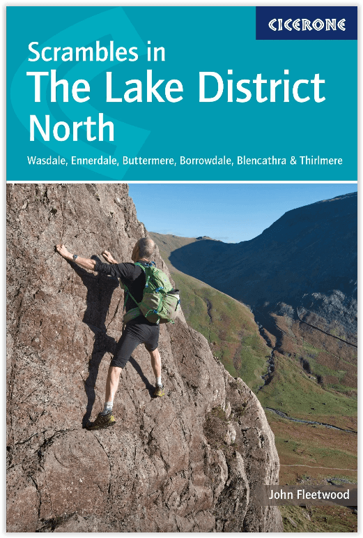
Wandelgids Lake District North - Cicerone Press
100 scrambling routes in the north of the English Lake District
Korte omschrijving
Walks & scrambles Lake District North - Cicerone Productomschrijving: omvat 100 klauterroutes in het noorden van het Engelse Lake District, die Wasdale, Ennerdale, Buttermere, Borrowdale, Bl...

Specificaties
- Uitgever: CICERONE Press
- ISBN-13: 9781786310460
- HOOFDCATEGORIEËN: Klimgidsen, Wandelgids
- Activiteiten: Wandelen, Hiking & Trekking
- Auteur: John Fleetwood
- Regio: Cumbria, England
- Land: England
- Blz.: 280, 304
- Afmeting: 12x17
- Editie: 1
- Taal: Engels
Volledige omschrijving
Walks & scrambles Lake District North - Cicerone
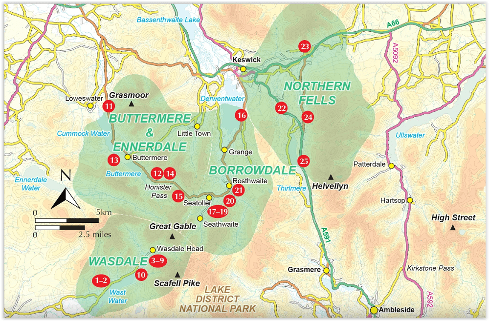
Productomschrijving: omvat 100 klauterroutes in het noorden van het Engelse Lake District, die Wasdale, Ennerdale, Buttermere, Borrowdale, Blencathra en Thirlmere omvatten. De gids presenteert een uitgebreide verzameling scrambles op rotsen en kieuwen, die aan elkaar zijn gekoppeld om 25 eersteklas bergdagen te vormen. De zorgvuldig gesorteerde routes variëren van klauterklasse 1 tot klimklasse V Diff, dus er is iets voor zowel beginners als ervaren bergbeklimmers. Voor moeilijkere routes is rotsklimmateriaal nodig.
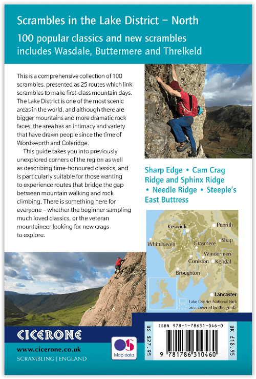
Engelse omschrijving: Guide to 100 scrambling routes in the north of the English Lake District, covering Wasdale, Ennerdale, Buttermere, Borrowdale, Blencathra and Thirlmere. It presents a comprehensive collection of scrambles on crags and gills, which are linked together to form 25 first-class mountain days. The carefully graded routes range from scrambling grade 1 to climbing grade V Diff, so there is something for beginners as well as veteran mountaineers. Rock climbing equipment is needed for more difficult routes.
Each scramble is described with notes about grade, quality, aspect and approach, with colour maps and topos to aid navigation. There is information on safety and equipment, and listings of scrambles by location and grade to allow the reader to assemble their own tailor-made combination of routes.
The Lake District is one of the most scenic areas in the world and this guide includes popular routes such as Sharp Edge, Cam Crag Ridge and Sphinx Ridge, dramatic gills like Sandbed and Ill Gills, and 28 classic rock climbs including Corvus, Needle Ridge, Grey Knotts Face and Steeple's East Buttress.
Artikelen uit dezelfde regio

Wandelkaart 303 Whitehaven & Workington - OSI • 9780319245552
Wandelkaart Whitehaven & Workington - Cumbria England Omvat ook: Cockermouth & Egremont. Productbeschrijving: OS Explorer kaart 303 toont Workington en Cockermouth tot aan Calderbridge, de westelijke rand van het Lake District National Park. Hoogtepunten zijn Ennerdale Water, Whitehaven Harbour en Lank Rigg, op 541 m. De OS Explorer kaart voor Whitehaven & Workington is beschikbaar in …

Wandelgids Borrowdale walking guide - Cicerone • 9781786310385
Wandelgids - Borrowdale walking guide - Cicerone Productomschrijving: Als deel van de Lakeland Fellranger wandelserie, bevat deze gids 28 cols in de centrale Fells van het nationale park van het Lake District in Cumbria Engalnd. De routes in deze gids bevatten rijke fauna, de natuur is er overweldigend en de meegaande ervaringen zullen u bijblijven voor de rest van het leven. Routes in de …

Wandelgids Forest of Bowland & Pendle - Cicerone • 9781852845155
Wandelgids - Forest of Bowland & Pendle - Cicerone Productomschrijving: Deze handige gids bevat 40 verschillende circulaire dagwandelingen geschikt voor wandelaars met navigatie/ GPS vaardigheden. Er is een variëteit aan terrein in de Forest of Bowland en Pendle waardoor het perfect is voor diegenen die een AONB willen verkennen. Sommige van de routes bedekken inclusief: Wards Stone, Pend…

Fietskaart Coast to Coast East England - Harvey maps • 9781851375325
Fietskaart Coast to Coast East England - Harvey maps Productomschrijving: De route van kust tot kust, is bedekt met twee kaarten. De doortocht van kust naar kust is ongeveer 200 mijl. Er is geen één definitieve route. Deze kaarten suggereren twee belangrijkste alternatieven, St Bees naar Robin Hoods Bay (bedacht door Tim Woodcock of Bicester aan Wykeham bedacht door pedaal Noord. De XT60 n…

Scramblegids Lake District South and East - Cicerone • 9781786310453
Scramblegids - Lake District South and East - Cicerone Productomschrijving: Gids met 126 klauterroutes in het Engelse Lake District. De gegradeerde scrambles beklimmen de rotsen en ghylls van Langdale, Easedale, Coniston, Duddon Valley, Howgills, Eskdale, Longsleddale en Kentmere. Routes variëren van graad 1 tot en met graad 2 tot 4, waarbij het gebruik van een touw wordt aanbevolen. Bevat…