
Wandelgids Walking in the Forest of Dean - Cicerone
25 wandelingen in de Forest of Dean- met Offa's Dyke Path
Korte omschrijving
Wandelgids - Walking in the Forest of Dean - Cicerone Productomschrijving: Een gids over 25 wandelingen in de Forest of Dean, met alle informatie die nodig is om te genieten van een scala aa...

Specificaties
- Uitgever: CICERONE Press
- ISBN-13: 9781852846893
- HOOFDCATEGORIEËN: Wandelgids
- Activiteiten: Wandelen, Hiking & Trekking
- Auteur: Mike Dunn
- Regio: Gloucestershire, Egland, West England
- Land: England, Wales
- Historische wandelroutes: Offa's Dyke Path (283 km)
- Lange afstand wandelroutes: Offa's Dyke Path (285 km)
- Regionale parken: Forest of Dean
- Blz.: 160
- Afmeting: 12x17
- Editie: 1
- Taal: Engels
Volledige omschrijving
Wandelgids - Walking in the Forest of Dean - Cicerone
Productomschrijving: Een gids over 25 wandelingen in de Forest of Dean, met alle informatie die nodig is om te genieten van een scala aan wandelingen in de dallen en de open ruimtes van dit oude gebied. Van korte 4-mijl lange wandelingen tot volle dagsecties van interlokale paden zoals de Offa's Dyke Path en Gloucestershire Way, is deze gids een ideaal hulpmiddel voor het verkennen van het bos en zijn geschiedenis.
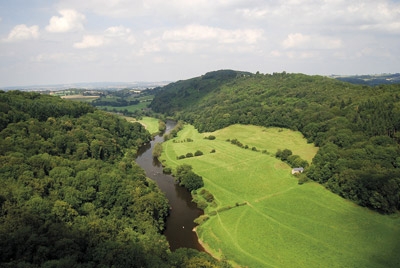
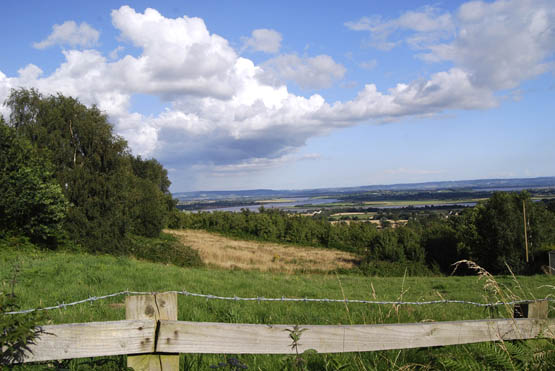
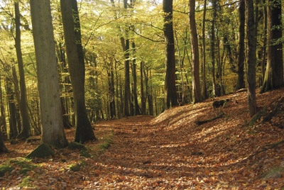
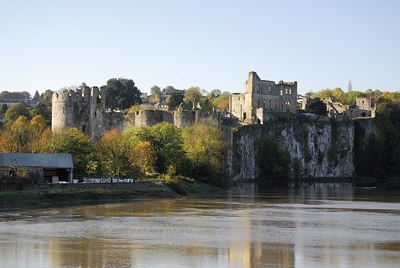
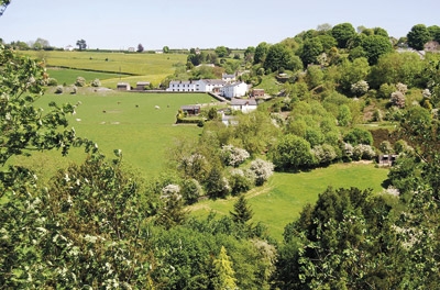
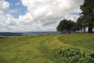
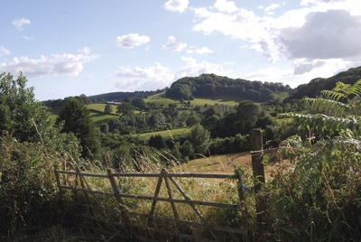
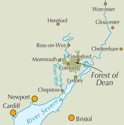
Detail: Ingesloten door twee belangrijke rivieren, de Severn en de Wye, is de Forest of Dean echt een spectaculair land, met een kenmerkend landschap en een uniek culturele identiteit. Citadel ruggen en de bosrijke hellingen geven de centrale Forest een geheimzinnige kwaliteit, terwijl de bergkammen boven de Wye-kloof en de Severn Vale sensationeel uitzicht bezorgen en gemakkelijke wandelingen bieden.
Product description: Guidebook to 25 walks in the Forest of Dean, between the Severn and Wye, from 4-mile routes to all-day sections of long-distance trails such as the Offa's Dyke Path and Gloucestershire Way, this guide is ideal for exploring the forest and its history and includes the information needed for walkers of all abilities to explore this ancient area.
Seasons:
Seasonswalks can be enjoyed in every season, with the central forest providing shelter on windy days.
Centres:
Accessible from Gloucester, Lydney and Chepstow, while the key centres within the Forest of Dean itself are Coleford and Cinderford.
Difficulty:
None of the routes should present any technical difficulties, although all of them require basic route-finding skills and the walks following part of long-distance trails are challenging full-day expeditions; many follow clear forest tracks and paths across farmland.
Must See:
Iconic hills (such as May Hill), forested slopes, coal and iron-making sites with furnaces and ponds, sensational views, picturesque landscapes and a rich cultural and social history.
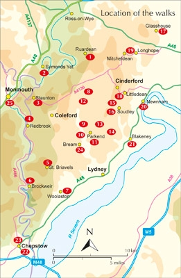
Locatie op kaart
Overzichtskaarten

Hystorische wandel- en fietsroutes
Hystorische wandel- en fietsroutes

Producten op de overzichtskaart
Klik op een product om naar de detailpagina te gaan.
- Wandelkaart - South Downs Way - Harvey maps
- Wandelgids - North Yorkshire historic walks - Cicerone
- Wandelkaart OL13 - Brecon Beacons NP - Eastern area - OSI
- Wandelgids - Pilgrim Pathways walking guide - Trailblazer
- Wandelgids - The Great Glen Way - Trailblazer
- Wandelgids - Hadrian's wall Path - Knife Edge
- Wandelgids - Hadrian's Wall Path - Trailblazer
- Wandelkaart XT40 - Offa's Dyke Path - Harvey Maps
- Wandelkaart OL43 - Hadrian's Wall - OSI
- Wandelkaart 351 - Dunbar & North Berwick- Schotland - OSI
- Wandelgids - Walking in the Forest of Dean - Cicerone
- Wandelkaart 130 - Salisburry & Stonehenge- Wiltshire - OSI
- Wandelkaart 256 - Wrexham- Wrecsam & Llangollen - OSI
- Wandelkaart 130 - Salisbury & Stonehenge- Wiltshire - OSI
- Wandelgids - John Muir Trail - Cicerone
- Wandelkaart - Rob Roy Way National trail - Harvey maps
- Wandelkaart - Hadrian's Wall Path - Harvey maps
- Wandelkaart - Offa's Dyke Path- Route Map Booklet - Cicerone
Artikelen uit dezelfde regio

Wandelgids The Cotswold Way 30 classic routes - Cicerone • 9781852848330
Wandelgids - The Cotswold Way 30 classic routes - Cicerone Productomschrijving: Deze gids beschrijft 30 circulaire wandelingen in de Cotswolds AONB van Zuid-Engeland. De gegradeerde routes zijn 4 tot 15 km lang, en omvat heuvel forten, lange kruiwagens en steencirkels, pittoreske dorpjes en delen van de Cotswold way National Trail als circulaire wandeling om te bezoeken. Bevat informatie o…

Wandelkaart 179 Gloucester Cheltenham & Stroud - OSI • 9780319243725
Wandelkaart Gloucester- Cheltenham & Stroud - Gloucestershire Productbeschrijving: Gloucester & Cheltenham 179 / Gloucester, Cheltenham & Stroud, Gloucestershire, England - Kaart nummer 179 in de OS Explorer reeks heeft betrekking op de omgeving van Gloucester, Cheltenham, Stroud. Hoogtepunten van het gebied zijn onder meer: The Cotswolds AONB gebied van uitzonderlijke natuurlijke scho…

Reisgids Cotswolds AONB - Rough Guides • 9781839059728
The Cotswolds AONB - Rough Guides Productomschrijving: Deze omvat het Cotswolds gebied in zuid-oost Engeland. Een gebied van uitmuntend natuurschoon, of in andere meer lokalere woorden, een AONB area, of Area of Outstanding Natural Beauty. Bij ons is dat bijvoorbeeld de westhoek, het Zwin, enz... Deze reisgids biedt u deze regio inclusief de locaties van Stratford-Uppon-Avon & Oxford die a…

Wandelgids 50 walks in Gloucestershire - AA Publishing • 9780749583729
50 walks in Gloucestershire - AA Publishing Productomschrijving: Gloucestershire, gelegen in het schilderachtige hart van Engeland, biedt een rijke verscheidenheid aan wandelroutes die zowel natuurliefhebbers als geschiedenisfanaten aanspreken. Met 50 wandelingen verspreid door de glooiende heuvels van de Cotswolds, diepe bossen van het Forest of Dean en langs historische bezienswaardighed…

Wandelgids The Cotswold Way - Cicerone • 9781786312105
The Cotswold Way - Cicerone Productomschrijving: Wandelgids over de Cotswold Way Nationale route. Tussen Chipping Campden en Bath verkent de 164 km lange route door de Cotswolds AONB (Area of Outstanding Natural Beauty). Beschreven in beide richtingen over 13 etappes. De Cotswold Way kan het hele jaar door belopen worden, en is geschikt voor beginnende wandelaars. Inclusief apart OS 1:25.0…