
Wandelkaart OL11 Brighton & Hove - Ordnance Survey
Lewes &- Burgess Hil - Portslade - Shoreham by Sea & Peacehaven
Korte omschrijving
Wandelkaart Brighton & Hove - Ordnance Survey Productomschrijving: Kaart nummer OL11 in de OS Explorer kaartenserie is ideaal voor wie op zoek is naar avontuur in de omgeving van Brighton e...

Specificaties
- Uitgever: Ordnance Survey
- ISBN-13: 9780319475751
- HOOFDCATEGORIEËN: Wandelkaart
- Activiteiten: Wandelen, Hiking & Trekking
- Regio: Sussex, England
- Land: England
- Waterafstotende kaart: Ordnance Survey ACTIVE Explorer Weatherproof Maps
- AONB - Area of Outstanding Beauty: Sussex Downs AONB
- Schaal: 1:25000
- Afmeting: 13x24
- Taal: Engels
- Reeks: Explorer ACTIVE Series OSI
Volledige omschrijving
Wandelkaart Brighton & Hove - Ordnance Survey
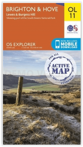
Productomschrijving: Kaart nummer OL11 in de OS Explorer kaartenserie is ideaal voor wie op zoek is naar avontuur in de omgeving van Brighton en Hove. De kust kan te voet worden verkend, waarbij u onderweg de bezienswaardigheden en geluiden van Brighton, Hove, Portslade, Shoreham by Sea, Peacehaven en Newhaven kunt bekijken. Het platteland in dit gebied biedt wandelaars glooiende Sussex Downs, mooie dorpjes en tal van prachtige landschappen om te bewonderen, evenals delen van de South Downs Way. Deze kaart vervangt het vorige Explorer blad 122 voor dit gebied.
Inclusief mobiele downloadBij deze kaart ontvangt u een code voor gebruik op uw iOS of Android smartphone of tablet. Meer informatie vindt u bij Veelgestelde vragen over mobiel downloaden.
Engelse omschrijving: Map sheet number OL11 in the OS Explorer map series is ideal for those seeking adventure in the Brighton and Hove area. The coast can be explored by foot taking in the sights and sounds of Brighton, Hove, Portslade, Shoreham by Sea, Peacehaven and Newhaven on the way. The countryside in this area offers walkers rolling Sussex Downs, pretty villages and plenty of stunning scenery to admire, as well as parts of the South Downs Way. This map replaces the previous Explorer sheet 122 for this area.
Includes mobile downloadWith this map you will receive a code for use on your iOS or Android smartphone or tablet. Find our more at Mobile Download FAQ.

Locatie op kaart
Overzichtskaarten

OSI Explorer & Explorer Active - Zuid England
OSI Explorer & Explorer Active - Zuid England

Producten op de overzichtskaart
Klik op een product om naar de detailpagina te gaan.
- Wandelkaart 117 Cerne Abbas & Bere Regis - Dorset - OSI
- Wandelkaart 118 Shaftesbury & Cranbourne Chase - OSI
- Wandelkaart 129 Yeovil & Sherborne - Somerset - OSI
- Wandelkaart 130 Salisburry & Stonehenge- Wiltshire - OSI
- Wandelkaart 131 Romsey & Andover - Hampshire - OSI
- Wandelkaart 135 Ashdown Forest - East Sussex - OSI
- Wandelkaart 141 Cheddar Gorge & Mendip Hills - OSI
- Wandelkaart 142 Shepton Mallet & Mendip Hills - OSI
- Wandelkaart 143 Warminster & Trowbridge - Wiltshire - OSI
- Wandelkaart 144 Basingstoke - Alton & Whitchurch - OSI
- Wandelkaart 145 Guildford & Farnham- Surrey - OSI
- Wandelkaart 146 Dorking- Box Hill & Reigate- Surrey - OSI
- Wandelkaart 147 Sevenoaks & Tonbridge- Kent - OSI
- Wandelkaart 154 Bristol West & Portishead- Bristol - OSI
- Wandelkaart 155 Bristol & Bath & Bristol Area - OSI
- Wandelkaart 156 Chippenham & Bradford-on-Avon - OSI
- Wandelkaart 157 Marlborough & Savernake Forest - OSI
- Wandelkaart 158 Newbury & Hungerford- Berkshire - OSI
- Wandelkaart 159 Reading- S.E. England - OSI
- Wandelkaart 160 Windsor- Weybridge & Bracknell - OSI
- Wandelkaart 161 London South - OSI
- Wandelkaart 162 Greenwich & Gravesend - OSI
- Wandelkaart 167 Thornbury- Dursley & Yate - England- OSI
- Wandelkaart 168 Stroud- Tetbury & Malmesbury - OSI
- Wandelkaart 169 Cirencester & Swindon - England - OSI
- Wandelkaart 170 Abingdon & Wantage - Oxfordshire - OSI
- Wandelkaart 171 Chiltern Hills West AONB - Wycombe - OSI
- Wandelkaart 172 Chiltern Hills East AONB - Wycombe - OSI
- Wandelkaart 173 London North- England - OSI
- Wandelkaart 174 Epping Forest & Lee Valley- Essex - OSI
- Wandelkaart 179 Gloucester- Cheltenham & Stroud - OSI
- Wandelkaart 180 Oxford- England - OSI
- Wandelkaart 181 Chiltern Hills North AONB- Wycombe - OSI
- Wandelkaart 182 St-Albans & Hatfield- Hertfordshire - OSI
- Wandelkaart OL22 New Forest- Southampton & Ringwood - OSI
- Wandelkaart OL32 Winchester & New Alresford - OSI
- Wandelkaart OL33 Haslemere- Petersfield & Midhurst - OSI
- Wandelkaart OL34 Crawley- Horsham & Cranleigh - OSI
- Wandelkaart OL29 Isle of Wight & Cowes - OSI
- Wandelkaart OL3 Meon Valley- Portsmouth & Gosport - OSI
- Wandelkaart OL3 Meon Valley- Portsmouth & Gosport - OSI
- Wandelkaart OL11 Brighton & Hove - Ordnance Survey
- Wandelkaart OL25 Eastbourne & Beachy Head - OSI
- Wandelkaart OL8 Chichester South Harting- England - OSI
Artikelen uit dezelfde regio

Wandelgids Park Rangers Favourite Walks South Downs - Collins • 9780008439118
Park Rangers Favourite Walks South Downs - Collins Productomschrijving: Wandelgids voor het South Downs National Park, met 20 van de beste routes uitgekozen door de parkwachters. Elke wandeling varieert in lengte van 2 tot 10 km en kan worden voltooid in minder dan 4 uur. Engelse omschrijving: Walking guide to the South Downs National Park, with 20 best routes chosen by the park ranger…

Wandelgids The South Downs Way - Cicerone • 9781786311610
The South Downs Way - Cicerone Productomschrijving: Wandelgids over de South Downs Way National Trail, een route van 100 mijl (160 km) tussen Winchester en Eastbourne door het South Downs National Park, beschreven in beide richtingen over 12 etappes. Gemakkelijke wandelingen over oude en historische paden, langs beboste gebieden, prachtige rivierdalen en mooie dorpjes. Met 1:25K OS kaarten…

Wandelgids South Downs NP short walks - Cicerone • 9781786312037
South Downs NP short walks - Cicerone Productomschrijving: 15 van de beste en mooiste wandelingen in het gebied van de Nationaal park van de South Downs, in de omgeving van Brighton, Eastbourne & Arundel. De gids komt met topografische kaarten erin van de befaamde cartograaf van Ordnance Survey. Perfect voor mensen die de South Downs nog nooit hebben bewandeld, en die opzoek zijn naar iets…

Wandelgids Sussex & the South Downs AONB - 50 walks - AA Publ. • 9780749583293
Wandelgids Sussex & the South Downs AONB - AA Publishing Productomschrijving: Wandelen is een van de favoriete vrijetijdsbestedingen in Groot-Brittannië en AA 50 Walks in Sussex bevat een verscheidenheid aan uitgestippelde wandelingen van twee tot tien mijl, geschikt voor alle niveaus. Het boek bevat alle praktische details die u nodig hebt, vergezeld van boeiende achtergrondinformatie ove…

Wandelgids South Downs National Park - Cicerone • 9781786312259
Wandelgids South Downs NP - Cicerone Productomschrijving: Gids met 40 rondwandelingen door het South Downs National Park, waarbij de prachtige krijtheuvels tussen Eastbourne en Winchester worden verkend. De wandelingen variëren van minder dan 5 mijl tot 11 mijl, inclusief Beachy Head en de Seven Sisters, Ditchling Beacon en honderden prehistorische vindplaatsen. Het hele jaar toegankelijk,…