
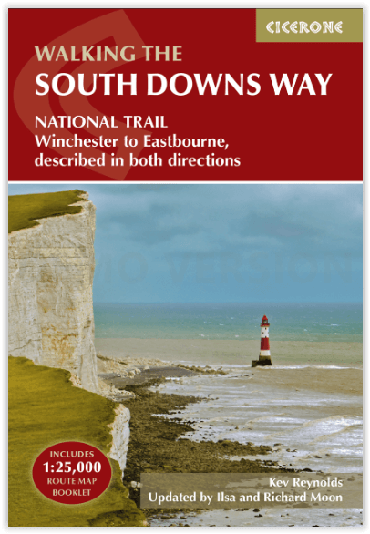
Wandelgids The South Downs Way - Cicerone
Tussen Winchester en Eastbourne - 160 km - 12 etappes
Korte omschrijving
The South Downs Way - Cicerone Productomschrijving: Wandelgids over de South Downs Way National Trail, een route van 100 mijl (160 km) tussen Winchester en Eastbourne door het South Downs Na...

Specificaties
- Uitgever: CICERONE Press
- ISBN-13: 9781786311610
- HOOFDCATEGORIEËN: Wandelgids
- Activiteiten: Wandelen, Hiking & Trekking
- Auteur: Ilsa Moon, Kevin Renolds, Richard Moon
- Regio: South England, Sussex, England
- Land: England
- Lange afstand wandelroutes: South Down's Way, (160 km)
- Nationale parken: South Downs NP, Sussex Egland
- Blz.: 200
- Schaal: 1:25000
- Afmeting: 12x17
- Editie: 5
- Taal: Engels
Volledige omschrijving
The South Downs Way - Cicerone
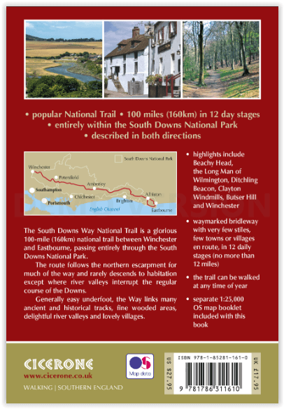
Productomschrijving: Wandelgids over de South Downs Way National Trail, een route van 100 mijl (160 km) tussen Winchester en Eastbourne door het South Downs National Park, beschreven in beide richtingen over 12 etappes. Gemakkelijke wandelingen over oude en historische paden, langs beboste gebieden, prachtige rivierdalen en mooie dorpjes. Met 1:25K OS kaartenboekje.
Engelse omschrijving: Guidebook to walking the South Downs Way National Trail, a 100 mile (160km) route between Winchester and Eastbourne through the South Downs National Park, described in both directions over 12 stages. Easy walking on ancient and historical tracks, taking in wooded areas, delightful river valleys and pretty villages. With 1:25K OS map booklet.
Seasons:
Can be walked at all times of year - this is one of the driest and warmest parts of England.
Centres:
Eastbourne, Alfriston, Lewes, Amberley, Burint, Exton, Winchester.
Difficulty:
The South Downs Way is a waymarked bridleway; very few stiles, few towns/villages en route: 12 stages (max length 12 miles).
Must See Must SeeBeachy Head, Long Man of Wilmington, Ditchling Beacon, Clayton Windmills, Butser Hill, Winchester.
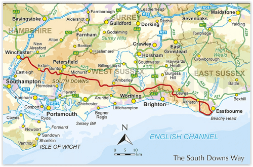
Locatie op kaart
Artikelen uit dezelfde regio

Reisgids England's South Coast - DK Eyewitness • 9780241290316
Reisgids England's South Coast - DK Eyewitness Productomschrijving: Experience the dark and brooding landscape of Dartmoor, laze on golden sandy beaches on the Jurassic coast or enjoy a day out at the seaside in Brighton: everything you need to know is clearly laid out within colour-coded chapters. Discover the best of England's South Coast with this indispensable travel guide. Inside …

Reisgids Go Slow Sussex & the South Downs, Weald & Coast - Bradt • 9781804690109
Reisgids Sussex & the South Downs, Weald & Coast - Bradt Productomschrijving: Deze nieuwe, grondig bijgewerkte derde editie van Sussex (Slow Travel), de veelgeprezen gids van Bradt, bevat de South Downs, de High Weald en de kust en biedt een grotere, persoonlijkere selectie van plaatsen om te verkennen dan welke andere gids dan ook. Auteur Tim Locke en bijwerkster Emma Gregg, beiden deskun…

Wandelkaart OL11 Brighton & Hove - Ordnance Survey • 9780319475751
Wandelkaart Brighton & Hove - Ordnance Survey Productomschrijving: Kaart nummer OL11 in de OS Explorer kaartenserie is ideaal voor wie op zoek is naar avontuur in de omgeving van Brighton en Hove. De kust kan te voet worden verkend, waarbij u onderweg de bezienswaardigheden en geluiden van Brighton, Hove, Portslade, Shoreham by Sea, Peacehaven en Newhaven kunt bekijken. Het platteland in …

Wandelgids South Downs National Park - Cicerone • 9781786312259
Wandelgids South Downs NP - Cicerone Productomschrijving: Gids met 40 rondwandelingen door het South Downs National Park, waarbij de prachtige krijtheuvels tussen Eastbourne en Winchester worden verkend. De wandelingen variëren van minder dan 5 mijl tot 11 mijl, inclusief Beachy Head en de Seven Sisters, Ditchling Beacon en honderden prehistorische vindplaatsen. Het hele jaar toegankelijk,…

Wandelgids Park Rangers Favourite Walks South Downs - Collins • 9780008439118
Park Rangers Favourite Walks South Downs - Collins Productomschrijving: Wandelgids voor het South Downs National Park, met 20 van de beste routes uitgekozen door de parkwachters. Elke wandeling varieert in lengte van 2 tot 10 km en kan worden voltooid in minder dan 4 uur. Engelse omschrijving: Walking guide to the South Downs National Park, with 20 best routes chosen by the park ranger…