
Wandelkaart 144 Basingstoke Alton & Whitchurch - OSI
Omvat Hampshire- Whitchurch tot Odiham en Alton
Korte omschrijving
Wandelkaart Basingstoke- Alton & Whitchurch - Hampshire England Productbeschrijving: Alton & Whitchurch Odiham, Overton & Hook. 144 / Basingstoke, Alton & Whitchurch - Hampshire, Englan...

Specificaties
- Uitgever: Ordnance Survey
- ISBN-13: 9780319243374
- HOOFDCATEGORIEËN: Wandelkaart
- Activiteiten: Wandelen, Hiking & Trekking
- Regio: Hampshire, England
- Land: England
- Waterafstotende kaart: Ordnance Survey ACTIVE Explorer Weatherproof Maps
- Schaal: 1:25000
- Afmeting: 13x23
- Taal: Engels
- Reeks: Explorer Series OSI
Volledige omschrijving
Wandelkaart Basingstoke- Alton & Whitchurch - Hampshire England
Productbeschrijving: Alton & Whitchurch Odiham, Overton & Hook.
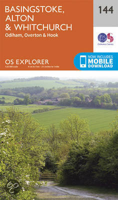
144 / Basingstoke, Alton & Whitchurch - Hampshire, England - Kaart nummerl 144 in de OS Explorer reeks heeft betrekking op een gebied in het noorden van Hampshire, van Whitchurch in het westen tot Odiham en Alton in het Oosten, rond in de stad van Basingstoke. De Wayfarer's kruist de North Wessex Downs, een gebied van uitzonderlijke natuurlijke schoonheid AONB. Andere hoogtepunten: Overton en haak, samen met de recreatieve paden van St Swithun's manier, de manier waarop drie kastelen en Test manier.
144 / Basingstoke, Alton & Whitchurch - Hampshire, England - Map sheet number 144 in the OS Explorer series covers an area in the north of Hampshire, from Whitchurch in the west to Odiham and Alton in the east, taking in the town of Basingstoke. The Wayfarer's Walk crosses the North Wessex Downs, an area of Outstanding Natural Beauty AONB. Other highlights: Overton and Hook, along with the recreational paths of St Swithun's Way, Three Castles Way and Test Way.
Locatie op kaart
Gekoppelde artikelen

Wandelkaart 144 Basingstoke Alton & Whitchurch - OSI • 9780319243374
standaard versieWandelkaart Basingstoke- Alton & Whitchurch - Hampshire England Productbeschrijving: Alton & Whitchurch Odiham, Overton & Hook. 144 / Basingstoke, Alton & Whitchurch - Hampshire, England - Kaart nummerl 144 in de OS Explorer reeks heeft betrekking op een gebied in het noorden van Hampshire, van Whitchurch in het westen tot Odiham en Alton in het Oosten, rond in de stad van Basingstoke…

Wandelkaart 144 Basingstoke Alton & Whitchurch- Hampshire • 9780319470169
weatherproof versieWandelkaart Basingstoke- Alton & Whitchurch - Hampshire England Omvat ook: Odiham, Overton & Hook. Productbeschrijving: Kaart nummer 144 in de OS Explorer kaarten reeks heeft betrekking op een gebied in het noorden van Hampshire, van Whitchurch in het westen tot Odiham en Alton in het Oosten, en betrekken de stad van Basingstoke. De Wayfarer's walk kruist de North Wessex Downs, een geb…
Overzichtskaarten

OSI Explorer & Explorer Active - Zuid England
OSI Explorer & Explorer Active - Zuid England

Producten op de overzichtskaart
Klik op een product om naar de detailpagina te gaan.
- Wandelkaart 117 Cerne Abbas & Bere Regis - Dorset - OSI
- Wandelkaart 118 Shaftesbury & Cranbourne Chase - OSI
- Wandelkaart 129 Yeovil & Sherborne - Somerset - OSI
- Wandelkaart 130 Salisburry & Stonehenge- Wiltshire - OSI
- Wandelkaart 131 Romsey & Andover - Hampshire - OSI
- Wandelkaart 135 Ashdown Forest - East Sussex - OSI
- Wandelkaart 141 Cheddar Gorge & Mendip Hills - OSI
- Wandelkaart 142 Shepton Mallet & Mendip Hills - OSI
- Wandelkaart 143 Warminster & Trowbridge - Wiltshire - OSI
- Wandelkaart 144 Basingstoke - Alton & Whitchurch - OSI
- Wandelkaart 145 Guildford & Farnham- Surrey - OSI
- Wandelkaart 146 Dorking- Box Hill & Reigate- Surrey - OSI
- Wandelkaart 147 Sevenoaks & Tonbridge- Kent - OSI
- Wandelkaart 154 Bristol West & Portishead- Bristol - OSI
- Wandelkaart 155 Bristol & Bath & Bristol Area - OSI
- Wandelkaart 156 Chippenham & Bradford-on-Avon - OSI
- Wandelkaart 157 Marlborough & Savernake Forest - OSI
- Wandelkaart 158 Newbury & Hungerford- Berkshire - OSI
- Wandelkaart 159 Reading- S.E. England - OSI
- Wandelkaart 160 Windsor- Weybridge & Bracknell - OSI
- Wandelkaart 161 London South - OSI
- Wandelkaart 162 Greenwich & Gravesend - OSI
- Wandelkaart 167 Thornbury- Dursley & Yate - England- OSI
- Wandelkaart 168 Stroud- Tetbury & Malmesbury - OSI
- Wandelkaart 169 Cirencester & Swindon - England - OSI
- Wandelkaart 170 Abingdon & Wantage - Oxfordshire - OSI
- Wandelkaart 171 Chiltern Hills West AONB - Wycombe - OSI
- Wandelkaart 172 Chiltern Hills East AONB - Wycombe - OSI
- Wandelkaart 173 London North- England - OSI
- Wandelkaart 174 Epping Forest & Lee Valley- Essex - OSI
- Wandelkaart 179 Gloucester- Cheltenham & Stroud - OSI
- Wandelkaart 180 Oxford- England - OSI
- Wandelkaart 181 Chiltern Hills North AONB- Wycombe - OSI
- Wandelkaart 182 St-Albans & Hatfield- Hertfordshire - OSI
- Wandelkaart OL22 New Forest- Southampton & Ringwood - OSI
- Wandelkaart OL32 Winchester & New Alresford - OSI
- Wandelkaart OL33 Haslemere- Petersfield & Midhurst - OSI
- Wandelkaart OL34 Crawley- Horsham & Cranleigh - OSI
- Wandelkaart OL29 Isle of Wight & Cowes - OSI
- Wandelkaart OL3 Meon Valley- Portsmouth & Gosport - OSI
- Wandelkaart OL3 Meon Valley- Portsmouth & Gosport - OSI
- Wandelkaart OL11 Brighton & Hove - Ordnance Survey
- Wandelkaart OL25 Eastbourne & Beachy Head - OSI
- Wandelkaart OL8 Chichester South Harting- England - OSI
Artikelen uit dezelfde regio

Wandelgids The South Downs Way - Rucksack readers • 9781898481447
Wandelgids South Downs Way - Omvat: Hampshire Sussex South East England Productomschrijving: De South Downs Way loopt voor 100 mijl (160 km) van de kathedraalstad van Winchester naar de spectaculaire witte kliffen van East Sussex, ter hoogte van Eastbourne. De golvende route biedt noorden wijds uitzicht over de zee. Het vormt de ruggengraat van Britains nieuwste Nationaal Park, met gl…

Reisgids New Forest National Park - Go Slow - Bradt guides • 9781804690482
Reisgids New Forest National Park - Bradt guides Productomschrijving: Deze nieuwe, grondig bijgewerkte en uitgebreide tweede editie van Bradt's New Forest - onderdeel van de bekroonde 'Slow travel' serie van gidsen over Britse regio's - richt zich op dit vredige, betoverende gebied in Hampshire. Wandelaars, fietsers, natuurliefhebbers, gezinnen en fijnproevers komen allemaal aan hun trekke…

Wandelkaart 186 Aldershot & Guildford England - OSI • 9780319475096
Wandelkaart Aldershot & Guildford- Camberley - Hampshire Productbeschrijving: Kaart nummer 186 OS Landranger kaarten reeks, is perfect voor het plannen van daguitstapjes in het gebied rond Aldershot en Guildford. Hier valt veel te doen en te zien, zoals de fantastische winkels in Guildford of wandelingen in de Noord-Downs. Hoogtepunten van het gebied: The North Downs Way, Guildford, Alton …

Wandelkaart 131 Romsey & Andover Hampshire - OSI • 9780319243275
Wandelkaart Romsey- Andover & Test Valley - Hampshire England Omvat ook: Stockbridge & Ludgershall. Productbeschrijving: Kaart nummer 131 in de OS Explorer reeks heeft betrekking op het gebied van Oxenwood en Ashmansworth in het noorden tot Romsey en Redlynch in het zuiden. Hoogtepunten van het gebied zijn onder andere: Andover, Ludgershall, Stockbridge en de wandelingen van de Test Wa…

Wandelkaart 185 Winchester & Basingstoke England - OSI • 9780319475089
Wandelkaart Winchester & Basingstoke - Andover Productbeschrijving: Kaart nummer 185 in de OS Landranger kaart reeks is de ideale kaart om te gebruiken bij het plannen van daguitstapjes rond het gebied Winchester en Basingstoke. Met tal van culturele attracties, naast een aangenaam landschap, doet dirt gebied beroep op alle soorten liefhebber van het buitenleven. Hoogtepunten van het gebie…