Wandelkaart Lake District National Park XT40 - Harvey Maps
Het volledige Lake District op 1 kaart
Korte omschrijving
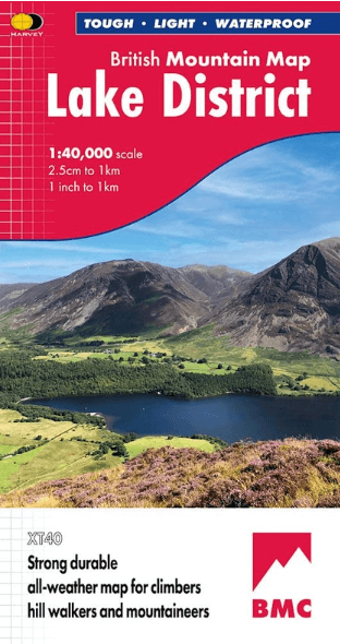
Wandelkaart Lake District XT40 - Harvey Maps Productomschrijving: Een nieuwe generatie kaarten van stevig polyethyleen. Ze zijn stevig, duurzaam en 100% waterdicht, compact en licht om mee t...

Specificaties
- Uitgever: HARVEY MAPS
- ISBN-13: 9781851376865
- HOOFDCATEGORIEËN: Wandelkaart
- Activiteiten: Wandelen, Hiking & Trekking
- Regio: Cumbria & Lake District, England
- Land: England
- Nationale parken: Lake District NP, Cumbria England
- Schaal: 1:40000
- Afmeting: 14x24
- Taal: Engels
- Reeks: Superwalker XT40, Harvey Maps
Volledige omschrijving
Wandelkaart Lake District XT40 - Harvey Maps
Productomschrijving: Een nieuwe generatie kaarten van stevig polyethyleen. Ze zijn stevig, duurzaam en 100% waterdicht, compact en licht om mee te nemen. Deze all weather Britse bergkaart voor klimmers, bergwandelaars, bergbeklimmers en mountainbikers is uitgegeven door HARVEY in samenwerking met de British Mountaineering Council.
De beroemde bergen en heuvels van het Lake District op één kaart, met kleurarcering voor eenvoudige identificatie van heuvels en dalen en gedetailleerde informatie over rotsen voor klimmers. De achterkant van de kaart bevat gedetailleerde 1:20000 vergrotingen van Scafell, Gable, Bowfell, Langdale Pikes en Pillar, een geologische kaart van het Lake District, advies over bergincidenten en eerste hulp.
Engelse omschrijving: A new generation of tough polyethylene maps. These maps are a leap forward in technical excellence. Tough, durable and 100% waterproof they are compact - not the great bulky package you get with a laminated map - and light to carry. This all weather British Mountain Map for climbers, hill wallkers, mountaineers and mountain bikers is published by HARVEY in co-operation with the British Mountaineering Council.
The Lake District's famous mountains and fells on a single map, colour shading for easy identification of hills and valleys and detailed crag information for climbers. The reverse side of the map includes detailed 1:20000 enlargements of Scafell, Gable, Bowfell, Langdale Pikes and Pillar, a Geological map of the Lake District, mountain incident and first aid advice.

Overzichtskaarten

Harvey Maps - Mountain XT40 Maps
Harvey Maps - Mountain XT40 Maps

Producten op de overzichtskaart
Klik op een product om naar de detailpagina te gaan.
- Wandelkaart Yorkshire Dales NP - Harvey Maps
- Wandelkaart Assynt & Coigach - Harvey Maps
- Wandelkaart Ben Nevis and Glen Coe Schotland - Harvey maps
- Wandelkaart Brecon Beacons NP - Harvey maps
- Wandelkaart Cairngorms National Park - Harvey maps
- Wandelkaart Dark Peak- Peak District NP England - Harvey maps
- Wandelkaart Dartmoor National Park - Harvey maps
- Wandelkaart Knoydart - Kintail & Glen Affric - Harvey maps
- Wandelkaart Lake District National Park XT40 - Harvey Maps
- Wandelkaart en klimkaart - North Yorkshire Moors - Harvey maps
- Wandelkaart Schiehallion - Ben Lawers & Glen Lyon - Harvey maps
- Wandelkaart Snowdonia NP South - Harvey maps
- Wandelkaart Torridon & remote Fisherfield Hills - Harvey maps
- Wandelkaart White Peak - Peak District NP - Harvey maps
- Wandelkaart South West Coast Path 2 - Harvey maps
- Wandelkaart South West Coast Path 3 - Harvey Maps
- Wandelkaart South Wales Coast Path 4 - Harvey Maps
- Wandelkaart Northumberland - Harvey Maps
- Wandelkaart Snowdonia Noord XT40 ultra - Harvey Maps
Artikelen uit dezelfde regio

Reisgids Lake District pocket guide - Lonely Planet • 9781787017610
Lake District pocket guide - Lonely Planet Product description: Covers Windermere, Grasmere, Coniston, Hawkeshead, Keswick, Derwentwater, Ullswater, Cumbrian Coast, Inland Cumbria and more The Perfect Choice: Lonely Planet's Pocket Lake District is our colourful, easy to use and handy guide that literally fits in your pocket, providing on-the-go assistance for those seeking the best si…

Reisgids Lake district Nationale Park UK - Rough Guides • 9781839058684
Reisgids Lake district NP - Rough Guides Omvat: Windermere, Grasmere and the central fells, Coniston Water, Hawkshead and the south, Keswick, Derwent Water and the north, the western fells and valleys, Ullswater, out of the National Park. Productomschrijving: The Rough Guide to the Lake District NP is de beste all-purpose gids voor het Engelse Lake District, prachtig geïllustreerd met …

Scramblegids Lake District North 110 scrambles - Cicerone • 9781852848323
Scramblegids / Lake District North - 110 scrambles (9781852848323) Cicerone Press Productomschrijving: Gids naar 110 scramble (klauter/wandel) routes in het Engelse Lake District. Graded scrambles routes op de rotsen in ghylls Road, Ennerdale, Newlands, Buttermere, Borrowdale, Thirlmere, Patterdale, Mardale & Swindale. Routes variëren van rang 1 door rangen 2 tot en met 4, waar het gebruik…

Fietsgids Lake District cycling - Cicerone • 9781786311887
Lake District cycling - Cicerone Productomschrijving: Fietsgids over een 5-daagse fietstocht door het Lake District, met 2 opties per dag tot een totaal van 299 km en bijna 5000 meter klimmen, en 15 pittige dagritten vanuit Keswick, Ambleside, Penrith en bases in het zuidwesten en zuidoosten van het nationale park. Met een overzicht van andere tochten en de Fred Whitton Challenge-rit (180 …

Wandelgids The Pennine Way - Trailblazer • 9781912716333
The Pennine Way 420 km - Trailblazer Productomschrijving: De Pennine Way, het bekendste nationale pad van Groot-Brittannië, slingert zich 420 km over woeste heidevelden en door stille dalen langs de ruggengraat van Noord-Engeland. Het begint in Edale in het Peak District en eindigt net over de grens in Schotland bij Kirk Yetholm. Dit prachtige wandelpad doorkruist 3 nationale parken - het …


