
Wandelkaart South West Coast Path 3 - Harvey Maps
Laatste DEEL > Plymouth naar Poole Harbour (339 km)
Korte omschrijving
South West Coast Path - Harvey Maps Productomschrijving: Het South West Coast path is een dikke 1014 km lang en omvat het volledige South-West-England met daarin Devon & Corwall. Het pad is ...

Specificaties
- Uitgever: HARVEY MAPS
- ISBN-13: 9781851376834
- HOOFDCATEGORIEËN: Wandelkaart
- Activiteiten: Wandelen, Hiking & Trekking
- Regio: Cornwall, England, Devon, England, South West England
- Land: England
- Lange afstand wandelroutes: South West Coast Path - SWCP (1014 km)
- Schaal: 1:40000
- Afmeting: 13x27, 14x25
- Taal: Engels
- Reeks: National Trails, UK
Volledige omschrijving
South West Coast Path - Harvey Maps
Productomschrijving: Het South West Coast path is een dikke 1014 km lang en omvat het volledige South-West-England met daarin Devon & Corwall. Het pad is een National trail en behoort tot de langste routes van Engeland. De route start in Minehead in Somerset en loopt de volledige kust af tot in Poole in Dorset. OPGELET: deze kaart omvat het laatste deel van de route: van Plymouth naar Poole Harbour 339 km.
Engelse omschrijving: The South West Coast path is a 1014km (630mile) long distance path and the longest National Trail in England.
The whole path stretches from Minehead in Somerset to Poole in Dorset. (1014 km)
- This updated Trail Map covers the third and final section of the South West Coast Path from Plymouth to Poole Harbour which is 339 km (211 miles).
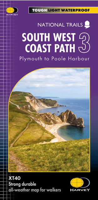
- Includes the Jurassic Coast World Heritage Site and Durdle Door, the famous sea arch in Dorset.
- The entire route on 3 sheets. This is map 3 of 3, a good two weeks? walking on one map.
- The XT40 is based on original HARVEY mapping with all the detail a walker would expect on a map at 1:40,000 scale.
- Clear and easy to read mapping which is uncluttered by information irrelevant to the walker.
- Printed on tough, light and 100% waterproof paper, less than half the weight of a laminated map.
- Shows facilities and services along the route
Overzichtskaarten

Harvey Maps - Mountain XT40 Maps
Harvey Maps - Mountain XT40 Maps

Producten op de overzichtskaart
Klik op een product om naar de detailpagina te gaan.
- Wandelkaart Yorkshire Dales NP - Harvey Maps
- Wandelkaart Assynt & Coigach - Harvey Maps
- Wandelkaart Ben Nevis and Glen Coe Schotland - Harvey maps
- Wandelkaart Brecon Beacons NP - Harvey maps
- Wandelkaart Cairngorms National Park - Harvey maps
- Wandelkaart Dark Peak- Peak District NP England - Harvey maps
- Wandelkaart Dartmoor National Park - Harvey maps
- Wandelkaart Knoydart - Kintail & Glen Affric - Harvey maps
- Wandelkaart Lake District National Park XT40 - Harvey Maps
- Wandelkaart en klimkaart - North Yorkshire Moors - Harvey maps
- Wandelkaart Schiehallion - Ben Lawers & Glen Lyon - Harvey maps
- Wandelkaart Snowdonia NP South - Harvey maps
- Wandelkaart Torridon & remote Fisherfield Hills - Harvey maps
- Wandelkaart White Peak - Peak District NP - Harvey maps
- Wandelkaart South West Coast Path 2 - Harvey maps
- Wandelkaart South West Coast Path 3 - Harvey Maps
- Wandelkaart South Wales Coast Path 4 - Harvey Maps
- Wandelkaart Northumberland - Harvey Maps
- Wandelkaart Snowdonia Noord XT40 ultra - Harvey Maps
Artikelen uit dezelfde regio

Wandelkaart 127 South Molton & Chulmleigh Devon - OSI • 9780319243237
Wandelkaart South Molton & Chulmleigh - Devon England Omvat ook: King’s Nympton, Chittlehampton & Dolton. Productbeschrijving: Kaart nummer 127 in de OS Explorer kaarten reeks is ideaal voor het ontdekken van de regio Noord-Devon. Dit gebied, net ten zuiden van Exmoor National Park, biedt een prachtig landschap en onbedorven wandelingen. Andere hoogtepunten van het gebied zijn Chittleh…

Wandelkaart 112 Launceston & Holsworthy Devon - OSI • 9780319243138
Wandelkaart Launceston & Holsworthy - Devon England - OSI Productomschrijving: - Roadford Lake. Kaart nummer 112 omvat Holsworthy en Launceston. Hoogtepunten zijn Dartmoor National Park, Tamar Valley en Roadford Lake. Omvat ook Sheepwash, Milton Abbot, Lifton en Chapmans Well. De OS Explorer kaart voor Launceston & Holsworthy is beschikbaar in zowel de standaard papieren versie als de …

Fietskaart Mountainbikekaart Dartmoor NP- Devon - Goldeneye • 9781859652701
Mountainbikekaart Dartmoor NP - Goldeneye Productomschrijving: Dartmoor national park verkennen op de mountainbike, met deze waterdichte Dartmoor kaart. Deze gebruiksvriendelijke kaart met 10 routes neemt u mee van de gebaande paden en helpt u de beste trails van Dartmoor te ontdekken. Elke route is gekozen voor zijn algemene kwaliteit - een vaste overtuiging dat fietsen is om te rijde…

Wandelgids Cornwall short walks - Collins • 9780008101558
Wandelgids - Cornwall short walks - Harper C. Productomschrijving: Cornwall, in het uiterste zuidwesten van het Engelse continent, is een toeverlaat voor de oudere generatie, die tijdens de zomer gevuld is met strandgangers en toeristen. Het stedelijke is er ver te zoeken, ondanks de regio niet meer zo klein is als vroeger. Wandelen in deze omgeving is er een sport geworden en zeer in tre…

Wandelkaart XT25 Exmoor NP Devon England - Harvey maps • 9781851376858
Wandelkaart Exmoor Nqtional Park - Harvey maps Productomschrijving: Meer dan een kaart - een essentieel stuk gereedschap. Deze nieuwe generatie HARVEY Superwalker is ontworpen om het meest praktische hulpmiddel te zijn voor navigatie buitenshuis. - Het hele Exmoor National Park op één blad - Bestrijkt Combe Martin in het westen, Minehead aan de noordkust en Exebridge in het zuiden …