
Wandelgids The Pennine Way - Trailblazer
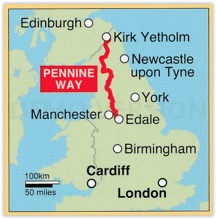
Edale (Peak District) tot Kirk Yetholm Scotisch borders - 420 km

Korte omschrijving
The Pennine Way 420 km - Trailblazer Productomschrijving: De Pennine Way, het bekendste nationale pad van Groot-Brittannië, slingert zich 420 km over woeste heidevelden en door stille dalen ...

Specificaties
- Uitgever: Trailblazer Publications
- ISBN-13: 9781912716333
- HOOFDCATEGORIEËN: Wandelgids
- Activiteiten: Wandelen, Hiking & Trekking
- Auteur: Bradley Mayhew, Stuart greig
- Regio: Cumbria & Lake District, England, Derbyshire & Peak District, England, Northumberland, Engeland, Yorkshire, England
- Land: England
- Lange afstand wandelroutes: Pennine Way (420 km)
- Blz.: 320
- Afmeting: 12x18
- Editie: 6
- Taal: Engels
Volledige omschrijving
The Pennine Way 420 km - Trailblazer
Productomschrijving: De Pennine Way, het bekendste nationale pad van Groot-Brittannië, slingert zich 420 km over woeste heidevelden en door stille dalen langs de ruggengraat van Noord-Engeland. Het begint in Edale in het Peak District en eindigt net over de grens in Schotland bij Kirk Yetholm. Dit prachtige wandelpad doorkruist 3 nationale parken - het Peak District, Yorkshire Dales en Northumberland - en toont het mooiste hooglandlandlandschap van Groot-Brittannië, terwijl het ook het literaire landschap van de familie Brontë en de Romeinse geschiedenis langs Hadrian's Wall raakt.
Engelse omschrijving: Pennine Way: Edale to Kirk Yetholm (British Walking Guide)
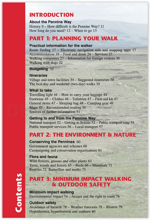
- 138 trail maps - 12 town plans - 15 stages maps with profiles and 2 overview maps- 60 colour photos - colour flower guide
The Pennine Way, Britain’s best-known National Trail, winds for 253 miles (420 km) over wild moorland and through quiet dales following the backbone of northern England. It begins in Edale in the Peak District and ends just over the border in Scotland at Kirk Yetholm. Crossing three national parks – the Peak District, Yorkshire Dales and Northumberland – this superb footpath showcases Britain’s finest upland scenery, while touching the literary landscape of the Brontë family and Roman history along Hadrian’s Wall.
- Post pandemic, stay-cations remain the holidays of choice
- Mapping now in new two-colour style
- All-in-one guide
Trailblazer guides include practical information not usually found in walking guides to the UK: reviews of places to stay, places to eat, attractions along the way and detailed public transport information showing all access points on the path and car parks near the trail, for weekend and day walkers. The largest scale walking maps available – At just under 1:20,000 (8cm or 31/8 inches to 1 mile) our maps (fully-edited and drawn by walkers for walkers) are bigger than even the most detailed walking maps currently available in the shops.
Artikelen uit dezelfde regio
Fietsgids Lake District cycling - Cicerone • 9781786311887
Lake District cycling - Cicerone Productomschrijving: Fietsgids over een 5-daagse fietstocht door het Lake District, met 2 opties per dag tot een totaal van 299 km en bijna 5000 meter klimmen, en 15 pittige dagritten vanuit Keswick, Ambleside, Penrith en bases in het zuidwesten en zuidoosten van het nationale park. Met een overzicht van andere tochten en de Fred Whitton Challenge-rit (180 …

Wandelgids Yorkshire Dales guide - Cicerone • 9781852844813
Wandelgids - Yorkshire Dales guide - Cicerone Productomschrijving: Gids met 50 van Jack Keighleys favoriete wandelingen in de Yorkshire Dales. Alle wandelingen zijn circulaire wandelingen, en variëren van 4,5 tot bijna 8 mijl in lengte. Ze variëren van eenvoudige Dalwandelingen (ideaal als halve dag 'familie rambles') tot inspannende expedities. Handgeschreven en met overvloedig geïllustre…
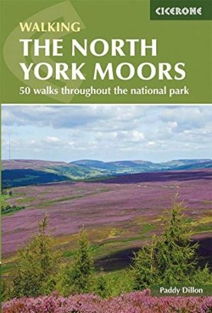

Wandelgids North York Moors walking guide - Cicerone • 9781852849511
Wandelgids - North York Moors walking guide - Cicerone Productomschrijving: Dit zeer bekende nationale park behoort tot de mooiste van Engeland. Het park is waliswaar zonder hoge bergtoppen, maar is en blijft een prachtig gebied, waar de Engelsen goed voor zorgen. Deze gids brengt u een dikke 50 wandelingen doorheen de North York Moors Nationaal Park. Kies er éne uit en neem een duik in de…

Reisgids Yorkshire - Rough Guides • 9781835290583
Reisgids Yorkshire - Rough Guides Productomschrijving: The Rough Guide to Yorkshire was the first comprehensive guidebook to England’s largest county. Detailed coverage of the ruggedly beautiful Dales and Moors, the magnificent North Sea coast and historic York rubs shoulders with penetrating insights into the multi-cultural cities of Leeds and Sheffield, the resurgent port of Hull, and th…
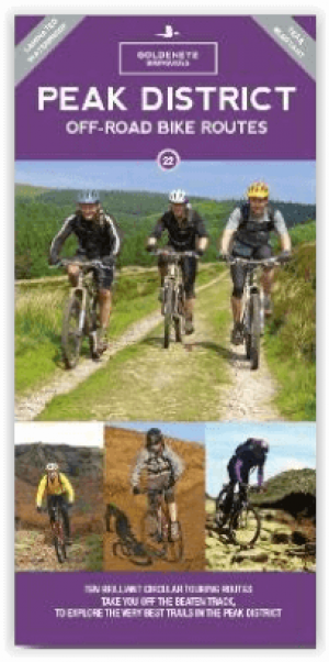
Fietskaart Mountainbikekaart Peak District NP - Goldeneye • 9781859652718
Mountainbikekaart Peak District NP - Goldeneye Productomschrijving: Het Peak District is een opmerkelijke plaats - vanuit het noorden strekt het omgekeerde hoefijzer van hoge, gritstenen heidevelden en rotsen van de Dark Peak zich zuidwaarts uit naar het oosten en westen van het contrasterende kalksteenplateau van het zachtere pastorale landschap van de White Peak, ingesneden door de valle…