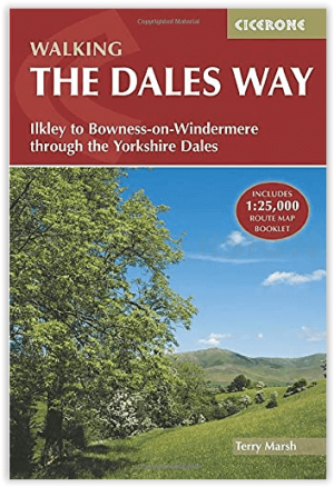
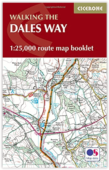
Wandelgids Dales Way Map Booklet - Cicerone
De 135 km lange Dales Way door de Yorkshire Dales
Korte omschrijving
Map Booklet - The Dales Way - Cicerone Press Productomschrijving: OPGELET: inbegrepen indien u de wandelgids zelf koopt. Kaart van de 79 mijl (135 km) lange Dales Way door de Yorkshire Dale...

Specificaties
- Uitgever: CICERONE Press
- ISBN-13: 9781786310941
- HOOFDCATEGORIEËN: Wandelgids
- Activiteiten: Wandelen, Hiking & Trekking
- Regio: North & North East England
- Land: England
- Lange afstand wandelroutes: The Dales Way (130 km)
- Blz.: 48
- Afmeting: 11x17
- Editie: 2
- Taal: Engels
Volledige omschrijving
Map Booklet - The Dales Way - Cicerone Press
Productomschrijving: OPGELET: inbegrepen indien u de wandelgids zelf koopt. Kaart van de 79 mijl (135 km) lange Dales Way door de Yorkshire Dales tussen Ilkley en Bowness-on-Windermere. Dit boekje is bijgesloten bij de Cicerone gids en toont de volledige route op OS 1:25,000 kaarten. Het is een van de meest rustige meerdaagse wandelingen in Groot-Brittannië en gaat door Grassington, Kettlewell, Dent, Sedbergh en Staveley.
Engelse omschrijving: Map of the 79 mile (135km) Dales Way through the Yorkshire Dales between Ilkley and Bowness-on-Windermere. This booklet is included with the Cicerone guidebook and shows the full route on OS 1:25,000 maps. One of the most gentle multi-day walks in Britain, it passes through Grassington, Kettlewell, Dent, Sedbergh and Staveley.
Seasons:
The walk is scenically at its best in Spring and Autumn (April-June and September-October), but is an all-year round walk for suitably equipped walkers.
Centres:
Ilkley, Grassington, Hawes, Sedbergh, Bowness-on-Windermere
Difficulty:
This is an ideal route for anyone wanted to attempt multi-day walking for the first time. There are no significant physical difficulties beyond the basic need to walk a certain distance each day.
Must See:
Historic buildings, roads, bridges, etc. Landscape, flowers and wildlife. Bolton Abbey, Dent, Dales villages. The scenery is outstanding throughout, and a string of communities line the route but without detracting from the sense of freedom.
.png)
Gekoppelde artikelen

Wandelgids The Dales Way West Yorkshire - Cicerone • 9781852849436
standaard versieWandelgids - The Dales Way West Yorkshire - Cicerone Productomschrijving: The Dales Way loopt van het Westelijke gelegen Bowness tot Ilkley in West-Yorkshire. Een route van om- en bij de 128 km. Een meerdaagse tocht uiteraard, maar wel één die door plaatsen loopt van uitmuntend natuurlijk schoon. Omschrijving van de uitge ver zelf: Guidebook to walking the Dales Way. This picturesque …

Wandelgids The Dales Way 135 km - Cicerone • 9781786310934
standaard versieThe Dales Way 135 km - Cicerone Productomschrijving: Gids voor het afleggen van de Dales Way. Deze schilderachtige route van 79 mijl (135 km) door de Yorkshire Dales tussen Ilkley en Bowness-on-Windermere, en is een van de rustigste lange-afstandswandelingen in Groot-Brittannië. De route wordt in beide richtingen beschreven en gaat door Wharfedale, Dentdale en de oostelijke rand van het La…
Artikelen uit dezelfde regio

Wandelgids The Pennine Way - Cicerone • 9781852849061
Wandelgids - The Pennine Way - Cicerone Productomschrijving: De Pennine Way National Trail met OS kaart boekje. De route van de 320 km van Edale naar Kirk Yetholm duurt drie weken om te lopen en is geschikt voor fit en langeafstand ervaren wandelaars. De route doorkruist het Peak District NP, de Yorkshire Dales NP en de North Pennines nationale parken. Bevat afzonderlijk boekje van de rout…

Wandelgids Yorkshire Dales South & West walking guide- Cicerone • 9781852848859
Wandelgids - Yorkshire Dales South & West walking guide- Cicerone Productomschrijving: Deel 2 van een 2-delige gidsen set omvat 44 wandelingen in het zuiden en het west van de Yorkshire Dales, incl het 23km lange "Three Peak cicuit" door Pen-y-Ghent, Whernside & Ingleborough. De andere, meestal bezienswaardige routes van ongeveer 13km ovatten de regio's tussen Sedbergh, Kirkby Lonsdale, Se…

Wandelgids South Pennine Walks - Cicerone • 9781852843908
Wandelgids - South Pennine Walks - Cicerone Productomschrijving: De 30 rondwandelingen in deze gids hebben betrekking op de Zuid-Pennines, de uitgestrektheid van de heuvesl rond de Lancashire / Yorkshire grens tussen de Yorkshire Dales en het Peak National Park. Deze wandelingen variëren van 4 tot 8 en een halve mijl om gevarieerde en contrasterende landschappen te kunnen verkennen. Door z…

Wandelkaart Coast to Coast - Harvey maps • 9781851376186
Wandelkaart Coast to Coast - Keld to Robin Hood's Bay - Harvey maps Productomschrijving: Toont de gehele oostelijke helft van de route op één vel. Heeft betrekking op het gedeelte van Keld naar Robin Hood's Bay. Omvat alle alternatieve routes. Gedetailleerde kaart met aanvullende informatie en handige telefoonnummers. Nieuwe generatie HARVEY Superwalker, XT25 waterproof, werden ontworp…

Wandelgids Great Mountain Days in the Pennines - Cicerone • 9781852846503
Wandelgids - Great Mountain Days in the Pennines - Cicerone Productomschrijving: Een inspirerende gids naar 50 klassieke wandelingen op het glooiende landschap van de Walliser. De gesorteerde routes, tussen 6 en 13 mijl in lengte, dekken de klassieke Walliser fells en veenland zoals Whernside, Ilkley Moor en Pendle Hill; verkennen van Noord- en Zuid-Pennines, Yorkshire Dales, Howgills en D…


