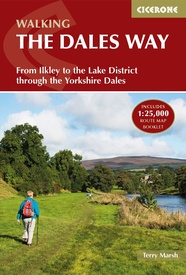
Wandelgids The Dales Way West Yorkshire - Cicerone
From Ilkley to the Lake District through the Yorkshire Dales
Korte omschrijving
Wandelgids - The Dales Way West Yorkshire - Cicerone Productomschrijving: The Dales Way loopt van het Westelijke gelegen Bowness tot Ilkley in West-Yorkshire. Een route van om- en bij de 128...

Specificaties
- Uitgever: CICERONE Press
- ISBN-13: 9781852849436
- HOOFDCATEGORIEËN: Wandelgids
- Activiteiten: Wandelen, Hiking & Trekking
- Auteur: Terry Marsch
- Regio: West Yorkshire, England
- Land: England
- Lange afstand wandelroutes: The Dales Way (130 km)
- Blz.: 176
- Afmeting: 12x17
- Editie: 3
- Taal: Engels
Volledige omschrijving
Wandelgids - The Dales Way West Yorkshire - Cicerone
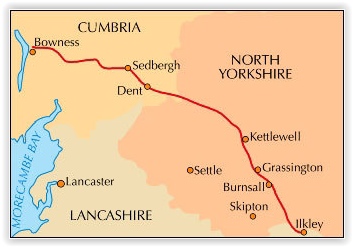
Productomschrijving: The Dales Way loopt van het Westelijke gelegen Bowness tot Ilkley in West-Yorkshire. Een route van om- en bij de 128 km. Een meerdaagse tocht uiteraard, maar wel één die door plaatsen loopt van uitmuntend natuurlijk schoon.
Omschrijving van de uitge ver zelf: Guidebook to walking the Dales Way. This picturesque 79 mile route through the Yorkshire Dales between Ilkley and Bowness-on-Windermere is one of the gentlest long-distance walks in Britain. The route is described in both directions, passing through Wharfedale, Dentdale and the eastern fringe of the Lake District. With 1:25K OS map booklet.
Seasons:
The walk is scenically at its best in Spring and Autumn (April-June and September-October), but is an all-year round walk for suitably equipped walkers.
Centres:
Ilkley, Grassington, Hawes, Sedbergh, Bowness-on-Windermere
Difficulty:
This is an ideal route for anyone wanted to attempt multi-day walking for the first time. There are no significant physical difficulties beyond the basic need to walk a certain distance each day.
Must See:
Historic buildings, roads, bridges, etc. Landscape, flowers and wildlife. Bolton Abbey, Dent, Dales villages. The scenery is outstanding throughout, and a string of communities line the route but without detracting from the sense of freedom.

Locatie op kaart
Artikelen uit dezelfde regio

Fietskaart 03 Peak District cycling map - Goldeneye • 9781859653043
Fietskaart Peak District cycling map - Goldeneye Productomschrijving: Het Peak District is een nationaal park van formaat pal in het centrum van Engeland. deze kaart biedt u een overzicht van alle fietsroutes in- en door het park. Het Peak District is dan ook goed gekend voor zijn heuvel, bergen, waterwegen, wandel- en fietsroutes. Egelse omschrijving: The Peak District offers some of …


