
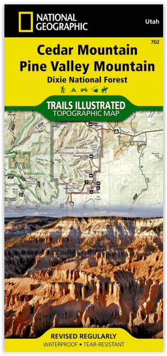
Wandelkaart 702 Cedar Mountain - Utah USA - Nat Geo
Pine Valley Mountain - Dixie National Forest
Korte omschrijving
Wandelkaart Cedar Mountain - Utah USA - Nat Geo Omvat: Ashdown Gorge Wilderness, Brian Head, Dixie National Forest, Kolob Terrace, Little Salt Lake, Markagunt Plateau, Panguitch Lake, Parowa...

Specificaties
- Uitgever: National Geographic
- ISBN-13: 9781566953061
- HOOFDCATEGORIEËN: Wandelkaart
- Activiteiten: Wandelen, Hiking & Trekking
- Regio: Utah, USA
- Land: Verenigde Staten van Amerika (USA)
- Waterafstotende kaart: Nat Geo waterproof series
- Schaal: 1:75000
- Afmeting: 10x19
- Taal: Engels
Volledige omschrijving
Wandelkaart Cedar Mountain - Utah USA - Nat Geo
Omvat: Ashdown Gorge Wilderness, Brian Head, Dixie National Forest, Kolob Terrace, Little Salt Lake, Markagunt Plateau, Panguitch Lake, Parowan Valley, Pine Valley Mountain Wilderness, Pine Valley Mountains, Signal Peak.
Engelse omschrijving: Cedar City is the headquarters of the Dixie National Forest which is a two-million-acre, 170-mile stretch of breathtaking wilderness across southern Utah. This map covers the Markagunt OHV Trail System from the stunning Pink Cliffs in the South to the Parowon Valley Northwest to the town of Panguitch in the East, and the spectacular Markagunt Plateau Scenic Drive—a 123-mile trail from Cedar City to Parowan.
Also featured are Cedar Breaks National Monument—with meadows at 10,000 feet and stunning nights for stargazing—as well as the shallow Navajo Lake, ideal for fishing, swimming, and boating, and the red limestone Hurricane Cliffs.
The area offers boundless outdoor recreation opportunities, from hiking, hunting, and horseback riding to skiing, swimming, and scenic driving—for all seasons, and a wide range of visitors. Recreation features are clearly marked, including trailheads, campgrounds, boat launches, mountain bike routes, ATV trails, downhill ski areas, scenic overlooks, and points of interest. The map includes contour lines, shaded relief, and elevations for summits and passes, as well as safety tips, visitor centers and ranger stations, and contact information for local agencies.
The printed map contains an inset showing greater detail of the popular Brian Head Ski Area and Cedar Breaks National Monument.
Every Trails Illustrated map is printed on "Backcountry Tough" waterproof, tear-resistant paper. A full UTM grid is printed on the map to aid with GPS navigation.
Other features found on this map include: Ashdown Gorge Wilderness, Brian Head, Dixie National Forest, Kolob Terrace, Little Salt Lake, Markagunt Plateau, Panguitch Lake, Parowan Valley, Pine Valley Mountain Wilderness, Pine Valley Mountains, Signal Peak.
Locatie op kaart
Overzichtskaarten

NAT GEO Utah trail maps
NAT GEO Utah trail maps

Producten op de overzichtskaart
Klik op een product om naar de detailpagina te gaan.
- Wandelkaart 210 Canyonlands NP - Utah - Natgeo
- Wandelkaart 211 Arches National Park- Utah - Natgeo
- Wandelkaart 214 Zion National Park - Natgeo
- Wandelkaart 219 Bryce Canyon NP Utah - Natgeo
- Wandelkaart 220 Dinosaur National Monument - Natgeo
- Wandelkaart 267 Capitol Reef NP Utah - Natgeo
- Wandelkaart 310 Canyonlands NP - Island in the Sky District
- Wandelkaart 311 Canyonlands NP - Needles District - Natgeo
- Wandelkaart 312 Canyonlands NP - Maze District - Natgeo
- Wandelkaart 702 Cedar Mountain - Utah USA - Nat Geo
- Wandelkaart 703 Manti-La Sal National forest - Natgeo
- Wandelkaart 704 Flaming Gorge- Recreational Area - Utah
- Wandelkaart 705 Mount Dutton & Aquarius Plateau - Nat Geo
- Wandelkaart 213 Glen Canyon & Capitol Reef NP - Nat Geo
Artikelen uit dezelfde regio

Wandelkaart 219 Bryce Canyon NP Utah - Natgeo • 9781566953207
TOPO Wandelkaart 219 - Bryce Canyon NP Utah - Natgeo Productomschrijving: Bryce Canyon Nationaal Park is een Amerikaans nationaal park gelegen in het zuidwesten van Utah. De hoofd atractie in het park is Bryce Canyon, die ondanks zijn naam, geen echte canyon is, maar een collectie van lange natuurlijke amphitheaters langs de oostelijke zijde van het Paunsaugunt Plateau. Engelse omschri…

Reisgids USA Southwest & National Parks - DK Eyewitness • 9780241365519
USA Southwest & National Parks Omvat: Arizona, Las Vegas, Southern Utah, the Four Corners & New Mexico. Productomschrijving: Staar naar de diepten van de Grand Canyon, ervaar de glitter en glamour van de Las Vegas strip, beklim de rotsachtige overspanningen van Arches National Park of wandel door het historische Santa Fe: alles wat u moet weten is overzichtelijk weergegeven in kleurgec…

Reisgids Utah's national parks - Lonely planet • 9781838699857
Utah's national parks - Lonely planet Productomschrijving: Lonely Planet Zion & Bryce National Parks is jou paspoort voor het meest relevante, actuele advies over wat je moet zien en overslaan, en welke verborgen ontdekkingen er op je wachten. Wandel de Cable Mountain trail in Zion, rijd op een paard of muilezel door Bryce of ga zwemmen of tuben in Zion's Virgin River, allemaal met je vert…

Wandelkaart 312 Canyonlands NP - Maze District - Natgeo • 9781566954624
Topografische Wandelkaart 312 - Canyonlands NP - Natgeo Productomschrijving: Canyonlands National Park is een Amerikaans nationaal park gelegen in het Zuidoosten van Utah, dichtbij de stad Moab. Het park omvat een kleurrijk landschap, geerodeerd in verschillende canyons door het water van de Colorado River. Het park is verdeeld in 4 districten: the Island in the Sky District, the Needles …

Wandelkaart 710 Canyons of the Escalante NP - Nat Geo • 9781566953245
Wandelkaart Canyons of the Escalante NP - Nat Geo Productomschrijving: Dit National monument omvat drie belangrijke gebieden, de Grand Staircase, het Kaiparowits Plateau, en de Canyons van de Escalante. De regio omvat de steden van Big Water, Glendale en Kanab in Utah in het zuidwesten en de steden van Escalante en Boulder in het noordoosten Omvat: Box-Death Hollow Wilderness, Capitol …