
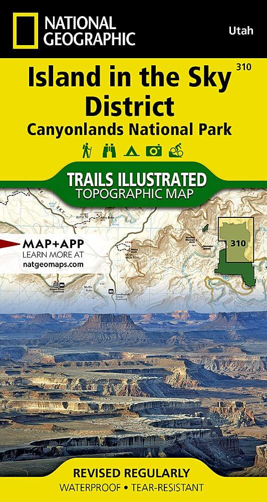
Wandelkaart 310 Canyonlands NP - Island in the Sky District
Gelegen in het Zuidoosten van Utah, dichtbij de stad Moab
Korte omschrijving
TOPO Wandelkaart 310 -Canyonlands NP - Island in the Sky District Productomschrijving: Canyonlands National Park is een Amerikaans nationaal park gelegen in het Zuidoosten van Utah, dichtbij...

Specificaties
- Uitgever: National Geographic
- ISBN-13: 9781566954600
- HOOFDCATEGORIEËN: Wandelkaart
- Activiteiten: Wandelen, Hiking & Trekking
- Regio: Utah, USA
- Land: Verenigde Staten van Amerika (USA)
- Nationale parken: Canyonlands NP, Utah USA
- Schaal: 1:35000
- Afmeting: 10x19
- Taal: Engels
Volledige omschrijving
TOPO Wandelkaart 310 -Canyonlands NP - Island in the Sky District
Productomschrijving: Canyonlands National Park is een Amerikaans nationaal park gelegen in het Zuidoosten van Utah, dichtbij de stad Moab. Het park omvat een kleurrijk landschap, geerodeerd in verschillende canyons door het water van de Colorado River. Het park is verdeeld in 4 districten: the Island in the Sky District, the Needles district, the Maze district, en the combined rivers—the Green & Colorado rivieren
Algemene kaart : 9781566953269
the Island in the Sky District - 9781566954600
Needles district - 9781566954617
Maze district - 9781566954624

Locatie op kaart
Gekoppelde artikelen

Wandelkaart 311 Canyonlands NP - Needles District - Natgeo • 9781566954617
standaard versieTOPO Wandelkaart 311 - Canyonlands NP - Needles District Productomschrijving: Canyonlands National Park is een Amerikaans nationaal park gelegen in het Zuidoosten van Utah, dichtbij de stad Moab. Het park omvat een kleurrijk landschap, geerodeerd in verschillende canyons door het water van de Colorado River. Het park is verdeeld in 4 districten: the Island in the Sky District, the Needles …

Wandelkaart 312 Canyonlands NP - Maze District - Natgeo • 9781566954624
standaard versieTopografische Wandelkaart 312 - Canyonlands NP - Natgeo Productomschrijving: Canyonlands National Park is een Amerikaans nationaal park gelegen in het Zuidoosten van Utah, dichtbij de stad Moab. Het park omvat een kleurrijk landschap, geerodeerd in verschillende canyons door het water van de Colorado River. Het park is verdeeld in 4 districten: the Island in the Sky District, the Needles …
Overzichtskaarten

NAT GEO Utah trail maps
NAT GEO Utah trail maps

Producten op de overzichtskaart
Klik op een product om naar de detailpagina te gaan.
- Wandelkaart 210 Canyonlands NP - Utah - Natgeo
- Wandelkaart 211 Arches National Park- Utah - Natgeo
- Wandelkaart 214 Zion National Park - Natgeo
- Wandelkaart 219 Bryce Canyon NP Utah - Natgeo
- Wandelkaart 220 Dinosaur National Monument - Natgeo
- Wandelkaart 267 Capitol Reef NP Utah - Natgeo
- Wandelkaart 310 Canyonlands NP - Island in the Sky District
- Wandelkaart 311 Canyonlands NP - Needles District - Natgeo
- Wandelkaart 312 Canyonlands NP - Maze District - Natgeo
- Wandelkaart 702 Cedar Mountain - Utah USA - Nat Geo
- Wandelkaart 703 Manti-La Sal National forest - Natgeo
- Wandelkaart 704 Flaming Gorge- Recreational Area - Utah
- Wandelkaart 705 Mount Dutton & Aquarius Plateau - Nat Geo
- Wandelkaart 213 Glen Canyon & Capitol Reef NP - Nat Geo
NAT GEO Utah trail maps
NAT GEO Utah trail maps
Producten op de overzichtskaart
Klik op een product om naar de detailpagina te gaan.
- Wandelkaart 210 Canyonlands NP - Utah - Natgeo
- Wandelkaart 211 Arches National Park- Utah - Natgeo
- Wandelkaart 214 Zion National Park - Natgeo
- Wandelkaart 219 Bryce Canyon NP Utah - Natgeo
- Wandelkaart 220 Dinosaur National Monument - Natgeo
- Wandelkaart 267 Capitol Reef NP Utah - Natgeo
- Wandelkaart 310 Canyonlands NP - Island in the Sky District
- Wandelkaart 311 Canyonlands NP - Needles District - Natgeo
- Wandelkaart 312 Canyonlands NP - Maze District - Natgeo
- Wandelkaart 703 Manti-La Sal National forest - Natgeo
- Wandelkaart 704 Flaming Gorge- Recreational Area - Utah
- Wandelkaart 709 Wasatch Front North Utah - Nat Geo
- Wandelkaart 710 Canyons of the Escalante NP - Nat Geo
- Wandelkaart 213 Glen Canyon & Capitol Reef NP - Nat Geo
Artikelen uit dezelfde regio

Wandelkaart 705 Mount Dutton & Aquarius Plateau - Nat Geo • 9781566954150
Wandelkaart Mount Dutton & Aquarius Plateau - Nat Geo Omvat: Black Butte, Bryce Canyon National Park, Dixie National Forest, Paunsaugunt Plateau, Pink Cliffs, Sevier Plateau. Engelse omschrijving: This map covers the spectacularly scenic stretch in southern Utah of the Powell and Escalante Ranger Districts of Dixie National Forest—from Bicknell Bottom State Wildlife Area in the Northw…

Reisgids USA Southwest & National Parks - DK Eyewitness • 9780241365519
USA Southwest & National Parks Omvat: Arizona, Las Vegas, Southern Utah, the Four Corners & New Mexico. Productomschrijving: Staar naar de diepten van de Grand Canyon, ervaar de glitter en glamour van de Las Vegas strip, beklim de rotsachtige overspanningen van Arches National Park of wandel door het historische Santa Fe: alles wat u moet weten is overzichtelijk weergegeven in kleurgec…

Wandelkaart 211 Arches National Park- Utah - Natgeo • 9781566953276
TOPO Wandelkaart 211 - Trails Illustrated Arches NP - Utah Productomschrijving: Het Arches National Park is een iets kleiner exemplaar onder die van Amerika vergeleken uiteraard. Het Park is beroemd omwille van de vele speciale rotsformaties en balancerende rotsen zoals de Courthouse Towers, Windows Section, Fiery Furnace, Devils Garden, Klondike Bluffs en de Balanced Rock. Er zijn meer da…

Wandelkaart 707 Fish Lake - Manti- Utah Natgeo • 9781566953306
TOPO Wandelkaart 707 - Fish Lake - Manti- Utah - Nat Geo Productomschrijving: Fish Lake is een soort Alpine meer gelegen op 2,700 m in Fishlake op de zuidelijke Wasatch Plateau regio van zuid-centraal Utah, United States. Het ligt binnen het Fishlake National Forest. Fish Lake is 7.9 km lang en 1.3 km breedt, en ligt in een geologische structuur gekend als "graben valley". Engelse oms…

Reisgids Zuidwest Amerika - Insight Guides • 9789066554801
Zuidwest Amerika - Insight Guides Productomschrijving: Zuidwest-Amerika is een fenomenaal mooi gebied dat zich uitstrekt over verschillende staten. Dit boek voert u mee door Arizona, New Mexico, Zuid-Utah en delen van Colorade, Texas en Nevada, inclusief Las Vegas. De auteurs en fotografen laten u op de bekende, onovertroffen en veelvuldig bekroonde Insight Guide -wijze in woord en bee…