
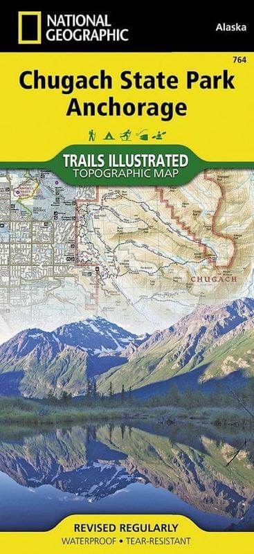
Wandelkaart 764 Chugach State Park- Anchorage - Natgeo
Omvat een dikke 2004 M² KM direct ten oosten van Anchorage
Korte omschrijving
TOPO Wandelkaart 764 - Chugach State Park- Anchorage - Natgeo Productomschrijving: Chugach State Park omvat een dikke 2004 M² KM, direct ten oosten van Anchorage Bowl in south-central Alaska...

Specificaties
- Uitgever: National Geographic
- ISBN-13: 9781566956789
- HOOFDCATEGORIEËN: Wandelkaart
- Regio: Alaska, USA
- Land: Verenigde Staten van Amerika (USA)
- Regionale parken: Chugach State Park, Anchorage Alaska USA
- Schaal: 1:75000
- Afmeting: 10x19, 11x24
- Taal: Engels
Volledige omschrijving
TOPO Wandelkaart 764 - Chugach State Park- Anchorage - Natgeo
Productomschrijving: Chugach State Park omvat een dikke 2004 M² KM, direct ten oosten van Anchorage Bowl in south-central Alaska.
Engelse omschrijving: National Geographic's Trails Illustrated map of Chugach State Park and Anchorage combines unmatched detail with helpful information to offer an invaluable tool for making the most of your visit to this exciting region. Expertly researched and created in partnership with local land management agencies, this map features key points of interest including Eklutna Lake, Knik River, Penguin Creek, North Fork Eagle River, and the communities of Anchorage, Eagle River, and Alyeska. Portions of Tony Knowles Coast Trail, Iditarod National Historic Trail, and Glenn Highway and Seward Highway scenic byways are shown, as well.
Whether you're traveling by horse, skis, snowmobile or on foot, you'll find trails marked according to your desired use. Trail mileage between intersections and handy summaries of Anchorage parks and trails will help you choose the path that's right for you. There is also an elevation profile of Crow Pass Trail. Some of the many recreation features shown include campgrounds, public cabins, yurts, trailheads, interpretive trails, rifle ranges, and river access locations for paddling and fishing. Helpful information about recreation activities available in the region, regulations, and safety tips are included as well. The map base includes contour lines, shaded relief, elevations for summits, and depth soundings and other navigational aids for boating. Every Trails Illustrated map is printed on "Backcountry Tough" waterproof, tear-resistant paper. A full UTM grid is printed on the map to aid with GPS navigation.
Other features found on this map include: Chickaloon River, Chugach National Forest, Eklutna Lake, Inner Lake George, Knik River, Matanuska River, Turnagain Arm, Upper Lake George.
Locatie op kaart
Artikelen uit dezelfde regio

Reisgids Alaska Escapade dans le Yukon - Petit Futé • 9782305078830
Alaska & Escapade dans le Yukon - Petit Futé Productomschrijving: Welkom in een van de laatste overgebleven natuurlijke paradijzen op onze prachtige planeet. Besneeuwde toppen zover het oog reikt, immense bossen, toendra's die trillen onder de hoeven van kariboes, otters die tussen de walvissen doorscharrelen aan de voet van enorme gletsjers, kale adelaars die de rivieren afspeuren - de na…

Wandelkaart 760 Kenai National Wildlife Refuge - Alaska - Nat Geo • 9781566953733
TOPO Wandelkaart 760 - Kenai National Wildlife Refuge - Alaska Productomschrijving: The Kenai National Wildlife Refuge is a 1.92-million-acre (7,770 km2) wildlife habitat preserve located on the Kenai Peninsula of Alaska, United States. It is adjacent to Kenai Fjords National Park. Engelse omschrijving: National Geographic's Trails Illustrated map of Kenai National Wildlife Refuge was …

Wandelkaart 255 Glacier Bay NP- Alaska - Nat Geo • 9781566953863
TOPO Wandelkaart 255 - Glacier Bay NP- Alaska - Nat Geo Productomschrijving: Glacier Bay National Park and Preserve is een nationaal park ter grootte van 13.287 km² in het zuiden van Alaska in de Verenigde Staten. Het park kan alleen over water of door de lucht worden bereikt omdat er geen wegen naartoe lopen. Desondanks bezoeken jaarlijks gemiddeld 380.000 bezoekers het park. Engelse…

Wandelkaart 763 Kachemak Bay State Park - Alaska - Nat Geo • 9781566950749
Wandelkaart Kachemak Bay State Park, Homer Alaska Omvat: Anchor Point, Chugach Islands, Fox River, Gore Point, Kachemak Bay, Kalgin Island, Kenai Fjords National Park, Kennedy Entrance, Nuka Bay, Nuka Island, Point Adam, Point Pogibshi, Port Dick, Tustumena Lake. Engelse omschrijving: Outdoor enthusiasts exploring the various public recreation lands in the southwestern part of the Kena…

Wandelkaart 248 Katmai NP- Alaska - Nat Geo • 9781566952903
TOPO Wandelkaart 248 - Katmai NP- Alaska - Nat Geo Productomschrijving: Katmai National Park is een Amerikaans nationaal park in het zuiden van de staat Alaska, gelegen op het Alaska-schiereiland. Het ligt ongeveer 450 kilometer ten zuidwesten van de stad Anchorage. Het gebied is alleen per boot of vliegtuig te bereiken. Engelse omschrijving: Known for its large population of bears an…