
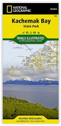
Wandelkaart 763 Kachemak Bay State Park - Alaska - Nat Geo
The southwestern part of the Kenai Peninsula- Homer Alaska
Korte omschrijving
Wandelkaart Kachemak Bay State Park, Homer Alaska Omvat: Anchor Point, Chugach Islands, Fox River, Gore Point, Kachemak Bay, Kalgin Island, Kenai Fjords National Park, Kennedy Entrance, Nuka...

Specificaties
- Uitgever: National Geographic
- ISBN-13: 9781566950749
- HOOFDCATEGORIEËN: Wandelkaart
- Activiteiten: Wandelen, Hiking & Trekking
- Regio: Alaska, USA
- Land: Verenigde Staten van Amerika (USA)
- Waterafstotende kaart: Nat Geo waterproof series
- Schaal: 1:110000
- Afmeting: 11x24
- Taal: Engels
Volledige omschrijving
Wandelkaart Kachemak Bay State Park, Homer Alaska
Omvat: Anchor Point, Chugach Islands, Fox River, Gore Point, Kachemak Bay, Kalgin Island, Kenai Fjords National Park, Kennedy Entrance, Nuka Bay, Nuka Island, Point Adam, Point Pogibshi, Port Dick, Tustumena Lake.
Engelse omschrijving: Outdoor enthusiasts exploring the various public recreation lands in the southwestern part of the Kenai Peninsula will find National Geographic's Trails Illustrated map of Kachemak Bay State Park an essential travel companion. This expertly researched map was created in cooperation with the National Park Service, Alaska State Parks and others. Coverage includes Kachemak Bay, State Park and Wilderness Park; Kenai Mountains, National Wildlife Refuge and Wilderness; southwestern Kenai Fjords National Park; Sterling Highway and its many recreation areas, from Soldotna to Homer, Tustumena Lake and Cook Inlet.
Navigate around the area by following along mapped highways, roads and various trails, including trails crossing private lands or with the aid of pinpointed seaplane bases, kayak landing beaches, mooring buoys and anchorage sites. Hiking trails are shown with mileage markers between intersections. Your expedition will be aided by displayed contour lines, elevations, peaks, summits, water features, glaciers, selected waypoints and clearly labeled areas of private, public and native lands. Recreation features include campgrounds, campsites, public cabins, picnic areas and shelters, boat launches, fishing holes, cross-country ski areas, potable water and water sources that require treatment. Essential park information is also provided, including background information, safety tips, points of interest, park guidelines and contact information.
Every Trails Illustrated map is printed on "Backcountry Tough" waterproof, tear-resistant paper. A full UTM grid is printed on the map to aid with GPS navigation.
Locatie op kaart
Overzichtskaarten

NAT GEO Alaska trails map
NAT GEO Alaska trails map

Producten op de overzichtskaart
Klik op een product om naar de detailpagina te gaan.
- Wandelkaart 231 Kenai Fjords NP- Alaska - Nat Geo
- Wandelkaart 248 Katmai NP- Alaska - Nat Geo
- Wandelkaart 254 Chilkoot Trail - Klondike Gold Rush - Nat Geo
- Wandelkaart 255 Glacier Bay NP- Alaska - Nat Geo
- Wandelkaart 257 Gates of the Arctic NP- Alaska - Nat Geo
- Wandelkaart 760 Kenai National Wildlife Refuge - Alaska - Nat Geo
- Wandelkaart 761 Prince William Sound West - Alaska - Nat Geo
- Wandelkaart 763 Kachemak Bay State Park - Alaska - Nat Geo
Artikelen uit dezelfde regio

Wandelkaart 257 Gates of the Arctic NP- Alaska - Nat Geo • 9781566953764
TOPO Wandelkaart 257 - Gates of the Arctic NP - Alaska Productomschrijving: Het Gates of the Arctic National Park and Preserve is een nationaal park ten noorden van de noordpoolcirkel in de Amerikaanse staat Alaska. Het is het meest noordelijk gelegen en op een na grootste nationale park van de Verenigde Staten. Met een oppervlakte van 34.287 km² is het park iets kleiner dan Zwitserland. …

Klimgids Denali - Mt McKinley - Rucksack reades • 9781898481539
Klimgids Denali - Mt McKinley - Summit of North America Productomschrijving: Met zijn 6194 m (20,320 ft) is Denali (Mt McKinley) de hoogste berg in Noord-Amerika. De Arctische latitude zorgt voor extreme weersomstandigheden en de afgelegen wildernis van Alaska betekent dat klimteams zelfstandig en ervaren moeten zijn. De auteur richte zich op de westelijke Buttress route die wordt gebruikt…

Wandelkaart 255 Glacier Bay NP- Alaska - Nat Geo • 9781566953863
TOPO Wandelkaart 255 - Glacier Bay NP- Alaska - Nat Geo Productomschrijving: Glacier Bay National Park and Preserve is een nationaal park ter grootte van 13.287 km² in het zuiden van Alaska in de Verenigde Staten. Het park kan alleen over water of door de lucht worden bereikt omdat er geen wegen naartoe lopen. Desondanks bezoeken jaarlijks gemiddeld 380.000 bezoekers het park. Engelse…

Wandelkaart 760 Kenai National Wildlife Refuge - Alaska - Nat Geo • 9781566953733
TOPO Wandelkaart 760 - Kenai National Wildlife Refuge - Alaska Productomschrijving: The Kenai National Wildlife Refuge is a 1.92-million-acre (7,770 km2) wildlife habitat preserve located on the Kenai Peninsula of Alaska, United States. It is adjacent to Kenai Fjords National Park. Engelse omschrijving: National Geographic's Trails Illustrated map of Kenai National Wildlife Refuge was …

Wandelkaart 249 Wrangell St.Elias NP - Nat.Geo. • 9781566953825
Wrangell St.Elias NP - National Geographic Productomschrijving: Met 13,2 miljoen hectare, zou Wrangell-St. Elias binnen de grenzen passen van Yellowstone, Grand Canyon, Glacier, Olympic en Yosemite National Parks met zelf nog ruimte over. Het strekt zich uit van een van de hoogste toppen van Noord-Amerika > Mount Stain Elias, tot aan de oceaan. Meer dan een kwart van het park is bedekt met…