
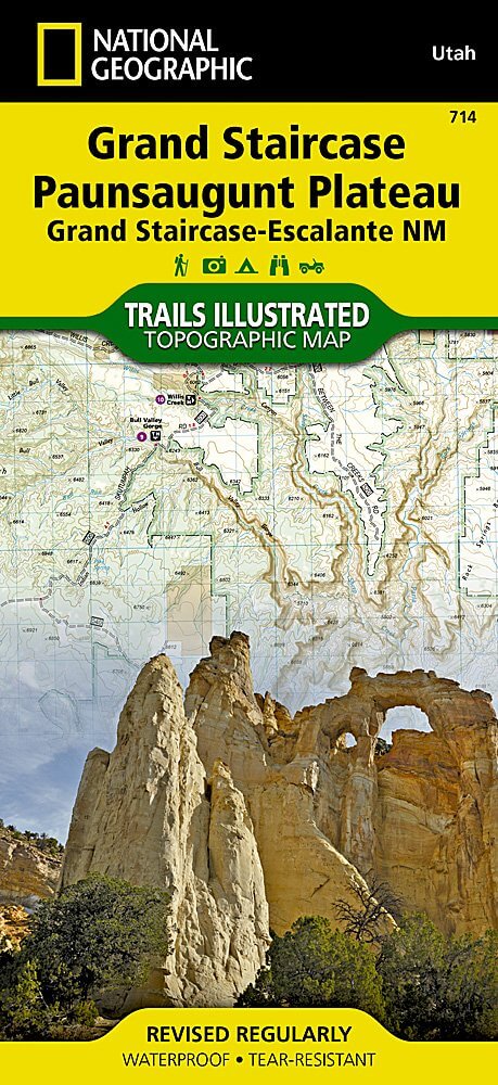
Wandelkaart 714 Grand Staircase - Natgeo
Een gebied van 7571 km² in het zuiden van Utah in de USA
Korte omschrijving
TOPO Wandelkaart 714 - Grand Staircase - Utah - Nat Geo Productomschrijving: Grand Staircase-Escalante National Monument is een gebied van 7571 km² in het zuiden van Utah in de Verenigde Sta...

Specificaties
- Uitgever: National Geographic
- ISBN-13: 9781566956864
- HOOFDCATEGORIEËN: Wandelkaart
- Regio: Utah, USA
- Land: Verenigde Staten van Amerika (USA)
- Schaal: 1:75000
- Afmeting: 10x19
- Taal: Engels
Volledige omschrijving
TOPO Wandelkaart 714 - Grand Staircase - Utah - Nat Geo
Productomschrijving: Grand Staircase-Escalante National Monument is een gebied van 7571 km² in het zuiden van Utah in de Verenigde Staten. Er zijn drie belangrijke gebieden: de Grand Staircase, het Kaiparowits Plateau, en de Canyons van de Escalante.
Engelse omschrijving: Outdoor enthusiasts seeking to enjoy the abundance of public lands and endless recreational opportunities in southern Utah will marvel at National Geographic's Trails Illustrated map of Grand Staircase and Paunsaugunt Plateau. Created in cooperation with the Bureau of Land Management, U.S. Forest Service, National Park Service and others, this expertly researched map provides unmatched detail between Utah towns Hatch in the northwest to Big Water in the southeast.
Coverage includes popular recreation areas Dixie National Forest, Bryce Canyon National Park, Grand Staircase-Escalante National Monument, Kodachrome Basin State Park and Wilderness Study areas The Blues, Carcass Canyon, Death Ridge, Mud Spring Canyon, Paria-Hackberry, Burning Hills, The Cockscomb and Wahweap.
Get off the beaten path and back on again by following along designated hiking, horseback riding, biking and motorized trails, shown with mileage markers between intersections, including the Great Western Trail and Paunsaugunt ATV Trail. Also mapped is a complete road network, including Forest Service, BLM and high-clearance roads as well as state and national scenic byways. Your navigation will be aided by the map's contour lines, elevations, labeled peaks and summits, water features, areas of wooded cover and color-coded boundaries between different land management agencies.
Some pinpointed recreation features are campgrounds, primitive campsites, backcountry cabins, RV dump stations, interpretive trails, boat ramps, picnic areas and scenic viewpoints. In addition, find background information about the area, survival tips, a point of interest guide and a QR code for current weather information.Every Trails Illustrated map is printed on "Backcountry Tough" waterproof, tear-resistant paper. A full UTM grid is printed on the map to aid with GPS navigation.
Other features found on this map include: Black Butte, Bryce Canyon National Park, Dixie National Forest, Kaiparowits Plateau, Paunsaugunt Plateau, Pink Cliffs, The Cockscomb, White Cliffs.
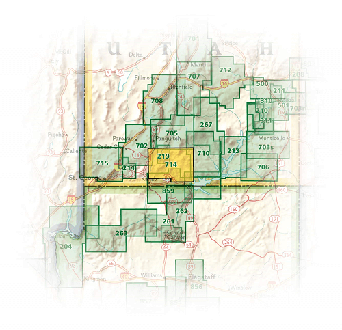
Locatie op kaart
Artikelen uit dezelfde regio

Reisgids Californië- Arizona- Nevada & Utah - Gottmer • 9789025779139
Californië- Arizona- Nevada & Utah van Gottmer Productomschrijving: Of je nu nieuwsgierig bent naar cultuurbepalende wereldsteden als San Francisco en Los Angeles dan wel je juist graag terugtrekt in de natuur: de zuidwestelijke hoek van de VS is voor iedereen een gebied vol hoogtepunten. Californië trekt het grootste aantal bezoekers, gevolgd door de Grand Canyon in Arizona, de nationale …

Wandelkaart 267 Capitol Reef NP Utah - Natgeo • 9781566956703
Wandelkaart Capitol Reef NP Utah - Nat Geo Productomschrijving: Capitol Reef National Park is een verborgen juweel gelegen in de Waterpocket Fold, een rimpel in de aarde die zich uitstrekt bijna 100 mijl door het zuiden-centrale rode rots land van Utah. National Geographic's Trails Illustrated kaart van Capitol Reef biedt ongeëvenaarde details van het park om tegemoet te komen aan de behoe…

Wandelkaart 700 Ogden- Monte Cristo Range Utah USA - Nat Geo • 9781566956345
Ogden- Monte Cristo Range- Utah USA - Nat Geo Productomschrijving: Outdoor enthousiastelingen die willen genieten van de grenzeloze recreatieve mogelijkheden in het noorden van Utah net ten oosten van Great Salt Lake zullen zich vergapen aan National Geographic's Trails Illustrated kaart van Ogden en de Monte Cristo Range. Ontworpen met een breed scala van bezoekers in het achterhoofd, wer…

Wandelkaart 703 Manti-La Sal National forest - Natgeo • 9781566953771
TOPO Wandelkaart 703 - Manti-La Sal National forest - Nat Geo Productomschrijving: Het Manti–La Sal National Forest omvat meer dan 4,900 km, en is gelegen in centraal- en zuidoostelijke deel van Utah en het extreme westelijke deel van Colorado. Engelse omschrijving: Expertly researched and created in cooperation with the U.S. Forest Service, Bureau of Land Management and others, Natio…

Reisgids Utah's national parks - Lonely planet • 9781838699857
Utah's national parks - Lonely planet Productomschrijving: Lonely Planet Zion & Bryce National Parks is jou paspoort voor het meest relevante, actuele advies over wat je moet zien en overslaan, en welke verborgen ontdekkingen er op je wachten. Wandel de Cable Mountain trail in Zion, rijd op een paard of muilezel door Bryce of ga zwemmen of tuben in Zion's Virgin River, allemaal met je vert…