
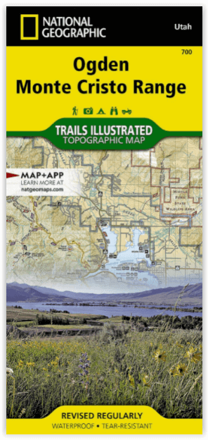
Wandelkaart 700 Ogden- Monte Cristo Range Utah USA - Nat Geo
Ontworpen voor echte de outdoor enthousiastelingen
Korte omschrijving
Ogden- Monte Cristo Range- Utah USA - Nat Geo Productomschrijving: Outdoor enthousiastelingen die willen genieten van de grenzeloze recreatieve mogelijkheden in het noorden van Utah net ten ...

Specificaties
- Uitgever: National Geographic
- ISBN-13: 9781566956345
- HOOFDCATEGORIEËN: Wandelkaart
- Activiteiten: Wandelen, Hiking & Trekking
- Regio: Utah, USA
- Land: Verenigde Staten van Amerika (USA)
- Schaal: 1:75000
- Afmeting: 11x24
- Taal: Engels
Volledige omschrijving
Ogden- Monte Cristo Range- Utah USA - Nat Geo
Productomschrijving: Outdoor enthousiastelingen die willen genieten van de grenzeloze recreatieve mogelijkheden in het noorden van Utah net ten oosten van Great Salt Lake zullen zich vergapen aan National Geographic's Trails Illustrated kaart van Ogden en de Monte Cristo Range. Ontworpen met een breed scala van bezoekers in het achterhoofd, werd deze deskundig onderzochte kaart gemaakt in samenwerking met de U.S. Forest Service en anderen.
De kaart omvat vele populaire recreatiepunten, waaronder Cache en Wasatch National Forests, Antelope Island, Willard Bay en East Canyon State Parks, East Canyon, Ogden Bay, Brigham Face en Middle Fork State Wildlife Areas, Wasatch en Bear River Ranges, Pineview Reservoir, en Ogden River. Een nauwkeurig wegennet tussen Brigham City en North Salt Lake wordt ook getoond.
Omvat eveneens: Antelope Island, Bountiful, Brigham City, Cache National Forest, Centerville, Clearfield, Clinton, Farmington, Kaysville, Layton, Little Bear River, Monte Cristo Range, North Ogden, North Salt Lake, Ogden, Pineview Reservoir, Roy, South Ogden, Syracuse, Wasatch National Forest, Weber River.
Engelse omschrijving: Outdoor enthusiasts looking to enjoy the limitless recreational opportunities in northern Utah just east of Great Salt Lake will marvel at National Geographic's Trails Illustrated map of Ogden and the Monte Cristo Range. Designed with a wide range of visitors in mind, this expertly researched map was created in cooperation with the U.S. Forest Service and others. The map covers many popular recreation points of interest, including Cache and Wasatch National Forests, Antelope Island, Willard Bay and East Canyon State Parks, East Canyon, Ogden Bay, Brigham Face and Middle Fork State Wildlife Areas, Wasatch and Bear River Ranges, Pineview Reservoir, and Ogden River. An accurate road network between Brigham City and North Salt Lake is also shown.
Select an area to explore with the aid of activity guides that list the location, elevation, available facilities and other information of various campgrounds, marinas and picnic grounds. Clearly mapped trails are shown with mileage markers, including part of the Great Western Trail, and are labeled according to designated usage, whether exploring on foot, horseback, mountain bike, motorcycle or ATV. Winter trails are also shown and labeled for ski or snowmobile use. To aid in your navigation, the map includes contour lines, elevations, labeled peaks and summits, and water features. Some of the other recreation features pinpointed are trailheads, paved biked roads, river access points, canoeing, kayaking and swimming areas, shooting ranges, ski areas, yurts and horse corrals.
Every Trails Illustrated map is printed on "Backcountry Tough" waterproof, tear-resistant paper. A full UTM grid is printed on the map to aid with GPS navigation.

Locatie op kaart
Artikelen uit dezelfde regio

Wandelkaart 703 Manti-La Sal National forest - Natgeo • 9781566953771
TOPO Wandelkaart 703 - Manti-La Sal National forest - Nat Geo Productomschrijving: Het Manti–La Sal National Forest omvat meer dan 4,900 km, en is gelegen in centraal- en zuidoostelijke deel van Utah en het extreme westelijke deel van Colorado. Engelse omschrijving: Expertly researched and created in cooperation with the U.S. Forest Service, Bureau of Land Management and others, Natio…

Wandelkaart 210 Canyonlands NP - Utah - Natgeo • 9781566953269
TOPO Wandelkaart 210 - Canyonlands NP - Utah - Nat geo Productomschrijving: Canyonlands National Park is een Amerikaans nationaal park gelegen in het Zuidoosten van Utah, dichtbij de stad Moab. Het park omvat een kleurrijk landschap, geerodeerd in verschillende canyons door het water van de Colorado River. The park is verdeeld in 4 districten: the Island in the Sky District, the Needles d…

Wandelkaart 219 Bryce Canyon NP Utah - Natgeo • 9781566953207
TOPO Wandelkaart 219 - Bryce Canyon NP Utah - Natgeo Productomschrijving: Bryce Canyon Nationaal Park is een Amerikaans nationaal park gelegen in het zuidwesten van Utah. De hoofd atractie in het park is Bryce Canyon, die ondanks zijn naam, geen echte canyon is, maar een collectie van lange natuurlijke amphitheaters langs de oostelijke zijde van het Paunsaugunt Plateau. Engelse omschri…

Wandelkaart 710 Canyons of the Escalante NP - Nat Geo • 9781566953245
Wandelkaart Canyons of the Escalante NP - Nat Geo Productomschrijving: Dit National monument omvat drie belangrijke gebieden, de Grand Staircase, het Kaiparowits Plateau, en de Canyons van de Escalante. De regio omvat de steden van Big Water, Glendale en Kanab in Utah in het zuidwesten en de steden van Escalante en Boulder in het noordoosten Omvat: Box-Death Hollow Wilderness, Capitol …

Wandelkaart 702 Cedar Mountain - Utah USA - Nat Geo • 9781566953061
Wandelkaart Cedar Mountain - Utah USA - Nat Geo Omvat: Ashdown Gorge Wilderness, Brian Head, Dixie National Forest, Kolob Terrace, Little Salt Lake, Markagunt Plateau, Panguitch Lake, Parowan Valley, Pine Valley Mountain Wilderness, Pine Valley Mountains, Signal Peak. Engelse omschrijving: Cedar City is the headquarters of the Dixie National Forest which is a two-million-acre, 170-mile…