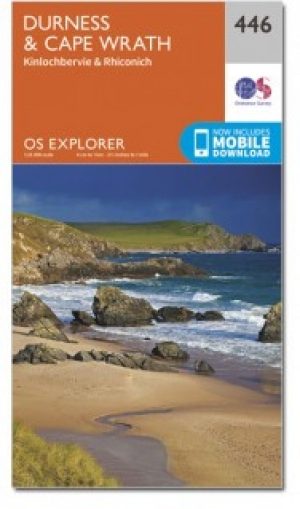
Wandelkaart 446 Durness & Cape Wrath Schotland - OSI
NW Sutherland- Loch Eriboll & Kinlochbervie
Korte omschrijving
Wandelkaart Durness & Cape Wrath - Highlands Schotland Productbeschrijving: Kinlochbervie & Rhiconich. 446 / Durness & Cape Wrath, Highlands, Schotland - Kaart nummer 446 omvat Durness ...

Specificaties
- Uitgever: Ordnance Survey
- ISBN-13: 9780319246894
- HOOFDCATEGORIEËN: Wandelkaart
- Activiteiten: Wandelen, Hiking & Trekking
- Regio: Highlands, Schotland
- Land: Schotland
- Schaal: 1:25000
- Afmeting: 13x23
- Taal: Engels
- Reeks: Explorer Series OSI
Volledige omschrijving
Wandelkaart Durness & Cape Wrath - Highlands Schotland
Productbeschrijving: Kinlochbervie & Rhiconich.
446 / Durness & Cape Wrath, Highlands, Schotland - Kaart nummer 446 omvat Durness en Cape Wrath. Hoogtepunten zijn North-West Sutherland, Loch Eriboll, Kinlochbervie, Kyle van Durness en Sandwood Loch. Omvat ook Rhiconich, Loch nb Gainmhich en Loch Meidaidh. De OS Explorer kaart voor Durness & Cape Wrath is beschikbaar in zowel de standaard papieren versie als weerbestendige 'Actief' versie.
446 / Durness & Cape Wrath, Highlands, Schotland - Map sheet number 446 covers Durness and Cape Wrath. Highlights include North-West Sutherland, Loch Eriboll, Kinlochbervie, Kyle of Durness and Sandwood Loch. Also includes Rhiconich, Loch na Gainmhich and Loch Meidaidh. The OS Explorer map for Durness & Cape Wrath is available in both the standard paper version and weatherproof 'Active' version.
Locatie op kaart
Gekoppelde artikelen

Wandelkaart 446 Durness & Cape Wrath Schotland - OSI • 9780319246894
standaard versieWandelkaart Durness & Cape Wrath - Highlands Schotland Productbeschrijving: Kinlochbervie & Rhiconich. 446 / Durness & Cape Wrath, Highlands, Schotland - Kaart nummer 446 omvat Durness en Cape Wrath. Hoogtepunten zijn North-West Sutherland, Loch Eriboll, Kinlochbervie, Kyle van Durness en Sandwood Loch. Omvat ook Rhiconich, Loch nb Gainmhich en Loch Meidaidh. De OS Explorer kaart voor…

Wandelkaart 446 Durness & Cape Wrath- Schotland - OSI • 9780319472989
weatherproof versieWandelkaart Durness & Cape Wrath - Highland's Schotland Omvat ook: Kinlochbervie & Rhiconich. Productbeschrijving: Kaart nummer 446 omvat Durness en Cape Wrath. Hoogtepunten zijn North-West Sutherland, Loch Eriboll, Kinlochbervie, Kyle van Durness en Sandwood Loch. Omvat ook Rhiconich, Loch na Gainmhich en Loch Meidaidh. De OS Explorer kaart voor Durness & Cape Wrath is beschikbaar in …
Artikelen uit dezelfde regio

Wandelgids Great Glen Way - Rucksack Readers • 9781898481874
Wandelgids - Great Glen Way - Rucksack Readers Productomschirjving: De Great Glen Way loopt 124 km lang langs de Great Glen van Schotland tussen Fort William en Inverness. Het volgt het historische Caledonische kanaal en loopt langs vier van de mooiste meren van de Hooglanden, waaronder Loch Ness, beroemd om zijn monsterlegende en om Urquhart Castle. SecLons van de High Route bieden een pr…

Wandelkaart Ben Venue Loch Ard and Trossachs - Harvey maps • 9781851374618
Wandelkaart Ben Venue Loch Ard and Trossachs - Harvey maps Productomschrijving: Ben Venue met inbegrip van Loch Ard Forest deze kaart beslaat het gebied ten westen van Callander in het zuidoostelijke deel van het Nationaal Park, met inbegrip van Ben Venue, Loch Ard bos en de Trossachs. Loch Ard Forest is op grote schaal gebruikt voor mountainbiken en routes worden weergegeven op de kaart. …

Wandelkaart 373 Iona Staffa & Ross of Mull - OSI • 9780319246207
Wandelkaart Iona- Staffa & Ross of Mull - Schotland Productbeschrijving: Iona vroeger ook wel bekend als Hy, is een eiland aan de westkust van Schotland. 373 / Iona, Staffa & Ross of Mull, Highlands, Schotland - Kaart nummer 373 is een all purpose kaart vol gepakt met informatie om u het gebied te helpen leren kennen. De 204 Explorer-kaarten bestrijken het land. Elke kaart heeft een op…

Wandelkaart 414 Glen Shiel & Kintail Forest Schotland OSI • 9780319472699
Wandelkaart Glen Shiel & Kintail Forest - Highland's Schotland Omvat ook: Shiel Bridge, Morvich, Killilan & Kinloch Hourn. Productbeschrijving: Als u van plan bent om zoveel Munros mogelijk af te lopen, gaat u deze OS Explorer kaart 414 nodig hebben. Met 32 Munros op één dubbelzijdige kaart heeft dit gebied ook drie nationale natuurgebieden, Loch Cluanie en Loch Quoich. De OS Explorer …

Wandelgids The West Highland Way - Rucksack Readers • 9781913817213
The West Highland Way - Rucksack Readers Productomschrijving: Een unieke intussen zeer gekende wandelroute, die loopt van Milngavie nabij Glasgow tot Fort William door de Schotse Hooglanden. De Route is 152 km Lang en brengt u door de westelijke Highlands van Schotland starten vanuit Glasgow. Engelse omschrijving: The West Highland Way is the first, and remains the most famous, of Scot…


