
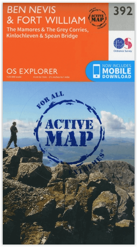
Wandelkaart 392 Ben Nevis- Highland's Schotland - OSI
Omvat het bergachtige gebied van Ben Nevi bij Fort William
Korte omschrijving
Wandelkaart Ben Nevis- Highland's Schotland - OSI The Mamores & The Grey Corries Kinlochleven & Spean Bridge. Productbeschrijving: Kaart nummer 392 in de OS Explorer kaart reeks is de pe...

Specificaties
- Uitgever: Ordnance Survey
- ISBN-13: 9780319472552
- HOOFDCATEGORIEËN: Wandelkaart
- Activiteiten: Wandelen, Hiking & Trekking
- Regio: Highlands, Schotland
- Land: Schotland
- Waterafstotende kaart: Ordnance Survey ACTIVE Explorer Weatherproof Maps
- Schaal: 1:25000
- Afmeting: 13x24
- Taal: Engels
Volledige omschrijving
Wandelkaart Ben Nevis- Highland's Schotland - OSI
The Mamores & The Grey Corries Kinlochleven & Spean Bridge.
Productbeschrijving: Kaart nummer 392 in de OS Explorer kaart reeks is de perfecte kaart om te gebruiken bij het verkennen van het bergachtige gebied van Ben Nevis, bij Fort William, The Mamores en The Grey Corries Kinlochleven Spean Bridge. Het gebied word bezocht door bergbeklimmers en wandelaars van alle hoeken van de wereld, of diegenen die willen genieten van het landschap. De OS Explorer kaart voor Ben Nevis & Fort William is beschikbaar in zowel de standaard papieren versie als de weerbestendige 'Actief' versie.
Productdiscription: Map sheet number 392 in the OS Explorer map series is the perfect map to use when exploring the mountainous area of Ben Nevis, Fort William, The Mamores and The Grey Corries Kinlochleven and Spean Bridge. The area is frequented by mountain climbers and hikers or those wishing to soak up the scenery. The OS Explorer map for Ben Nevis & Fort William is available in both the standard paper version and weatherproof 'Active' version.
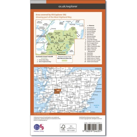
Locatie op kaart
Gekoppelde artikelen

Wandelkaart 392 Ben Nevis & Fort William- Highlands - OSI • 9780319246351
standaard versieWandelkaart Ben Nevis & Fort William - Highlands Schotland Productbeschrijving: The Mamores & The Grey Corries Kinlochleven & Spean Bridge. 392 / Ben Nevis & Fort William, Highlands, Schotland - Kaart nummer 392 in de OS Explorer kaart reeks is de perfecte kaart om te gebruiken bij het verkennen van het bergachtige gebied van Ben Nevis, Fort William, The Mamores en The Grey keteldale…

Wandelkaart 392 Ben Nevis- Highland's Schotland - OSI • 9780319472552
weatherproof versieWandelkaart Ben Nevis- Highland's Schotland - OSI The Mamores & The Grey Corries Kinlochleven & Spean Bridge. Productbeschrijving: Kaart nummer 392 in de OS Explorer kaart reeks is de perfecte kaart om te gebruiken bij het verkennen van het bergachtige gebied van Ben Nevis, bij Fort William, The Mamores en The Grey Corries Kinlochleven Spean Bridge. Het gebied word bezocht door bergbek…
Artikelen uit dezelfde regio

Mountainbikegids West & Norh West Schotland - Cicerone • 9781852847463
Mountainbikegids - West & Norh West Schotland - Cicerone Productomschrijving: Deze gids beschrijft 25 mountainbike routes in Noord- en Noord West Schotland, een gebied met inbegrip van Fort William, Rannoch Moor, Glen Spean, Invergarry, Loch Sunart, Strathfarrar, Kinlochewe, Sutherland, de Buiten-Hebriden en de bergen van Torridon. De routes variëren van 19,5 km tot 73.25 km, blauw, rood o…

Wandelkaart 407 Isle of Skye & Dunvegan Highland's - OSI • 9780319246429
Wandelkaart Isle of Skye & Dunvegan - Highland's Schotland Omvat ook: Waternish & Macleod’s Tables. Productbeschrijving: Kaart nummer 407 in de OS Explorer kaarten reeks is de perfecte kaart om te gebruiken bij het verkennen van "The Isle of Skye", Dunvegan, Waternish en de Macleod's tables. Het gebied is rijk aan geschiedenis en de perfecte plek om te genieten van kust wandelingen. Ho…

Wandelkaart 428 Kyle of Lochalsh Plockton & Applecross • 9780319246603
Wandelkaart Kyle of Lochalsh- Plockton & Applecross Productbeschrijving: Kyle of Lochalsh, Plockton & Applecross, Highlands Schotland. OS Explorer kaart 428 - Omvat de westelijke kant van de Wester Ross nationale Scenic Area. U kunt ook de ruige kustlijn en kleine dorpjes erkennen. De OS Explorer kaart voor Kyle van Lochalsh, Plockton & Applecross is beschikbaar in zowel de standaard …

Wandelkaart 446 Durness & Cape Wrath Schotland - OSI • 9780319246894
Wandelkaart Durness & Cape Wrath - Highlands Schotland Productbeschrijving: Kinlochbervie & Rhiconich. 446 / Durness & Cape Wrath, Highlands, Schotland - Kaart nummer 446 omvat Durness en Cape Wrath. Hoogtepunten zijn North-West Sutherland, Loch Eriboll, Kinlochbervie, Kyle van Durness en Sandwood Loch. Omvat ook Rhiconich, Loch nb Gainmhich en Loch Meidaidh. De OS Explorer kaart voor…

Wandelkaart 442 Assynt & Lochinver- Schotland - OSI • 9780319472941
Wandelkaart Assynt & Lochinver - Highland's Schotland Omvat ook: Kylesku & Inchnadamph. Productbeschrijving: Van Kylesku tot Lochinver en The Minch, het hele gebied werd aangewezen als een National Scenic Area. Er zijn 2 Munro's is dit gebied - Ben More Assynt staat met zijn 998m op kop. De OS Explorer kaart voor Assynt & Lochinver is beschikbaar in zowel als de standaard papieren vers…