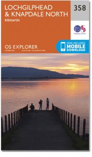
Wandelkaart 358 Lochgilphead & Knapdale North - OSI
Omvat het meeste van de Knapdale nationale Scenic Area
Korte omschrijving
Wandelkaart Lochgilphead & Knapdale North - Argyll & Bute Omvat ook: Kilmartin. Productbeschrijving: OS Explorer kaart 358 omvat Noord Knapdale, met inbegrip van het meeste van de nation...

Specificaties
- Uitgever: Ordnance Survey
- ISBN-13: 9780319472293
- HOOFDCATEGORIEËN: Wandelkaart
- Activiteiten: Wandelen, Hiking & Trekking
- Regio: Argyll & Bute, Schotland
- Land: Schotland
- Waterafstotende kaart: Ordnance Survey ACTIVE Explorer Weatherproof Maps
- Schaal: 1:25000
- Afmeting: 13x24
- Taal: Engels
- Reeks: Explorer ACTIVE Series OSI
Volledige omschrijving
Wandelkaart Lochgilphead & Knapdale North - Argyll & Bute
Omvat ook: Kilmartin.
Productbeschrijving: OS Explorer kaart 358 omvat Noord Knapdale, met inbegrip van het meeste van de nationale Scenic Area Knapdale, evenals Lochgilphead en de westelijke oever van Loch Fyne. De OS Explorer kaart voor Lochgilphead & Knapdale North is beschikbaar in zowel de standaard papieren versie als de weerbestendige 'Actief' versie.
Productdiscription: OS Explorer map 358 covers northern Knapdale, including most of the Knapdale National Scenic Area, as well as Lochgilphead and the western shores of Loch Fyne. The OS Explorer map for Lochgilphead & Knapdale North is available in both the standard paper version and weatherproof 'Active' version.
Locatie op kaart
Gekoppelde artikelen

Wandelkaart 358 Lochgilphead & Knapdale North - OSI • 9780319246092
standaard versieWandelkaart Lochgilphead & Knapdale North - Highland's Schotland Omvat ook: Kilmartin. Productbeschrijving: OS Explorer kaart 358 omvat Noord Knapdale, met inbegrip van de meeste van de nationale Scenic Area's Knapdale, evenals Lochgilphead en de westelijke oever van Loch Fyne. De OS Explorer kaart voor Lochgilphead & Knapdale North is beschikbaar in zowel de standaard papieren versie …

Wandelkaart 358 Lochgilphead & Knapdale North - OSI • 9780319472293
weatherproof versieWandelkaart Lochgilphead & Knapdale North - Argyll & Bute Omvat ook: Kilmartin. Productbeschrijving: OS Explorer kaart 358 omvat Noord Knapdale, met inbegrip van het meeste van de nationale Scenic Area Knapdale, evenals Lochgilphead en de westelijke oever van Loch Fyne. De OS Explorer kaart voor Lochgilphead & Knapdale North is beschikbaar in zowel de standaard papieren versie als de w…
Artikelen uit dezelfde regio

Wandelkaart 14 Tarbert & Loch Seaforth Schotland - OSI • 9780319261125
Wandelkaart Tarbert & Loch Seaforth - Schotland Productbeschrijving: De OS Landranger kaart 14 van Tarbert & Loch Seaforth bevat ook Maraig, Scalpay, Loch Langabhat, Grabhair, Caolas Stocinis, alsmede Tioga Moraym De OS Landranger kaarten reeks heeft betrekking op Groot-Brittannië met 204 gedetailleerde kaarten, perfect voor dagtochten en korte pauzes. Elke kaart bevat alle informatie …

Wandelkaart OL37 Cowal East- Dunoon & Iverary - OSI • 9780319469552
Wandelkaart Cowal East- Dunoon & Iverary - Argyl & Bute Omvat ook: Dunoon & Inveraray Productbeschrijving: Kaart nummer OL 37 omvat Cowal East, Dunoon & Inveraray. Hoogtepunten Loch Lomond en de Trossachs National Park, Argyll Forest Park en Kyles of Bute. Ook Loch Fyne, Holy Loch en West Island way. Deze kaart vervangt de vorige OS Explorer kaart 363 voor dit gebied. De OS Explorer ka…

Wandelkaart 352 Islay South Argyl & Bute- Schotland - OSI • 9780319246030
Wandelkaart Islay South - Argyl & Bute Schotland Omvat ook: Port Ellen, Bowmore & Bridgend Productomschrijving: Hier word de zuidelijke helft van Islay getoont op de Binnen-Hebriden, in de Schotse regio Argyl & Bute, en omvat OS Explorer kaart blad 352 ook het eiland 'kapitaal', Bowmore. U kunt er Port Ellen en het schiereiland van Oa verkennen. De OS Explorer kaart voor zuid Islay is …

Wandelkaart 362 Cowal West & Isle of Bute- Argyl & Bure • 9780319472330
Wandelkaart Cowal West & Isle of Bute - Argyl & Bute Schotland Omvat ook: Rothesay. Productbeschrijving: Kaart nummer 362 omvat Cowal West, Rothesay en the Isle of Bute. Hoogtepunten zijn Kyles of Bute, Loch Riddon en Loch Lomond en de Trossarchs National Park. Omvat ook Loch Fyne, Garbhallt en Kingarth. De OS Explorer kaart voor Cowal West & Isle of Bute is beschikbaar in zowel de sta…

Wandelkaart 63 Firth of Clyde Argyl & Bute Schotland - OSI • 9780319261613
Wandelkaart Firth of Clyde - Schotland Productbeschrijving: De diepe wateren rond de Firth of Clyde maakten hen ideaal voor zware schepen-gebouw in het verleden. Nu veel van de zware industrie is verdwenen, heeft het gebied nu een weer oplevende wildlife, met inbegrip van zeehonden, bruinvissen, dolfijn. Kaart OS Landranger 63 omvat ook Dunoon, Greenock, Port Glasgow, Rothesay, Millport, B…


