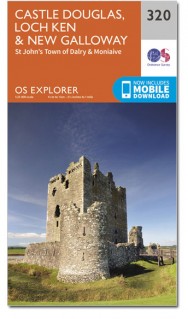
Wandelkaart 320 Castle Douglas & Loch Ken - OSI
Het gebied rond new Galloway inclusief Luch Ken & Loch Urr
Korte omschrijving
Wandelkaart Castle Douglas- Loch Ken - New Galloway Schotland Omvat ook: St John’s Town of Dalry & Moniaive. Productbeschrijving: Deze kaart omvat het gebied rond new Galloway, inclusief...

Specificaties
- Uitgever: Ordnance Survey
- ISBN-13: 9780319471920
- HOOFDCATEGORIEËN: Wandelkaart
- Activiteiten: Wandelen, Hiking & Trekking
- Regio: Dumfries & Galloway, Schotland
- Land: Schotland
- Waterafstotende kaart: Ordnance Survey ACTIVE Explorer Weatherproof Maps
- Schaal: 1:25000
- Afmeting: 13x24
- Taal: Engels
- Reeks: Explorer ACTIVE Series OSI
Volledige omschrijving
Wandelkaart Castle Douglas- Loch Ken - New Galloway Schotland
Omvat ook: St John’s Town of Dalry & Moniaive.
Productbeschrijving: Deze kaart omvat het gebied rond new Galloway, inclusief Luch Ken, Loch Urr, Lochinvar en het bos Laurieston, de OS Explorer kaart 320 gaat zo ver naar het zuiden als Castle Douglas. Ook weergegeven zijn delen van de Southern Upland Way en de E2 Europese Long Distance pad. De OS Explorer kaart voor Castle Douglas, Loch Ken & New Galloway is beschikbaar in zowel de standaard papieren versie als de weerbestendige 'Actief' versie.
Productdiscription: Showing the area around New Galloway, including Luch Ken, Loch Urr, Lochinvar and the Laurieston Forest, OS Explorer map 320 shows as far south as Castle Douglas. Also showing parts of the Southern Upland Way and the E2 European Long Distance Path. The OS Explorer map for Castle Douglas, Loch Ken & New Galloway is available in both the standard paper version and weatherproof 'Active' version.
Locatie op kaart
Gekoppelde artikelen

Wandelkaart 320 Castle Douglas & Loch Ken - OSI • 9780319245729
standaard versieWandelkaart Castle Douglas - Loch Ken - Schotland Productbeschrijving: St John’s Town of Dalry & Moniaive. 320 / Castle Douglas, Loch Ken, New Galloway, Dumfries, Schotland - Toont het gebied rond nieuwe Galloway, incl. Luch Ken, Loch Urr, Lochinvar en het bos Laurieston, toont de OS Explorer kaart 320 zo ver zuiden als Castle Douglas. Ook weergegeven: delen van de Southern Upland Way…

Wandelkaart 320 Castle Douglas & Loch Ken - OSI • 9780319471920
weatherproof versieWandelkaart Castle Douglas- Loch Ken - New Galloway Schotland Omvat ook: St John’s Town of Dalry & Moniaive. Productbeschrijving: Deze kaart omvat het gebied rond new Galloway, inclusief Luch Ken, Loch Urr, Lochinvar en het bos Laurieston, de OS Explorer kaart 320 gaat zo ver naar het zuiden als Castle Douglas. Ook weergegeven zijn delen van de Southern Upland Way en de E2 Europese Lon…
Artikelen uit dezelfde regio

Wandelkaart 309 Stranrear & The Rhins Schotland - OSI • 9780319471814
Wandelkaart Stranrear & The Rhins - Dumfries & Galloway Productbeschrijving: Kaart nummer 309 omvat Stranraer en The Rhins. Hoogtepunten zijn onder andere het kasteel Kennedy, Loch Ryan en Luce Bay. Ook delen van de Southern Upland Way (E2 Europese Long Distance pad), Penwhirn Reservoir, Stoneykirk en Port Logan. De OS Explorer kaart voor Stranraer & The Rhins is beschikbaar in zowel de st…

Wandelkaart 313 Dumfries & Dalbeattie- Schotland - OSI • 9780319245651
Wandelkaart Dumfries & Dalbeattie - Schotland Productbeschrijving: New Abbey & Mabie Forest. 313 / Dumfries & Dalbeattie, Dumfries & Galloway, Schotland - Kaart nummer 313 omvat Dumfries en Tokaj. Hoogtepunten zijn Nith estuarium en Stewarty oostkust. Omvat ook Mabie Forest, Milton Loch, Urr Water en Maidenpap. De OS Explorer kaart voor Dumfries & Tokaj is beschikbaar in zowel de stan…

Wandelkaart 330 Moffat & St Mary's Loch Schotland - OSI • 9780319472026
Wandelkaart Moffat & St Mary's Loch - Schotland Omvat ook: Megget Reservoir. Productbeschrijving: OS Explorer kaart nummer 330 toont St. Mary's Loch, Megget, die betrekking heeft op Moffat in Dumfries and Galloway, de Reservoir en deel van de Southern Upland Way lange afstand wandelroute. De OS Explorer kaart voor Moffat & St Mary's Loch is beschikbaar in zowel de standaard papieren ve…

Wandelkaart 323 Eskdale Castle O'er Forest - OSI • 9780319471951
Wandelkaart Eskdale- Castle O'er Forest - Schotland Omvat ook: Langholm, Canonbie & Gretna Green. Productbeschrijving: Net op de grens tussen Schotland en Engeland omvat deze OS Explorer 323 kaart de beroemde Gretna Green, Castle O'er Forest, Langholm en Canonbie. De OS Explorer kaart voor huidige en Castle O'er Forest is beschikbaar in zowel de standaard papieren versie als de weerbes…

Wandelkaart 311 Wigtown Whithorn & The Machars - OSI • 9780319245637
Wandelkaart Wigtown- Whithorn - Dumfries & Galloway Productbeschrijving: OS Explorer kaart 331 omvat Whithorn en The Machars. De Machars zijn een gebied met glooiende groene heuvels waarvan sommige met belangrijke vroege oude nederzettingen. Wigton Bay is een Site van bijzonder wetenschappelijk belang zowel als een natuurreservaat terwijl Luce Bay een speciale beschermingszone is. De OS Ex…


