
Wandelkaart 268 Lassen Volcanic NP - California - Nat Geo
Met zijn Lassen Peak- een 3181 meter hoge kegelvulkaan

Korte omschrijving
TOPO Wandelkaart 268 - Lassen Volcanic NP - Nat Geo Productomschrijving: Het Lassen Volcanic National Park is een Amerikaans nationaal park in het noordoosten van de staat Californië. Het m...

Specificaties
- Uitgever: National Geographic
- ISBN-13: 9781566956796
- HOOFDCATEGORIEËN: Wandelkaart
- Activiteiten: Wandelen, Hiking & Trekking
- Regio: Californië, USA
- Land: Verenigde Staten van Amerika (USA)
- Nationale parken: Lassen Volcanic NP, California USA
- Schaal: 1:50000
- Afmeting: 10x19, 11x24
- Taal: Engels
Volledige omschrijving
TOPO Wandelkaart 268 - Lassen Volcanic NP - Nat Geo
Productomschrijving: Het Lassen Volcanic National Park is een Amerikaans nationaal park in het noordoosten van de staat Californië. Het meest in het oog springende kenmerk in het park is de Lassen Peak, een 3181 meter hoge kegelvulkaan en de meest zuidelijke vulkaan in het Cascadegebergte.
Engelse omschrijving: Lassen Volcanic National Park in northern California is one of the few places in the world where one can see all four types of volcano. National Geographic's Trails Illustrated map of this unusual park offers outdoors enthusiasts a valuable tool for exploring the park's fumaroles, hot springs, mud pots, mountain lakes, and forests. Expertly researched and created in partnership with local land management agencies, this map features trail networks in Lassen Volcanic National Park and the adjacent national forests along with key points of interest including Lassen Peak; the Lassen Volcanic and Caribou wilderness areas; Cinder Cone; Juniper, Snag, and Butte lakes; and the Volcanic Legacy Scenic Byway. The print version of the map includes a detailed inset of the Manzanita Lake area.
Over 150 miles of trails including 17 miles of the Pacific Crest Trail and a portion of the California National Historic Trail are clearly marked and include approximate mileage between intersections and trail use designations. A chart of campgrounds, their elevations, the number of sites, and the facilities available at each will help you choose the one that's right for you. Interpretive information regarding the area's unique geology and descriptions of the important hydrothermal areas are also included. The map base shows contour lines and elevations for summits, passes and many lakes. A variety of recreation features are noted as well, including campgrounds, trailheads, picnic areas, boat launches, cabins, and scenic viewpoints. Every Trails Illustrated map is printed on "Backcountry Tough" waterproof, tear-resistant paper. A full UTM grid is printed on the map to aid with GPS navigation.
Other features found on this map include: Caribou Wilderness, Lassen National Forest, Lassen Peak, Lassen Volcanic National Park.
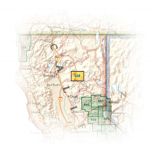
Locatie op kaart
Artikelen uit dezelfde regio

Reisgids California wine country USA - Top 10 - Eyewitness • 9781409326823
California wine country USA - Top 10 - Eyewitness Productomschrijving: Explore California's world-class wineries, take a leisurely tour on the Napa Valley Wine Train, cycle along the Silverado Trail or venture to the Russian River for the renowned River Jazz and Blues Festival. From Top 10 festivals to the Top 10 beaches - discover the best of California Wine Country with this easy-to-use …

Wandelgids The California Mission Trails - Cicerone • 9781786311139
The California Mission Trails - Cicerone Productomschrijving: Gids over het wandelen en fietsen van de 1289 km lange California Missions Trail tussen San Francisco Bay en San Diego. De pelgrimsroute voert langs 21 historische Spaanse missies en kan worden voltooid in 50-60 wandeldagen of 2-3 weken fietsen. Met 1:100.000 kaarten, routebeschrijving en details van accommodatie en faciliteiten…

Wandelkaart 309 Yosemite SE - Ansel Adams Wilderness - Nat Geo • 9781566954136
Wandelkaart Ansel Adams Wilderness - Nat Geo Productomschrijving: National Geographic's Trails Illustrated kaart van Yosemite SE levert ongeëvenaarde details en waardevolle informatie om u te helpen bij uw verkenning van deze adembenemende wildernis. Deze kaart is gemaakt in samenwerking met lokale landbeheerders en biedt ongeëvenaarde details en nuttige informatie voor zowel ervaren outdo…

Reisgids San Francisco & Northern California - DK Eyewitness • 9780241360071
San Francisco & Northern California Omvat: Presidio, Pacific Heights and the Marina, Fisherman's Wharf and North Beach, Chinatown and Nob Hill, Financial District and Union Square, Civic Center, Haight Ashbury and the Mission, Golden Gate Park and Land's End, and sights beyond the city, plus major parts of Northern California including Carmel, Mendocino, Napa Wine Country, Lake Tahoe & Yos…
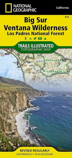
Wandelkaart 814 Big Sur & Ventana Wilderness - Natgeo • 9781566955782
TOPO Wandelkaart 814 - Big Sur & Ventana Wilderness - Natgeo Productomschrijving: Big Sur & Ventana Wilderness California- Natgeo zijn in andere woorden, het Los Padres National Forest in het United States national forest in southern en central California. National Geographic's Trails Illustrated map of Big Sur, Ventana Wilderness combines unmatched detail with helpful information to o…