Wandelkaart 17 Discoverer Lower Lough Erne - OSNI
County Fermanagh in Noord-Ierland
Korte omschrijving
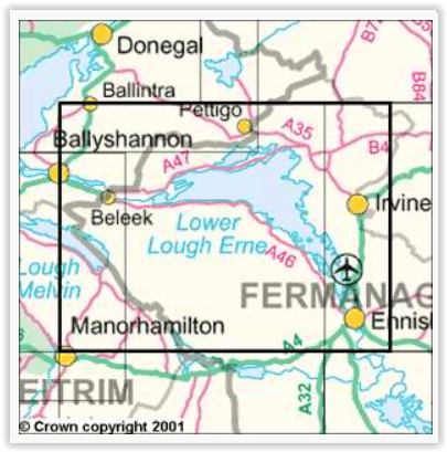
Wandelkaart Lower Lough Erne - OSI Productomshrijving: Lower Lough Erne is het noordelijkste en grootste van de twee meren met de naam "Lough Erne". De locatie is gelegen in county Fermanagh...

Specificaties
- Uitgever: Ordnance Survey
- ISBN-13: 9781905306862
- HOOFDCATEGORIEËN: Wandelkaart
- Activiteiten: Wandelen, Hiking & Trekking
- Regio: county Fermanagh
- Land: Ierland
- Schaal: 1:50000
- Afmeting: 11x18
- Taal: Engels
- Reeks: OSNI, Northern Ireland
Volledige omschrijving
Wandelkaart Lower Lough Erne - OSI
Productomshrijving: Lower Lough Erne is het noordelijkste en grootste van de twee meren met de naam "Lough Erne". De locatie is gelegen in county Fermanagh in Noord-Ierland
Engelse omschrijving: OSNI has replaced the One-Inch maps with a completely new series at 1:50 000 scale. The series is numbered on an all-Ireland basis and Ordnance Survey of Northern Ireland is responsible for the design and publication of the sheets that cover Northern Ireland and adjoining parts of the Republic of Ireland. The layout incorporates a number of overlaps. This map is derived from the latest large scale material, supplemented by new aerial photographs and ground surveys. It is the country's most detailed small-scale map and as well as showing all the features that were on the One-Inch map.

Overzichtskaarten

OSNI Northern Ireland - OSNI
OSNI Northern Ireland - OSNI

Producten op de overzichtskaart
Klik op een product om naar de detailpagina te gaan.
- Wandelkaart 04 Discoverer Coleraine- Northern Ireland - OSNI
- Wandelkaart 05 Discoverer Ballycastle - Discoverer series - OSNI
- Wandelkaart 07 Discoverer Londonderry- Ulster - N.Ireland - OSNI
- Wandelkaart 08 Ballymoney County Antrim - OSNI
- Wandelkaart 09 Larne County Antrim - OSNI
- Wandelkaart 13 The Sperrins Ulster N. Ireland - OSNI
- Wandelkaart 14 Discoverer Lough Neagh - Antrim - N.Ireland - OSNI
- Wandelkaart 17 Discoverer Lower Lough Erne - OSNI
- Wandelkaart 18 Discoverer Enniskillen & Irvinestown - OSNI
- Wandelkaart 19 Armagh Northern Ireland - Ordnance Survey
- Wandelkaart 20 Discoverer Craigavon- N.Ireland - OSNI
- Wandelkaart 21 Strangford Lough County Cork - OSNI
- Wandelkaart 27 Upper Lough Erne (Lisnaskea) - OSNI
- Wandelkaart 28 Monaghan-Keady (Castleblayney) - OSNI
- Wandelkaart 29 Discoverer The Mournes - OSNI


