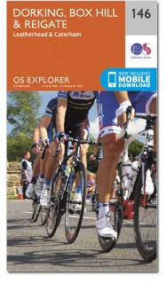
Wandelkaart 146 Dorking Box Hill & Reigate Surrey - OSI
Omvat Surrey Hills AONB- het E2-pad & de North Downs Way
Korte omschrijving
Wandelkaart Dorking- Box Hill & Reigate - Surrey S. England Omvat ook: Leatherhead & Caterham. Productbeschrijving: Kaart nummer 146 in de OS Explorer reeks omvat Reigate, Leatherhead, C...

Specificaties
- Uitgever: Ordnance Survey
- ISBN-13: 9780319470183
- HOOFDCATEGORIEËN: Wandelkaart
- Activiteiten: Wandelen, Hiking & Trekking
- Regio: Surrey South England
- Land: England
- Waterafstotende kaart: Ordnance Survey ACTIVE Explorer Weatherproof Maps
- AONB - Area of Outstanding Beauty: Surrey Hills AONB
- Schaal: 1:25000
- Afmeting: 13x24
- Taal: Engels
- Reeks: Explorer ACTIVE Series OSI
Volledige omschrijving
Wandelkaart Dorking- Box Hill & Reigate - Surrey S. England
Omvat ook: Leatherhead & Caterham.
Productbeschrijving: Kaart nummer 146 in de OS Explorer reeks omvat Reigate, Leatherhead, Caterham, Dorking, Gatwick Airport, Redhill, Horley, Box Hill, Warlingham en Couldson. Hoogtepunten van het gebied zijn onder andere: Surrey Hills AONB, & het E2-pad en de North Downs Way. De OS Explorer kaart voor Dorking, Box Hill & Reigate is beschikbaar in zowel de standaard papieren versie als de weerbestendige 'Actief' versie.
Productdiscription: Map sheet number 146 in the OS Explorer series covers Reigate, Leatherhead, Caterham, Dorking, Gatwick Airport, Redhill, Horley, Box Hill, Warlingham and Couldson. Highlights of the area include: Surrey Hills AONB, the E2 Path and the North Downs Way. The OS Explorer map for Dorking, Box Hill & Reigate is available in both the standard paper version and weatherproof 'Active' version.
Locatie op kaart
Gekoppelde artikelen

Wandelkaart 146 Dorking Box Hill & Reigate Surrey - OSI • 9780319243398
standaard versieWandelkaart Dorking- Box Hill & Reigate - Surrey England Productbeschrijving: Leatherhead & Caterham. 146 / Dorking, Box Hill & Reigate, Surrey, England - Kaart nummer 146 in de OS Explorer reeks omvat Reigate, Leatherhead, Caterham, Dorking, Gatwick Airport, Redhill, Horley, Box Hill, Warlingham en Couldson. Hoogtepunten van het gebied zijn onder andere: Surrey Hills AONB, het E2-pad …

Wandelkaart 146 Dorking Box Hill & Reigate Surrey - OSI • 9780319470183
weatherproof versieWandelkaart Dorking- Box Hill & Reigate - Surrey S. England Omvat ook: Leatherhead & Caterham. Productbeschrijving: Kaart nummer 146 in de OS Explorer reeks omvat Reigate, Leatherhead, Caterham, Dorking, Gatwick Airport, Redhill, Horley, Box Hill, Warlingham en Couldson. Hoogtepunten van het gebied zijn onder andere: Surrey Hills AONB, & het E2-pad en de North Downs Way. De OS Explorer…
Artikelen uit dezelfde regio

Wandelkaart 187 Dorking- Reigate & Crawley - OSI • 9780319475102
Wandelkaart Dorking- Reigate & Crawley - Surrey S. England Productbeschrijving: Dorking & Reigate, zijn historische marktsteden in het hart van de Surrey Hills AONB, en beschreven op de OS Landranger kaart 187. Het E2 Europese Long Distance pad en de North Downs Way passert het weelderige groene landschap met Crawley & Horsham naar het zuiden. Hoogtepunten zijn Leith Hill, het hoogste punt…

Wandelgids North Downs Way- 246 km - Trailblazer • 9781905864904
The 246 km long North Downs Way - Trailblazer Productomschrijving: The North Downs Way, is een lange afstand route van om en bij de 246 km. Een meerdaagse wandelroute in het zuiden van Engeland zeg maar. Het loopt van Farnham tot Dover, lags Guildford, Dorking, Merstham, Otford & Rochester, lags de Surrey Hills "Area of Outstanding Natural Beauty" (AONB) and Kent Downs AONB. De route besta…

Wandelkaart 187 Dorking & Reigate- Surrey England - OSI • 9780319262856
Wandelkaart Dorking & Reigate - Surrey South England Productbeschrijving: De Dorking & Reigate historische marktsteden in het hart van de Surrey Hills AONB, vind u op deze OS Landranger kaart 187 Het E2 Europese Long Distance pad en de North Downs Way, passeren de weelderige groene landschappen met Crawley en Horsham naar het zuiden. Hoogtepunten zijn: Leith hill, het hoogste punt in Zuid-…

Wandelkaart 145 Guildford & Farnham- Surrey - OSI • 9780319470176
Wandelkaart Guildford & Farnham - Surrey England Omvat ook: Godalming & Farnborough. Productbeschrijving: Of u nu een doorwinterde buiten deskundige of een ontspannen sightseer bent, met deze OS Explorer kaart 145 in de hand, zult u op het juiste spoor blijven waar uw avontuur zich ook bevindt. Hoogepunten zijn: Guildford, Farnham, Surrey Hills, deel van de North Downs Way, Hogs Back, …


