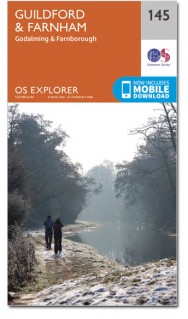
Wandelkaart 145 Guildford & Farnham- Surrey - OSI
Guildford- Farnham- Surrey Hills & de North Downs Way
Korte omschrijving
Wandelkaart Guildford & Farnham - Surrey England Omvat ook: Godalming & Farnborough. Productbeschrijving: Of u nu een doorwinterde buiten deskundige of een ontspannen sightseer bent, met...

Specificaties
- Uitgever: Ordnance Survey
- ISBN-13: 9780319470176
- HOOFDCATEGORIEËN: Wandelkaart
- Activiteiten: Wandelen, Hiking & Trekking
- Regio: Surrey South England
- Land: England
- Waterafstotende kaart: Ordnance Survey ACTIVE Explorer Weatherproof Maps
- Schaal: 1:25000
- Afmeting: 13x24
- Taal: Engels
- Reeks: Explorer ACTIVE Series OSI
Volledige omschrijving
Wandelkaart Guildford & Farnham - Surrey England
Omvat ook: Godalming & Farnborough.
Productbeschrijving: Of u nu een doorwinterde buiten deskundige of een ontspannen sightseer bent, met deze OS Explorer kaart 145 in de hand, zult u op het juiste spoor blijven waar uw avontuur zich ook bevindt. Hoogepunten zijn: Guildford, Farnham, Surrey Hills, deel van de North Downs Way, Hogs Back, Puttenham, de rivier Wey, Pewley Down, Godalming, Frimley, Farnborough en Woking. De OS Explorer kaart voor Guildford & Farnham is beschikbaar in zowel de standaard papieren versie als de weerbestendige 'Actief' versie.
Productdiscription: Whether you’re a seasoned outdoor expert or a leisurely sightseer, with the OS Explorer Sheet 145 in hand, you’ll be on the right track wherever your adventure takes you. Highlights: Guildford, Farnham, Surrey Hills, part of the North Downs Way, Hogs Back, Puttenham, the River Wey, Pewley Down, Godalming, Frimley, Farnborough and Woking. The OS Explorer map for Guildford & Farnham is available in both the standard paper version and weatherproof 'Active' version.
Extra info: Trusted by outdoor enthusiasts, this easy-to-follow map is the perfect companion for holidays and days out in the Surrey Hills and the countryside around the historic towns of Guildford and Farnham. Surrey is the most wooded county in Britain and the Surrey Hills has deservedly been made an Area of Outstanding Natural Beauty. From bustling market towns to quiet tranquil get-away-from-it-all places, the area includes the glorious River Wey.
The first section of the North Downs Way goes from the attractive Georgian town of Farnham to the county town of Surrey, Guildford with highlight along the way including the Hogs Back, the picturesque village of Puttenham, part of the Losely estate, finishing with a walk along the banks of the Wey. Whether you’re planning a day trip or a longer hike, discover the highlights of some of the Surrey landscape with this user-friendly guide.
Locatie op kaart
Gekoppelde artikelen

Wandelkaart 145 Guildford & Farnham- Surrey - OSI • 9780319243381
standaard versieWandelkaart Guildford & Farnham- Surrey England Productbeschrijving: Guildford & Farnham- Surrey zijn plaatsen in het bestuurlijke gebied Guildford, in het Engelse graafschap Surrey. 145 / Guildford & Farnham, Surrey, England - Kaart nummer 145 is een all purpose kaart vol gepakt met informatie om u het gebied te helpen leren kennen. De 204 Landranger-kaarten bestrijken het land. Elke …

Wandelkaart 145 Guildford & Farnham- Surrey - OSI • 9780319470176
weatherproof versieWandelkaart Guildford & Farnham - Surrey England Omvat ook: Godalming & Farnborough. Productbeschrijving: Of u nu een doorwinterde buiten deskundige of een ontspannen sightseer bent, met deze OS Explorer kaart 145 in de hand, zult u op het juiste spoor blijven waar uw avontuur zich ook bevindt. Hoogepunten zijn: Guildford, Farnham, Surrey Hills, deel van de North Downs Way, Hogs Back, …
Artikelen uit dezelfde regio

Wandelkaart 187 Dorking- Reigate & Crawley - OSI • 9780319475102
Wandelkaart Dorking- Reigate & Crawley - Surrey S. England Productbeschrijving: Dorking & Reigate, zijn historische marktsteden in het hart van de Surrey Hills AONB, en beschreven op de OS Landranger kaart 187. Het E2 Europese Long Distance pad en de North Downs Way passert het weelderige groene landschap met Crawley & Horsham naar het zuiden. Hoogtepunten zijn Leith Hill, het hoogste punt…

Wandelkaart 146 Dorking Box Hill & Reigate Surrey - OSI • 9780319470183
Wandelkaart Dorking- Box Hill & Reigate - Surrey S. England Omvat ook: Leatherhead & Caterham. Productbeschrijving: Kaart nummer 146 in de OS Explorer reeks omvat Reigate, Leatherhead, Caterham, Dorking, Gatwick Airport, Redhill, Horley, Box Hill, Warlingham en Couldson. Hoogtepunten van het gebied zijn onder andere: Surrey Hills AONB, & het E2-pad en de North Downs Way. De OS Explorer…

Wandelkaart 187 Dorking & Reigate- Surrey England - OSI • 9780319262856
Wandelkaart Dorking & Reigate - Surrey South England Productbeschrijving: De Dorking & Reigate historische marktsteden in het hart van de Surrey Hills AONB, vind u op deze OS Landranger kaart 187 Het E2 Europese Long Distance pad en de North Downs Way, passeren de weelderige groene landschappen met Crawley en Horsham naar het zuiden. Hoogtepunten zijn: Leith hill, het hoogste punt in Zuid-…

Wandelgids North Downs Way- 246 km - Trailblazer • 9781905864904
The 246 km long North Downs Way - Trailblazer Productomschrijving: The North Downs Way, is een lange afstand route van om en bij de 246 km. Een meerdaagse wandelroute in het zuiden van Engeland zeg maar. Het loopt van Farnham tot Dover, lags Guildford, Dorking, Merstham, Otford & Rochester, lags de Surrey Hills "Area of Outstanding Natural Beauty" (AONB) and Kent Downs AONB. De route besta…


