
Wandelkaart 113 Cowdrey- North Sand Hills Colorado - Nat Geo
Geniet van de overvloedige recreatieve n het noorden van Colorado

Korte omschrijving
Cowdrey- North Sand Hills Colorado - Nat Geo Productomschrijving: Geniet van de overvloedige recreatieve mogelijkheden in het noorden van Colorado met de hulp van National Geographic's Trail...

Specificaties
- Uitgever: National Geographic
- ISBN-13: 9781566952880
- HOOFDCATEGORIEËN: Wandelkaart
- Activiteiten: Wandelen, Hiking & Trekking
- Regio: Colorado, USA
- Land: Verenigde Staten van Amerika (USA)
- Schaal: 1:40000
- Afmeting: 10x19
- Taal: Engels
Volledige omschrijving
Cowdrey- North Sand Hills Colorado - Nat Geo
Productomschrijving: Geniet van de overvloedige recreatieve mogelijkheden in het noorden van Colorado met de hulp van National Geographic's Trails Illustrated kaart van Cowdrey en North Sand Hills. Deskundig onderzocht en gemaakt in samenwerking met de U.S. Forest Service, Bureau of Land Management, Colorado State Parks en anderen, zal de kaart u van de gebaande paden leiden en weer terug met ongeëvenaarde details van het gebied. Het omvat populaire recreatiegebieden, zoals Roosevelt en Routt National Forests, Platte River en Rawah Wilderness gebieden, Lake John, Richard, Cowdrey Lake en Diamond J State Wildlife Areas, State Forest State Park, Medicine Bow Mountains, en North Platte River.
Engelse omschrijving: Enjoy the abundant recreational opportunities in northern Colorado with the help of National Geographic's Trails Illustrated map of Cowdrey and North Sand Hills. Expertly researched and created in cooperation with the U.S. Forest Service, Bureau of Land Management, Colorado State Parks and others, the map will guide you off the beaten path and back on again with unparalleled detail of the area. Coverage includes popular recreation spots, such as Roosevelt and Routt National Forests, Platte River and Rawah Wilderness areas, Lake John, Richard, Cowdrey Lake and Diamond J State Wildlife Areas, State Forest State Park, Medicine Bow Mountains, and North Platte River.
Mapped trails, Forest Service roads and BLM routes are marked for hiking, road or mountain bike, snowmobile, OHV or motorized use. To aid in your navigation, the map also includes contour lines, elevations, labeled peaks, summits and passes, water features, areas of wooded cover, selected waypoints and clear color-coded boundaries between different land management agencies. Some additional recreation features pinpointed are campgrounds, picnic areas, river access points, boat launches, fishing areas, RV dump stations and wildlife viewing. Additionally, wilderness regulations, survival tips, Leave No Trace guidelines and essential contact information is provided.
Every Trails Illustrated map is printed on "Backcountry Tough" waterproof, tear-resistant paper. A full UTM grid is printed on the map to aid with GPS navigation.
Other features found on this map include: Independence Mountain, Lake John, Medicine Bow Mountains, Rawah Wilderness, Roosevelt National Forest, Routt National Forest.
Locatie op kaart
Artikelen uit dezelfde regio

Wandelkaart 103 Winter Park, Central City & Rollins Pass • 9781566952767
Wandelkaart Winter Park, Central City & Rollins Pass Productomschrijving: National Geographic's Trails Illustrated kaart van Winter Park, Central City en Rollins Pass biedt ongeëvenaarde details voor outdoor enthousiastelingen die het hele jaar door willen genieten van de recreatieve mogelijkheden in de zuidelijke delen van Roosevelt en Arapaho National Forest. Deskundig onderzocht en gema…
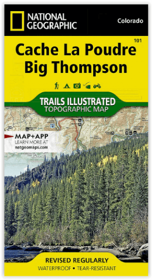
Wandelkaart 101 Cache La Poudre- Big Thompson Colorado - Nat Geo • 9781566953900
Cache La Poudre, Big Thompson Colorado - Nat Geo Productomschrijving: Canyon Lakes Ranger District, dat is het bezienswaardige bosgebied, of zeg maar wildernis gebied dat naast Fort Collins Colorado ligt. Outdoor enthousiastelingen die willen genieten van de recreatieve mogelijkheden net ten oosten van Rocky Mountain National Park zullen National Geographic's Trails Illustrated kaart van C…

Reisgids Colorado USA - Lonely Planet • 9781787016811
Reisgids Colorado - Lonely Planet Productomschrijving: Spectaculaire vergezichten, eindeloze poedersneeuwafdalingen en bergstadjes met echo's van het Oude Westen - Colorado is een plek die al heel lang mensen tot avontuur uitnodigt. Lonely Planet brengt je naar het hart van Colorado, met geweldige reiservaringen en het beste planningsadvies. Ga de pistes op in Aspen, ontdek het Oude Westen…

Wandelkaart 119 Yampa & Gore Pass Colorado USA - Nat Geo • 9781566953931
Yampa & Gore Pass Colorado USA - Nat Geo Productomschrijving: Outdoor enthousiastelingen die het hele jaar door willen genieten van de recreatieve mogelijkheden in en rond het zuiden van Routt National Forest zullen zich verbazen over National Geographic's Trails Illustrated kaart van Yampa en Gore Pass. Gemaakt in samenwerking met de U.S. Forest Service, Bureau of Land Management en ander…

Wandelkaart 208 Colorado National Monument - Natgeo • 9781566954013
TOPO Wandelkaart 208 - Colorado National Monument - Natgeo Productomschrijving: recreatie regio's doorheen Colorado's 'Grand Valley' omvatten de steden: Grand Junction, Fruita, Palisade & Loma. Dit veel gebruikte gebied is gekend onder de de mensen die in Colorado wonen. Dit gebied is nationaal bekend voor zijn speciale mountainbiketrails en evengoed gekend voor de start van het Kokepelli …