
Wandelkaart 101 Cache La Poudre- Big Thompson Colorado - Nat Geo
Vormt deel van het Rocky Mountain National Park

Korte omschrijving
Cache La Poudre, Big Thompson Colorado - Nat Geo Productomschrijving: Canyon Lakes Ranger District, dat is het bezienswaardige bosgebied, of zeg maar wildernis gebied dat naast Fort Collins ...

Specificaties
- Uitgever: National Geographic
- ISBN-13: 9781566953900
- HOOFDCATEGORIEËN: Wandelkaart
- Activiteiten: Wandelen, Hiking & Trekking
- Regio: Colorado, USA
- Land: Verenigde Staten van Amerika (USA)
- Schaal: 1:40000
- Afmeting: 10x19
- Taal: Engels
Volledige omschrijving
Cache La Poudre, Big Thompson Colorado - Nat Geo
Productomschrijving: Canyon Lakes Ranger District, dat is het bezienswaardige bosgebied, of zeg maar wildernis gebied dat naast Fort Collins Colorado ligt. Outdoor enthousiastelingen die willen genieten van de recreatieve mogelijkheden net ten oosten van Rocky Mountain National Park zullen National Geographic's Trails Illustrated kaart van Cache La Poudre en Big Thompson een essentiële reisgenoot vinden. Deskundig onderzocht en gemaakt in samenwerking met de U.S. Forest Service en anderen, bestrijkt de kaart delen van het Roosevelt National Forest, waaronder Cache La Poudre River en Wilderness, Big Thompson River en Canyon, Lake Estes en Bulwark Ridge.
Omvat onder meer: Cache La Poudre Wilderness, Roosevelt National Forest.
Engelse omschrijving: Outdoor enthusiasts looking to enjoy the recreational opportunities just east of Rocky Mountain National Park will find National Geographic's Trails Illustrated map of Cache La Poudre and Big Thompson an essential travel companion. Expertly researched and created in partnership with the U.S. Forest Service and others, the map covers parts of the Roosevelt National Forest, including Cache La Poudre River and Wilderness, Big Thompson River and Canyon, Lake Estes and Bulwark Ridge.
Get off the beaten path and back on again by following the map to clearly marked trailheads and then along trails, marked according to their designated usage, including trails which are part of the National Recreation Trail system. Also shown are Forest Service roads, many of which serve as ATV trails. To aid in your navigation, the map includes contour lines, elevations, labeled peaks and summits, water features, areas of wooded cover and color-coded boundaries between different land management organizations. Some of the recreational points of interest are campgrounds, interpretive trails, fishing areas, boat launch points and picnic areas. The Cache la Poudre Scenic Byway is marked for those who are interested in taking in the scenery by car.
Every Trails Illustrated map is printed on "Backcountry Tough" waterproof, tear-resistant paper. A full UTM grid is printed on the map to aid with GPS navigation.
Other features found on this map include: Cache La Poudre Wilderness, Roosevelt National Forest.
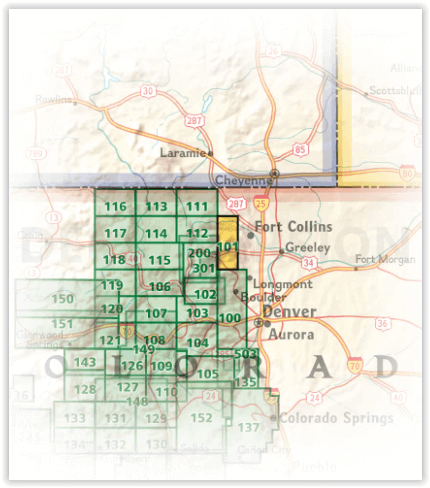
Locatie op kaart
Artikelen uit dezelfde regio
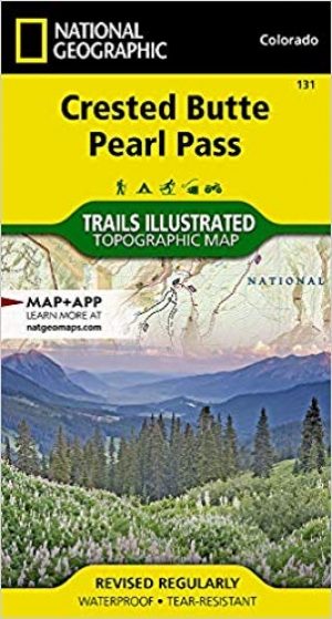
Wandelkaart 131 Crested Butte- Pearl Pass - Nat geo • 9781566952477
TOPO Wandelkaart 131 - Crested Butte- Pearl Pass Colorado, USA - National geographic Productomschrijving: Crested Butte is een rustige wandel- en MTB uitvalsbasis in Gunnison County, Colorado, United States. Omvat de oude kool industrie, en noemt nu "the last great Colorado ski town". Crested Butte is aeveneens een locatie voor skiërs & mountainbiking, als ook een verzameling van andere ou…
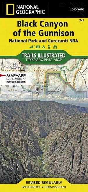
Wandelkaart 245 Black Canyon of the Gunnison NP - Natgeo • 9781566953689
TOPO Wandelkaart 245 - Black Canyon of the Gunnison NP - Nat Geo Productomschrijving: Het Black Canyon of the Gunnison National Park is een nationaal park in het westen van de Amerikaanse staat Colorado. Het beschermt 19 km van de 77 km lange kloof van de Gunnison River, een zijrivier van de Colorado River. Engelse omschrijving: The Black Canyon, 48 miles of awe-inspiring, steep-walle…

Reisgids Colorado - Insight Guides ENG • 9781789198393
Reisgids Colorado USA - Insight Guides ENG Productomschrijving: Van het beslissen wanneer je gaat, tot het kiezen van wat te zien als je aankomt, deze gids voor Colorado is alles wat je nodig hebt om je perfecte reis te plannen, met insider informatie over must-see, top attracties zoals Denver Art Museum, Pikes Peak en het Old Fort National Historic Site, en culturele juweeltjes zoals de g…

Reisgids Colorado USA - Lonely Planet • 9781787016811
Reisgids Colorado - Lonely Planet Productomschrijving: Spectaculaire vergezichten, eindeloze poedersneeuwafdalingen en bergstadjes met echo's van het Oude Westen - Colorado is een plek die al heel lang mensen tot avontuur uitnodigt. Lonely Planet brengt je naar het hart van Colorado, met geweldige reiservaringen en het beste planningsadvies. Ga de pistes op in Aspen, ontdek het Oude Westen…

Wandelkaart 1203 Colorado Trail & Collegiate Loop- Natgeo • 9781566957229
Wandelkaart 1203- Colorado Trail & Collegiate Loop- Natgeo Productomschrijving: The Colorado Trail is een lange-afstands wandelroute van om en bij de 782 km. Deze loopt van de mond van Waterton Canyon ten zuidwesten van Denver tot Durango in Colorado. Zijn hoogste punt is 4,045 meter boven zeeniveau, en de overgrote meerderheid van de route loopt boven de 3,000 meter. Ondanks zijn hoog gel…