
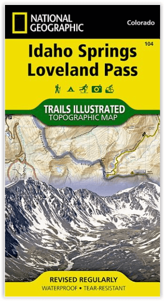
Wandelkaart 104 Idaho Springs & Loveland Pass - Nat Geo
Grays Peak National Recreation Trail & Continental Divide trail
Korte omschrijving
Wandelkaart Idaho Springs & Loveland Pass Colorado Productomschrijving: Deskundig onderzocht en gemaakt in samenwerking met lokale landbeheerders, biedt National Geographic's Trails Illustr...

Specificaties
- Uitgever: National Geographic
- ISBN-13: 9781566952491
- HOOFDCATEGORIEËN: Wandelkaart
- Activiteiten: Wandelen, Hiking & Trekking
- Regio: Colorado, USA
- Land: Verenigde Staten van Amerika (USA)
- Schaal: 1:40000
- Afmeting: 10x19
- Taal: Engels
Volledige omschrijving
Wandelkaart Idaho Springs & Loveland Pass Colorado
Productomschrijving: Deskundig onderzocht en gemaakt in samenwerking met lokale landbeheerders, biedt National Geographic's Trails Illustrated kaart van Idaho Springs, Loveland Pass een ongeëvenaard hulpmiddel voor het verkennen van deze schilderachtige regio. Ongeacht het seizoen, zult u deze kaart handig vinden voor het uitoefenen van een groot aantal recreatieve activiteiten, van skiën en sneeuwscooteren tot wandelen en kamperen. Deze kaart bevat vele belangrijke punten van belang,
Omvat: Arapaho, White River, and Pike national forests, Echo Lake, Mount Evans Wilderness, Guanella Pass Scenic Byway and the Keystone, Loveland.
Engelse omschrijving: Expertly researched and created in partnership with local land management agencies, National Geographic's Trails Illustrated map of Idaho Springs, Loveland Pass provides an unparalleled tool for exploring this scenic region. Whatever the season, you'll find this map handy for pursuing a host of recreational activities from skiing and snowmobiling to hiking and camping. This map features many key points of interest including Arapaho, White River, and Pike national forests, Echo Lake, Mount Evans Wilderness, Guanella Pass Scenic Byway and the Keystone, Loveland, and Arapahoe Basin ski areas.
With miles of trails including Grays Peak National Recreation Trail and portions of the Colorado and Continental Divide trails, this map can guide you off the beaten path and back again. Hiking, equestrian, bike, snowmobile, and ski trails are clearly marked, as well as a variety of recreational features including fishing areas, trailheads, campgrounds, and picnic areas. The map base includes contour lines and elevations for summits, passes and many lakes.
Every Trails Illustrated map is printed on "Backcountry Tough" waterproof, tear-resistant paper. A full UTM grid is printed on the map to aid with GPS navigation.
Other features found on this map include: Arapaho National Forest, Chief Mountain, Front Range, Ganley Mountain, Grays Peak, Loveland Pass, Mount Bierstadt, Mount Evans, Mount Evans Wilderness, Pike National Forest, Torreys Peak, White River National Forest.
Locatie op kaart
Artikelen uit dezelfde regio

Reisgids Colorado - Insight Guides ENG • 9781786715319
Colorado - Insight Guides ENG Productomschrijving: The Rocky Mountain State of Colorado offers soaring peaks, world-class skiing and vibrant cities that lure travellers from all over the world to America's alpine heartland. Be inspired to visit by the new edition of Insight Guide Colorado, a comprehensive full-colour guide to the state. Inside Insight Guide Colorado: A fully-overh…

Wandelkaart 128 Maroon Bells- Redstond & Marble - Nat Geo • 9781566952484
TOPO Wandelkaart 128 - Maroon Bells- Redstond & Marble - National Geographic Productomschrijving: De Maroon Bells zijn 2 bergtoppen in de Elk Mountains, Maroon Peak & North Maroon Peak, met een dikke half kilometer gescheiden. De liggen liggen op de grens tussen Pitkin County & Gunnison County, Colorado, United States Engelse omschrijving: Colorado's Maroon Bells are the most photograp…

Wandelkaart 1201 Colorado Trail Zuid - NAT GEO • 9781566956949
TOPO Wandelkaart 1201 - Colorado Trail Zuid - Durango tot Monarch Productomschrijving: The Colorado Trail is een lange-afstands wandelroute van om en bij de 782 km. Deze loopt van de mond van Waterton Canyon ten zuidwesten van Denver tot Durango in Colorado. Zijn hoogste punt is 4,045 meter boven zeeniveau, en de overgrote meerderheid van de route loopt boven de 3,000 meter. Ondanks zijn h…

Wandelkaart 1302 Colorado 14'ers- Noord - Nat geo • 9781566956994
TOPO Wandelkaart 1302 - Colorado 14'ers- Noord - Natgeo Productomschrijving: De Colorado 14'ers bestaat uit 14 van de meest indrukwekkende bergmassieven in Colorado, verdeeld over drie verschillende regio's als Front Range, Momsquito Tenmile Ranges en de Sawatch Range. een indrukwekkende locatie om te gaan trekken uiteraard. Front Range: Mount Bierstadt, Mount Evans, Grays Peak, Longs …

Wandelkaart 200 Rocky Mountain NP- Colorado - Nat Geo • 9781566953429
TOPO Wandelkaart 200 - Rocky Mountain NP- Colorado - National Geographic Productomschrijving: Rocky Mountain National Park is een Amerikaans nationaal park in de Southern Rocky Mountains in het noorden van de staat Colorado. Rocky Mountain National Park bezit majestueuze berggezichten, gevarieerde klimaten en omgevingen – van bossen tot bergtoendra – en makkelijk te bereiken wandelroutes e…